Overview of Aerial Real Estate Photography
In the competitive Miami real estate market, high-quality visual content has become an essential component of effective property marketing. Aerial real estate photography serves as a powerful tool to showcase property features from a unique vantage point, offering prospective buyers a comprehensive view of the property layout, surrounding environment, and neighborhood context. By capturing images from above, agents and sellers can highlight expansive outdoor spaces, intricate architectural details, and the property's position within its community, creating an emotionally compelling visual narrative that can significantly influence purchasing decisions.
Modern aerial photography employs advanced drone technology, which allows for versatile and cost-effective imaging compared to traditional helicopter or airplane photography. The ability to access different angles, perspectives, and altitudes enables real estate professionals in Miami to craft more engaging and informative listings. These images not only enhance the aesthetic appeal but also provide clarity and transparency, giving potential buyers confidence in the property's attributes. When integrated into a well-rounded marketing strategy, aerial visuals can elevate property listings from standard to standout, capturing attention across online platforms, print advertisements, and virtual tours.
Utilizing aerial shots can also emphasize the property's proximity to local landmarks, parks, schools, and transportation hubs, which are vital considerations for many buyers. Consequently, real estate agents and developers recognize the value of incorporating high-quality aerial imagery in their marketing campaigns to attract a broader audience and facilitate faster sales. As Miami continues to grow as a hub for luxury and commercial developments, the demand for professional aerial real estate photography services has surged, making it an integral part of modern property presentation strategies.

Types of Aerial Photography Equipment and Techniques
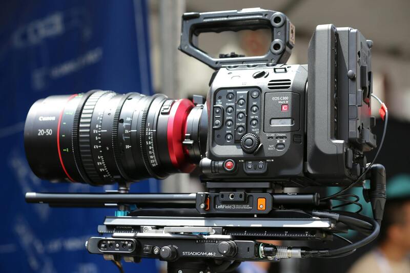
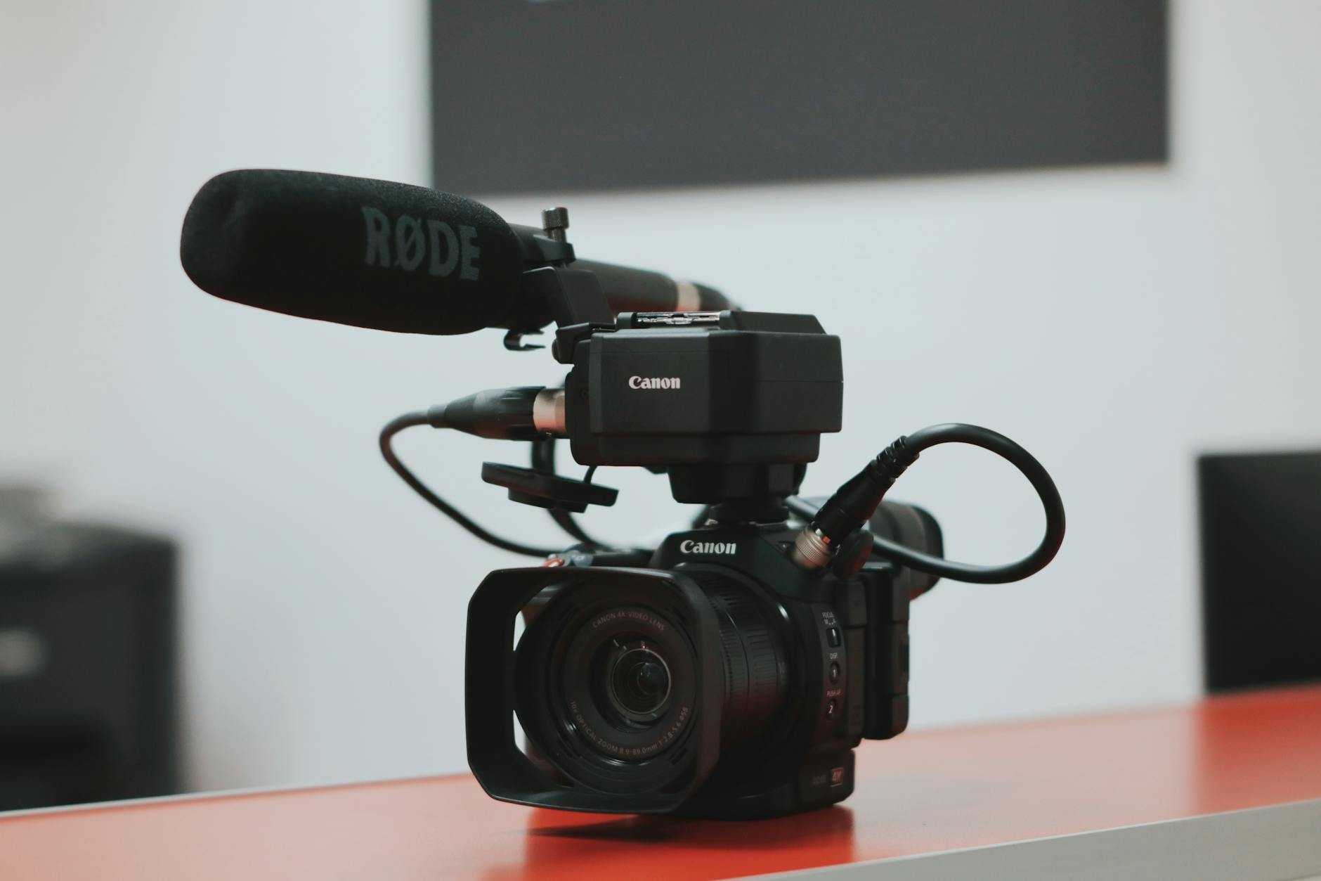
Utilizing the appropriate equipment and techniques is essential for capturing stunning aerial images that accurately represent a property’s features and surroundings. Contemporary aerial real estate photography primarily relies on advanced drone technology equipped with high-resolution cameras, which enable operators to obtain crisp, detailed visuals from various altitudes and angles. The choice of drone model depends on the project scope, with professional-grade models offering stability, longer flight times, and enhanced camera control.
High-quality cameras mounted on these drones typically feature large sensors, such as full-frame or APS-C sensors, capable of capturing images with remarkable clarity, color accuracy, and dynamic range. This allows for detailed depiction of both expansive properties and intricate architectural features. Equipped with adjustable lenses, photographers can select focal lengths suited for wide-angle shots or zoomed-in close-ups, optimizing each shot for maximum visual impact.
Shooting techniques involve strategic planning of flight paths, altitudes, and angles to maximize coverage and highlight key property elements. Common methods include linear flight patterns to showcase property boundaries, orbit shots to display building facades, and vertical elevations for comprehensive site overviews. Flight planning tools and software assist in mapping out precise routes, ensuring safety, compliance, and efficient use of time.
Additionally, controlling environmental factors such as lighting and weather conditions is critical to achieving high-quality results. Dawn and dusk provide optimal natural lighting, while clear weather minimizes atmospheric distortions. Post-flight editing further enhances images by correcting color balance, removing minor imperfections, and emphasizing architectural details to ensure the visuals are compelling and precise representation of the property.
Overview of Aerial Real Estate Photography
Aerial real estate photography has revolutionized the way properties are showcased, providing dynamic, comprehensive perspectives that ground-level images simply cannot capture. By utilizing advanced drone technology, real estate professionals can present a property's full scope—from expansive landscapes and intricate architectural details to surrounding neighborhood amenities—within a single visual narrative. This method not only enhances the aesthetic appeal of listings but also facilitates an immersive viewing experience for potential buyers, enabling them to better understand the property's spatial relationships and contextual environment.
High-quality aerial imagery is particularly effective in highlighting key property features, such as large estates, waterfront locations, or extensive outdoor spaces, which are often major selling points. Aerial shots reveal the property's proximity to essential amenities, like parks, schools, and transportation hubs, providing additional context that can influence purchasing decisions. In markets like Miami, where waterfront and luxury properties dominate the landscape, aerial photography offers a unique vantage point that emphasizes exclusivity and lifestyle appeal.
Employing the right techniques and equipment ensures that each shot captures the property’s best features. From elevated vantage points to sweeping panoramas, aerial photography involves careful planning, including selecting optimal flight paths and camera angles to maximize visual impact. Flight planning software and environmental considerations, such as lighting and weather, play crucial roles in producing consistent, high-quality images that stand out in competitive real estate markets.
Overall, aerial real estate photography is a strategic asset that enhances listing appeal, speeds up sales, and provides a distinctive edge in marketing efforts. When executed with professionalism and precision, these images serve as an invaluable tool for engaging prospective buyers and showcasing properties in their best light.
Types of Aerial Photography Equipment and Techniques
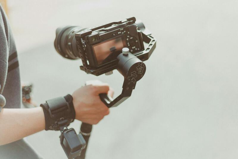
In the realm of aerial real estate photography, equipment choices directly influence the quality and scope of imagery produced. Modern UAV (unmanned aerial vehicle) platforms equipped with high-definition cameras have become industry staples, offering flexibility, maneuverability, and safety for capturing stunning visuals of properties from various altitudes and angles. These drones often feature stabilization systems, multiple flight modes, and programmable flight paths, facilitating precise control necessary for detailed property showcase.
Camera technology utilized in these platforms typically includes full-frame or APS-C sensors capable of recording in high-resolution formats, ensuring sharp, vibrant images that accurately reflect the property’s features. Adjustable lenses facilitate appropriate framing, whether wide-angle shots to encompass entire estates or zoomed-in shots for focal architectural details. Gimbals and stabilization equipment ensure that even in challenging conditions, the images remain crisp and free of motion blur.
Techniques such as orbit shots, which circle around a property to highlight its architectural design, or vertical elevations, which provide comprehensive site overviews, are standard in aerial real estate photography. Flight planning tools help map out specific routes, ensuring coverage of all salient features and compliance with safety protocols. Environmental factors like lighting conditions are also carefully managed, with early morning or late afternoon hours preferred for warmer light and softer shadows.
Effective post-flight editing enhances these images, adjusting for color balance, contrast, and minor imperfections, guaranteeing that each visual element contributes to a compelling property presentation. Mastery of equipment and technique thus combines to deliver images that elevate the marketing potential of real estate listings, capturing the attention of discerning buyers with striking, authentic visuals.
Legal Considerations and Regulations in Miami
Executing aerial real estate photography services in Miami requires meticulous adherence to state and municipal guidelines that ensure safe and responsible drone operation. Local authorities enforce specific restrictions on flight altitudes, no-fly zones, and timeframes to minimize disruption and protect privacy. Professional operators are well-versed in these parameters and maintain up-to-date knowledge of any adjustments to regulations, allowing seamless integration of aerial imagery into marketing campaigns without interruptions.
One fundamental aspect involves obtaining appropriate permissions for flights over private properties or densely populated areas. This process often includes coordinating with property owners and, in some cases, securing flight clearances from city authorities. Additionally, Miami’s airspace is regulated to coordinate drone activity within controlled zones, especially near airports or critical infrastructures. Experienced aerial photographers utilize advanced flight planning tools to assess these zones, ensuring compliance and operational safety.
Operators must also follow safety protocols such as pre-flight risk assessments, establishing clear communication channels, and maintaining visual line of sight with drones at all times. These measures mitigate hazards for people, animals, and other aircraft, confirming that high-quality imagery is gathered within a framework of responsible drone use. Continuous training and certifications further demonstrate a commitment to maintaining standards and staying informed about evolving regulations, solidifying professionalism in the industry.
By working with seasoned aerial real estate photography providers, clients can ensure their marketing visuals adhere to all existing protocols, thereby avoiding potential interruptions or legal issues while enhancing the property's presentation through compliant and captivating aerial imagery.
Legal Considerations and Regulations in Miami
Operating aerial real estate photography services in Miami requires adherence to established protocols designed to ensure the safety of all airspace users and the general public. A critical component involves coordinating flight operations with local authorities and property owners to secure necessary permissions, particularly when capturing images over private estates or densely populated neighborhoods. This process often necessitates detailed flight plans and documentation to demonstrate operational safety and compliance with city-specific guidelines.
Miami’s airspace is managed through a series of regulated zones that include controlled and restricted areas, especially near airports, heliports, and sensitive infrastructures. Photographers and operators deploy sophisticated flight planning tools that map out these zones, enabling them to avoid no-fly zones and minimize disruption. Advanced navigation systems and real-time airspace information are essential for maintaining compliance throughout the operation, reducing the risk of inadvertent breaches that could compromise safety or operational integrity.
Pre-flight safety assessments are a standard part of the process, involving thorough checks of weather conditions, wind speeds, and visibility to ensure safe drone operation. Establishing clear communication channels among team members and with local authorities helps streamline the operation and manage any unforeseen circumstances swiftly. Maintaining visual line of sight (VLOS) with the drone at all times allows for better control and situational awareness, essential for safe flight execution in urban environments with complex airspace dynamics.
Professional aerial real estate photographers invest in ongoing training and certification to stay current with evolving regulations and best practices. Certifications from recognized industry authorities showcase their commitment to responsible operation and skillful execution of aerial captures. This dedication not only ensures client peace of mind but also helps foster industry standards that prioritize safety, quality, and professionalism in every project undertaken.
Preparing Properties and Sites for Aerial Photography
Effective aerial real estate photography hinges not only on the equipment and techniques used but also on meticulous preparation of the property and surrounding environment. Proper site readiness enhances the visual impact of the aerial footage and minimizes disruptions during the shoot. This preparation involves several key steps, focusing on safety, aesthetics, and operational efficiency.
Property Maintenance and Staging
Ensuring that the property appears pristine is vital for capturing compelling aerial images. Landscaping should be well-maintained, with trimmed lawns, clear pathways, and minimal clutter. Overgrown bushes or unkempt yards can detract from the visual appeal of the property, so they should be addressed beforehand. It is also advisable to remove or reposition vehicles, outdoor furniture, or any temporarily placed items that could interfere with the shot or appear distracting in the footage.
Staging outdoor features, such as gardens or patios, can further elevate the property's visual allure. Simply arranging furnishings or decorative elements can create inviting atmospheres that resonate well with prospective buyers viewing the aerial footage. In addition, decluttering exterior spaces ensures the focus remains on the property’s architectural appeal and surroundings.
Environmental and Weather Considerations
Weather dramatically influences the quality of aerial images. Clear skies with consistent lighting conditions produce sharper, more vibrant visuals. Overcast days can diffuse light, reducing shadows and highlighting details, but are generally less ideal for dramatic, eye-catching images. Wind speeds must be monitored closely, as strong gusts can impact drone stability and safety, potentially leading to blurry footage or risky flight conditions.
Timing and Scheduling
Timing is crucial for capturing the property at its most attractive. Early morning or late afternoon light, often referred to as the golden hour, enhances visual warmth and depth, showcasing architectural features and landscape details effectively. Scheduling the shoot during these times requires coordination with local weather forecasts and property owners to ensure optimal conditions.
Communication and Access Arrangements
Advance communication with property owners, neighbors, and local authorities helps facilitate smooth operations. Securing permissions for drone flights over private property, especially in densely populated areas like Miami, ensures that the shoot complies with any specific access requirements. Planning aerial paths to avoid restricted airspace or congested zones minimizes potential conflicts and operational delays.
Preparing a detailed flight plan that outlines takeoff points, flight paths, and landing zones improves safety and efficiency. Additionally, having backup plans for weather or technical issues ensures the project remains on track. Proper preparation ultimately results in high-quality aerial images that effectively showcase the property’s features and surroundings, attracting potential buyers and enhancing marketing efforts.
Overview of Aerial Real Estate Photography
Aerial real estate photography has revolutionized the way properties are showcased to potential buyers and investors. By capturing expansive views and intricate details from above, high-quality aerial images provide a comprehensive perspective that ground-level photos cannot offer. This method not only highlights the property's architecture and landscape but also emphasizes the surrounding area, offering context and appeal that can significantly influence a buyer's perception.
Utilizing advanced aerial photography techniques allows real estate professionals to create engaging visual narratives. These images often include striking views of the property's exterior, landscaping, nearby amenities, and proximity to key locations such as schools, parks, and business districts. The ability to showcase an entire estate or development in a single shot maximizes the property's visual impact. Moreover, aerial imagery can reveal features that are difficult to capture with traditional photography, such as large plots, waterfront access, or unique architectural elements.
In Miami's dynamic real estate market, the strategic use of aerial imagery has become an essential component of marketing campaigns. It aids in distinguishing listings in competitive markets by providing prospective buyers with a more immersive view, inspiring confidence and interest. As technology continues to advance, the integration of aerial photographs with virtual tours and interactive maps offers even more engaging ways to present properties. These innovations empower real estate agencies to attract a broader audience and shorten the sales cycle by delivering compelling, transparent property visuals.
Types of Aerial Photography Equipment and Techniques
The selection of appropriate equipment and techniques is pivotal to capturing premium aerial real estate images. Modern aerial photography primarily relies on drones equipped with high-resolution cameras. These unmanned aerial vehicles (UAVs) provide flexibility and access to hard-to-reach angles, making them ideal for real estate applications.
Various drone models cater to different needs, from compact, lightweight units for quick setup to more advanced systems with stabilization features, increased flight times, and higher-quality imaging sensors. The deployment of stabilizers, such as gimbals, ensures smooth footage and sharp images even in windy conditions. The choice of camera lenses, range, and resolution directly impacts the clarity and detail of the final shots.
In addition to drones, traditional helicopter or fixed-wing aircraft can be employed for larger-scale projects or when covering expansive properties. These methods, while less common, offer extraordinarily high-quality imagery and can include specialized equipment like professional aerial cameras and panoramic systems. Advanced techniques such as HDR photography, panoramic stitching, and 3D mapping further enhance visual content, offering clients impressive, store-ready visuals that elevate property marketing efforts.
Advantages of Using Aerial Photography for Real Estate Listings
Implementing aerial photography in real estate marketing yields numerous benefits that significantly impact property sales. Foremost, aerial images establish a compelling first impression by showcasing the property's exterior and its surrounding environment in a way ground photos cannot replicate. This comprehensive view helps prospective buyers understand the property's scale, layout, and proximity to key features, making listings more engaging and informative.
Furthermore, aerial shots facilitate highlighting unique selling points, such as waterfront access, large gardens, or sprawling estates. They also assist in depicting neighborhood characteristics — proximity to beaches, parks, downtown Miami, or other attractions — fostering an emotional connection with potential buyers who can better envisage their lifestyle.
Qualitative improvements in listing presentations, increased viewer engagement, and higher online traffic are direct outcomes of professional aerial imagery. When combined with visually appealing ground photography, aerial photos enhance the overall aesthetics, leading to faster sales and potentially higher sale prices. Employing aerial photography becomes especially advantageous in showcasing large or complex properties, where inclusivity of all features in one image elevates the property's perceived value.
Legal Considerations and Regulations in Miami
Compliance with local regulations while conducting aerial photography is essential for ensuring smooth operations in Miami. While specific guidelines may not be explicitly discussed here, understanding the typical procedures involves coordinated planning with relevant authorities to avoid airspace conflicts. Acquiring proper permissions and adhering to geographic restrictions helps facilitate seamless drone flights over private and public properties.
Operators should be familiar with Miami’s specific airspace classifications, restricted zones, and flight altitude limits. Respect for privacy and safety concerns remains paramount, making the pre-flight planning process critical. By developing a detailed flight plan, including takeoff points, flight paths, and designated landing zones, aerial photography teams can navigate effectively through busy or sensitive areas while respecting the local environment and community expectations.
Enhancing Real Estate Listings with Aerial Photography: Best Practices and Optimization
To maximize the impact of aerial real estate photography in Miami, it is crucial to implement a strategic approach that ensures high-quality imagery and effective marketing integration. Proper planning, execution, and presentation are key components that determine the success of aerial visuals in attracting prospective buyers and accelerating sales.
Strategic Planning and Shooting Protocols
Effective aerial photography begins long before the drone takes flight. It involves a meticulous pre-shoot planning process that includes assessing the property’s unique features, understanding the surrounding environment, and designing a shot list that highlights the property's best attributes. When preparing for the shoot, consider the following:
- Optimal timing for natural lighting, typically during early morning or late afternoon, to achieve warm and inviting visuals.
- Weather conditions that influence drone stability and image clarity, such as avoiding high winds or rain.
- Identifying vantage points that showcase the property's size, landscape, and neighborhood context effectively.
- Developing a flight plan that encompasses a variety of angles, elevations, and compositions.
During the shoot, maintaining consistency in altitude and framing ensures a cohesive collection of images. Employing professional-grade drones equipped with high-resolution cameras helps capture detailed visuals, while stabilization technology minimizes motion blur—resulting in sharp, professional-quality photographs.
Post-Production Enhancements for Maximum Impact
Post-processing is an essential step that elevates aerial imagery from good to outstanding. Techniques such as color correction, contrast enhancement, and cropping further define each shot’s visual appeal. Additionally, drone operators can create panoramic views or HDR (High Dynamic Range) images to emphasize property features in various lighting conditions. For larger marketing campaigns, integrating aerial photos into virtual tours or 3D walkthroughs creates comprehensive property presentations. Combining these elements with traditional ground-level shots offers prospective buyers a multi-dimensional experience, strengthening their perception of the property’s value.
Optimizing Content for Search Engines and Marketing Platforms
To attract targeted traffic and generate inquiries, it is important to optimize aerial real estate photographs for online display. Incorporate descriptive, keyword-rich filenames and alt text that include phrases like aerial real estate photography services in Miami. When posting on listing portals or social media, use engaging captions and strategically include these keywords to improve visibility.
Implementing a structured content strategy involves combining high-quality images with compelling descriptions that highlight property features and location benefits. Consistency in branding and a portfolio showcasing versatile aerial shots can establish authority and trust with prospective clients and partners.
Leveraging Data and Analytics for Campaign Success
Tracking engagement metrics such as views, clicks, and inquiries allows real estate professionals to refine their visual marketing approach. Analyzing which specific aerial images resonate most with audiences can guide future shoot planning and editing strategies. Continued assessment ensures that aerial photography remains a core element of effective real estate marketing in Miami, adapting to evolving market preferences and technological innovations.