Overview of Drone Photography in Real Estate
Drone photography has revolutionized the way properties are showcased in the real estate industry. By leveraging unmanned aerial vehicles equipped with high-resolution cameras, real estate professionals can capture breathtaking aerial views that were previously difficult or costly to obtain. These images provide potential buyers with a comprehensive perspective of the property's exterior, surrounding neighborhood, and landscape, offering a visual experience that enhances property listings significantly. The ability to present properties from angles that highlight their unique features and the overall environment makes drone photography an indispensable tool in modern real estate marketing.
The strategic use of drone imagery not only improves the visual appeal of listings but also aids in providing context about location advantages and nearby amenities. High-quality aerial shots attract more attention online, increasing engagement and potentially reducing the time a property spends on the market. With the advent of sophisticated drone technology, capturing dynamic footage such as sweeping panoramas, fly-overs, and detailed close-ups of architectural elements has become more accessible, affordable, and efficient.
In today's competitive real estate landscape, integrating drone photography into marketing strategies allows agents and property owners to present their listings more compellingly. Not only does this technology enhance visual storytelling, but it also provides a comprehensive view that can convey the property's full potential, location benefits, and context—making it a vital element in successful real estate campaigns.
Legal Considerations and Regulations in Miami
For real estate professionals and property owners utilizing drone photography, adherence to established guidelines ensures the safe and responsible operation of aerial equipment. In Miami, specific protocols are outlined by regulatory bodies overseeing airspace activities, requiring operators to obtain appropriate authorizations before conducting drone flights. These measures are designed to facilitate the seamless integration of drone technology into the vibrant Florida real estate market while maintaining safety standards that protect both the public and private interests.
Operators must familiarize themselves with designated airspace classifications, which stipulate where drone operations can take place. In residential and commercial zones, maintaining an appropriate distance from populated areas and private properties is essential, not only for safety but also to respect the privacy rights of individuals. Compliance with altitude restrictions prevents interference with manned aircraft, particularly in proximity to airports and restricted zones.
Additionally, operators should be aware that obtaining necessary permits or authorizations through the Federal Aviation Administration (FAA) or local authorities may be required depending on the scope and scope of the footage. In situations where automated or beyond visual line-of-sight (BVLOS) flights are involved, a more detailed application process and adherence to operational standards become mandatory. This ensures that all drone activities align with overarching safety guidelines and operational limits outlined by governing agencies.
Engaging licensed and experienced drone pilots who are conversant with Miami’s specific airspace restrictions also minimizes risks of non-compliance. These professionals typically maintain up-to-date knowledge of the latest regulations and possess the necessary certifications, enabling seamless integration of drone flights into property marketing efforts without disruption or legal complications.
By proactively addressing these regulations, real estate professionals can leverage the advantages of drone imagery while ensuring operations proceed smoothly, safeguarding their marketing investments and enhancing their reputation in the Miami property market. Proper planning, adherence to established procedures, and engaging qualified operators are key components in executing successful drone photography campaigns that align with regional standards.
Technical Requirements and Equipment
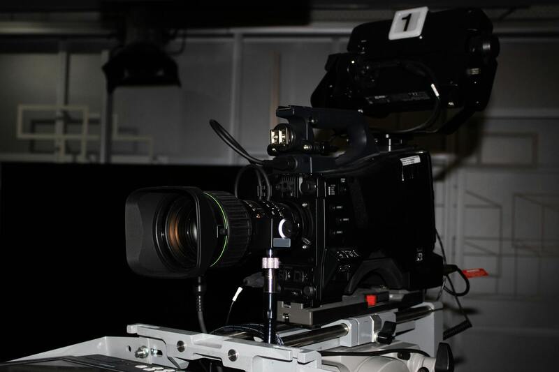
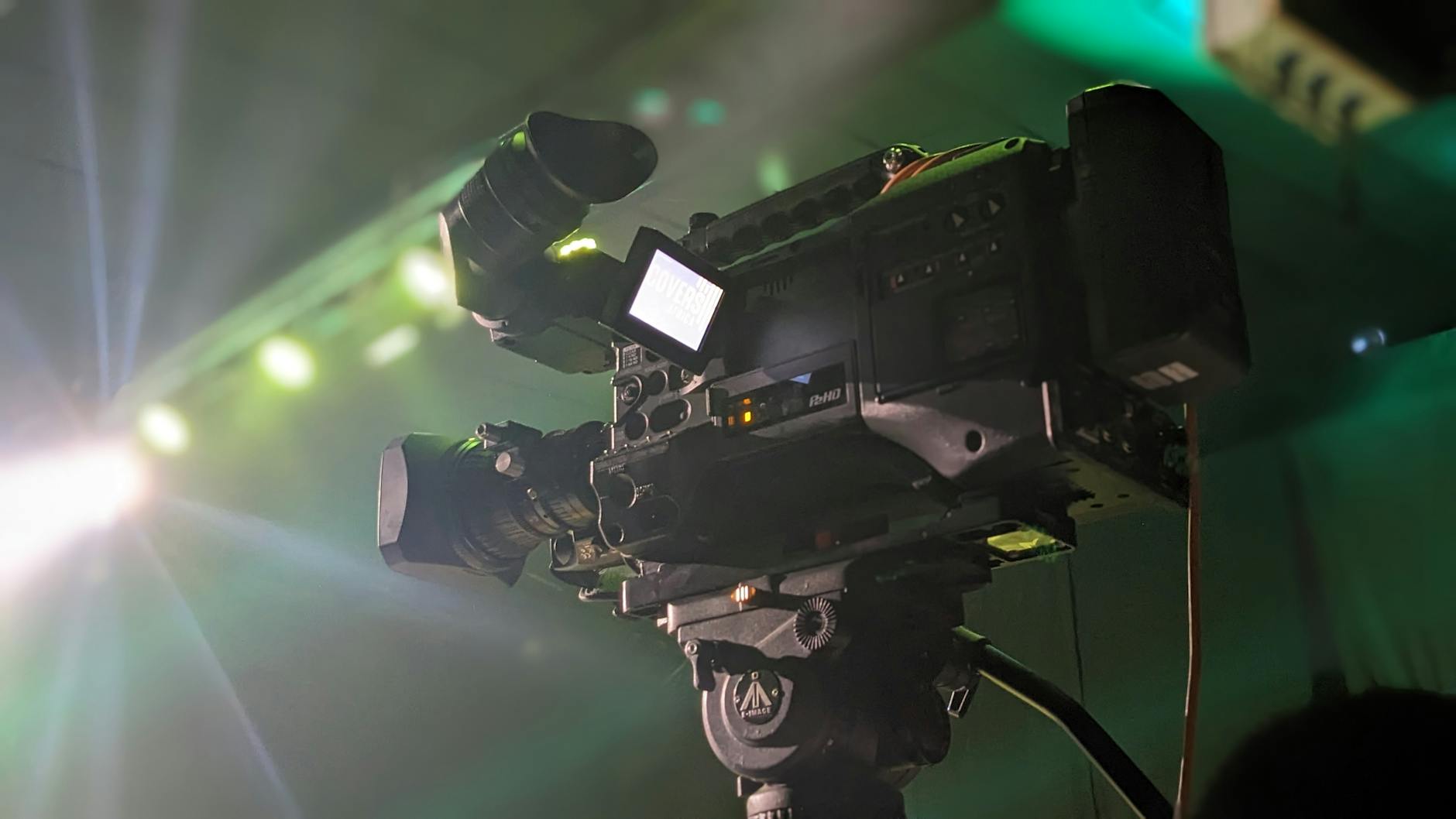
Executing high-quality drone real estate photography necessitates a careful selection of appropriate equipment and adherence to technical standards. To achieve professional results, operators should utilize drones equipped with high-resolution cameras capable of capturing detailed imagery from various angles and altitudes. The camera specifications should include capabilities such as 4K video recording and 20-megapixel (or higher) still images, ensuring sharp, vibrant visuals that showcase the property’s features effectively.
Furthermore, the stabilization system is critical. Gimbal technology stabilizes the camera during flight, reducing motion blur and providing steady, clear footage, which is particularly important for capturing sweeping panoramic views and intricate architectural details. Flight controllers should feature advanced GPS systems for precise positioning and smooth navigation, especially when capturing complex shots or performing automated flight paths.
Battery life and flight time are essential considerations. Extended flight durations allow the capture of comprehensive aerial footage without frequent battery swaps, minimizing disruptions during shoots. Many commercial drones support interchangeable batteries, enabling operators to prolong their filming sessions efficiently.
In addition to drone hardware, supplemental accessories such as aerial ladders, gimbal guards, and high-quality lenses can optimize shot quality and protect expensive equipment during operation. Operators should also invest in robust controllers with real-time video transmission capabilities to monitor footage quality during the flight.
Careful calibration of all equipment prior to shoots ensures consistency and optimal image quality. Regular maintenance, including firmware updates and sensor cleaning, also plays a vital role in preventing technical issues and maintaining professional standards.
Post-Production and Image Editing
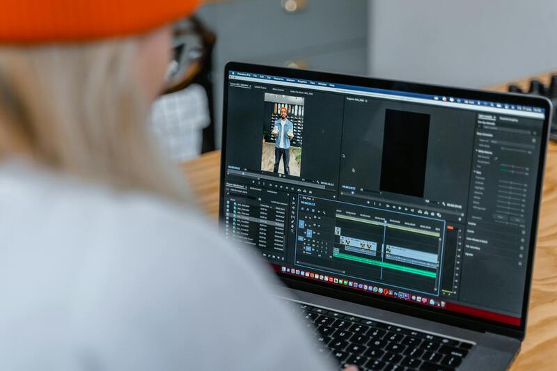
Post-production plays a pivotal role in transforming raw drone footage into compelling visual content that appeals to prospective buyers. High-resolution images and videos often require color correction, exposure adjustment, and contrast enhancement to accurately represent the property’s attributes. Utilizing professional editing software, such as Adobe Lightroom and Photoshop, allows for precise refinement of visual elements.
Corrections should aim to produce images that are both visually striking and true-to-life, capturing the property's true appearance under different lighting conditions. For panoramic or wide-angle shots, stitching multiple images seamlessly creates expansive views that further enhance the property’s appeal.
Motion stabilization and stabilization effects can be applied to smooth out any camera jitters, particularly in videos. Additionally, overlays, annotations, or highlighted features may be added to emphasize unique property details, amenities, or landscape features.
File optimization for different platforms ensures that images load swiftly and retain high quality across various marketing channels. Consistent editing standards across all visuals establish a recognizable branding style and add professionalism to property listings.
Quality control remains essential. Review all images for clarity, color fidelity, and framing before distribution. Properly edited visuals not only elevate marketing efforts but also attract more interest from serious buyers.
Technical Requirements and Equipment
For effective drone real estate photography, selecting the right equipment is paramount. High-quality drones equipped with advanced stabilization systems and high-resolution cameras are essential for capturing sharp, detailed images. For properties with expansive grounds or multiple structures, drones with longer flight times and extensive battery life enable comprehensive coverage without frequent interruptions.
Camera specifications also play a crucial role. Capable drones should feature sensors with high megapixel counts and wide-angle lenses to capture wide, immersive shots. Additionally, adjustable gimbal systems ensure smooth footage and precise framing, minimizing motion blur even in variable weather conditions.
Operational considerations include GPS-assisted navigation and obstacle avoidance features. These technologies facilitate safe flying maneuvers around complex property terrains, reducing risks during shoots. A stable transmission system allows real-time monitoring of footage, enabling professionals to decide if additional shots are necessary.
Complementary accessories such as extra batteries, carrying cases, and remote controllers contribute to efficient workflow. Setting up and calibrating drone hardware before each shoot guarantees optimal performance and consistent results.
Post-Production and Image Editing
Following the capture phase, editing plays a critical role in refining drone visuals. Color correction ensures that aerial images accurately depict the property’s colors under various lighting conditions, while exposure adjustments help balance shadows and highlights for a natural appearance.
Advanced editing techniques may include perspective correction to ensure architectural lines remain straight, preventing images from appearing distorted. Stitching software can be employed to produce seamless panoramic images, providing viewers with expansive vistas.
Stabilization effects and motion smoothing add professionalism to videos, making walkthroughs more engaging. Overlay annotations or virtual staging elements can highlight key features, guiding potential buyers’ attention.
Marketing Strategies for Drone Real Estate Content
Integrating high-quality drone visuals into marketing campaigns enhances property visibility across digital platforms. Customizing content for specific channels—such as social media, property websites, or virtual tours—maximizes engagement.
Employing an SEO-focused approach involves optimizing image metadata, utilizing descriptive alt tags, and incorporating relevant keywords into captions and descriptions. This not only improves search engine rankings but also ensures potential buyers discover listings through organic searches.
Consistent branding and professional presentation of drone visuals build credibility and attract serious inquiries. Collaborating with experienced photographers and videographers ensures that each image aligns with industry standards and client expectations.
Future Trends and Innovations in Drone Real Estate Photography
Emerging technologies such as 8K video resolution, AI-powered editing tools, and autonomous flight systems are revolutionizing the landscape of drone real estate photography. These innovations aim to produce even more detailed, interactive, and immersive visual experiences.
Another advancement includes the integration of 3D mapping and virtual reality, allowing prospective buyers to explore properties remotely with high fidelity. As flight regulations evolve, the deployment of next-generation drones will enable more intricate aerial surveys and real-time data collection.
Official Methods for Drone Real Estate Photography in Miami
While engaging in drone real estate photography, adhering to approved and recognized procedures ensures a seamless and professional experience. The process begins with selecting authorized drone operators who possess the appropriate certifications and conform to the standard operational protocols established by industry authorities. These operators are trained to handle equipment responsibly, ensuring safety during flights while capturing high-quality visuals.
Utilizing state-of-the-art drone technology that complies with industry standards guarantees the production of crisp, stable images and videos that meet the demands of high-end real estate marketing. This includes employing drones equipped with professional-grade cameras capable of capturing detailed aerial shots at various angles and altitudes. The choice of equipment plays a vital role in obtaining visuals that accurately represent property features, scenic surroundings, and neighboring amenities.
Pre-flight planning is crucial and involves detailed site assessments to map out optimal flight paths and angles for capturing the property perspective. Operators typically use mapping tools and site surveys to plan flights meticulously, avoiding obstructions like power lines, trees, or other structures. This disciplined approach ensures comprehensive coverage of the property while maintaining operational safety.
Post-flight, the selection of images and footage should follow a systematic review process, utilizing professional editing software to enhance visual clarity, color accuracy, and overall aesthetic appeal. This step involves adjusting brightness, contrast, and sharpness to ensure the visuals convey the property's true appeal.
In addition, maintaining detailed records of flight logs and camera settings supports transparency and quality control throughout the project. These records serve as documentation that the images were captured under controlled, verified procedures, aligning with industry best practices.
Choosing licensed drone operators who follow these official methods guarantees high-quality, legally compliant content that elevates the property's marketing profile and builds trust with prospective buyers and partners.
Technical Requirements and Equipment
Professional drone real estate photography hinges on the use of high-quality, reliable equipment tailored to meet the demanding needs of property showcase visuals. The selection of drones equipped with high-resolution cameras capable of capturing detailed imagery is essential for producing compelling real estate visuals. Models with stabilized gimbals ensure smooth footage free from jitters, enhancing the overall aesthetic appeal. Additionally, drones with advanced flight stability systems provide precise control, especially in variable weather conditions common in Miami.
Camera specifications must include features such as wide-angle lenses, high dynamic range (HDR), and adjustable aperture settings to accommodate different lighting environments. These specifications help achieve images that are crisp, vibrant, and true-to-life, accurately reflecting property details and scenic backgrounds. For example, capturing expansive ocean views requires equipment capable of handling broad vistas without distortion.
Battery life and flight endurance are crucial for completing comprehensive property surveys without frequent interruptions. Drones with longer flight times facilitate more extensive coverage within a single flight session, ensuring no critical angles or views are missed. Furthermore, remote controllers with intuitive interfaces and real-time data linkages enhance pilot control and situational awareness, especially when operating at higher altitudes or in complex environments.
Alongside the drone, supplemental equipment such as lightweight, portable lighting, and filters can be employed to optimize image quality, particularly during overcast days or interior shoots. Ground control systems and GPS modules provide real-time positioning data, allowing for precise navigation and synchronized shot planning.
Meticulous maintenance and regular calibration of all equipment are critical. Keeping sensors clean and camera lenses free of smudges ensures clarity and color fidelity. Consistent software updates and firmware checks help prevent operational issues, maintaining the drone's performance at optimal levels. A systematic approach to equipment management underpins the delivery of high-caliber visuals that meet industry standards and client expectations.
Post-Processing and Image Enhancement Techniques
After capturing high-quality footage and images through drone photography, the next essential step involves post-processing to maximize visual impact. This process not only refines the raw footage but also ensures that each shot highlights the property’s unique features effectively. Skilled editing can correct minor exposure inconsistencies, enhance color vibrancy, and optimize contrast levels, resulting in images that are vibrant yet true to life.
Color grading plays a vital role in elevating the visual appeal of drone photography. By adjusting color tones and saturation, editors can create a consistent aesthetic across a property’s visual portfolio, which aligns with the marketing strategy and brand identity. Additionally, perspective corrections can be applied to ensure that vertical structures like buildings are perfectly aligned, avoiding distortions that might distract prospective buyers.
When working with aerial footage, stabilization and cropping are crucial. Advanced editing software allows for the removal of unwanted camera shake and stabilization of shaky sequences, producing smooth, cinematic visuals. Cropping techniques help emphasize key property features, such as landscaping, swimming pools, or architectural details, directing the viewer’s attention seamlessly.
It is also beneficial to create a variety of visual content by stitching images into panoramic views or 3D models, providing potential buyers with immersive experiences. These advanced visuals require precise alignment and blending, which can be managed through specialized software to produce eye-catching presentations.
Finally, consistent file management and image optimization are fundamental to delivering high-quality content. Proper resolution settings, compression without quality loss, and organized storage facilitate quick deployment across various marketing channels, ensuring that the visuals maintain their professional standards in all formats and platforms.
Technical Requirements and Equipment for Drone Real Estate Photography
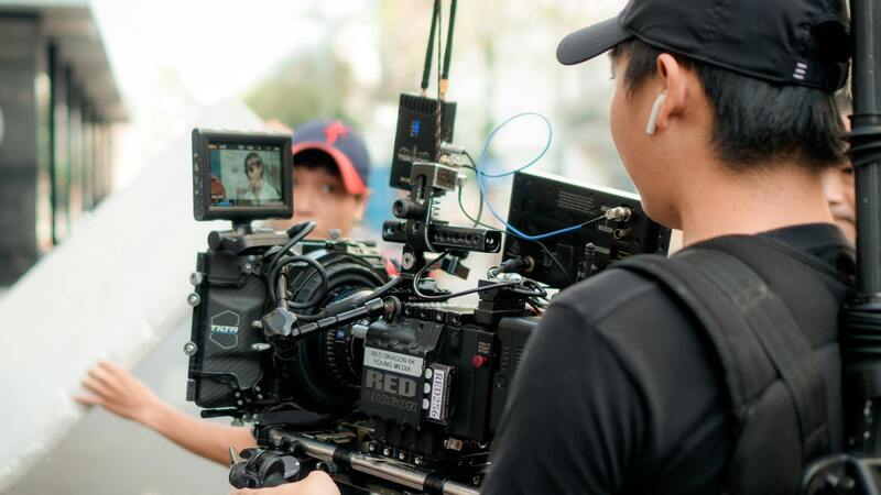
Achieving high-quality aerial images and videos for real estate listings requires a comprehensive understanding of the technical specifications and equipment involved. Selection of the right drone platform is crucial, as it impacts image stability, resolution, flight time, and maneuverability. Professionals often opt for advanced drone models equipped with high-resolution cameras capable of capturing detailed images suitable for large property displays and close-up architectural features.
Camera specifications play a pivotal role in the quality of drone imagery. Cameras with sensors of at least 1 inch and capable of shooting in 4K resolution are preferred to produce sharp, vibrant visuals. Adjustable aperture settings further enhance image quality by controlling light intake, which is particularly beneficial in varying lighting conditions prevalent in South Florida.
Gimbals are essential components that ensure stabilization during flight, minimizing motion blur caused by drone vibrations or wind disturbances. A three-axis gimbal is the standard for professional aerial photography, providing smooth, steady shots and allowing for precise framing and angle control.
Other critical equipment includes remote controllers with intuitive interfaces, extra batteries to extend flight sessions, and high-capacity storage solutions for handling large image and video files. For precise flight planning, professionals often utilize GPS-enabled flight systems that facilitate automated grid patterns and waypoint missions, ensuring comprehensive coverage of the property and maximizing efficiency.
Post-Production and Image Editing
Post-processing workflows are vital to enhancing aerial imagery’s visual appeal and ensuring it meets marketing standards. Skilled editors utilize software like Adobe Photoshop and Lightroom to adjust color balance, contrast, and sharpness. Perspective correction tools allow alignment of vertical lines, ensuring building edges appear straight and true to life, which enhances the viewer’s trust in the visual representation.
Stitching multiple images into panoramic views creates immersive virtual experiences for online house tours. This process employs high-precision software capable of blending overlaps seamlessly, maintaining image quality and perspective accuracy. Video footage can be stabilized and color-corrected to produce cinematic sequences that captivate potential buyers and capture the property's essence from a compelling aerial perspective.
Ensuring Consistency and Optimization Across Content
Consistent file management practices and optimization techniques play a significant role in professional real estate marketing. Using standardized resolution settings, such as 4K or higher, guarantees detail preservation across various platforms. Compression algorithms should be applied strategically to reduce file sizes without compromising the visual quality, ensuring quick load times and smooth playback on websites, mobile devices, and social media channels.
Organized storage systems facilitate easy retrieval and updates of marketing materials, enabling real estate agents and marketing teams to deploy fresh content regularly, which sustains audience engagement and amplifies property visibility.
Future Trends and Innovations in Drone Real Estate Photography
Emerging technological advancements promise to revolutionize drone-based real estate marketing further. Innovations such as 3D mapping enable the creation of detailed property models that provide potential buyers with interactive virtual experiences. Combining drone footage with virtual reality (VR) headsets allows users to explore properties remotely with immersive depth, transforming the way listings are presented. Additionally, advancements in autonomous flight and AI-driven imaging analysis will enhance the efficiency, accuracy, and appeal of aerial marketing strategies.