Overview of Commercial Real Estate Drone Services
In the competitive landscape of Miami’s commercial real estate market, professionals seek innovative solutions to enhance property visibility, streamline inspections, and optimize operational workflows. Commercial real estate drone services have emerged as a vital asset, leveraging advanced unmanned aerial vehicle (UAV) technology to provide high-resolution imagery, comprehensive surveys, and real-time data collection. These services play a pivotal role in elevating marketing strategies and operational efficiency for property owners, brokers, and developers.
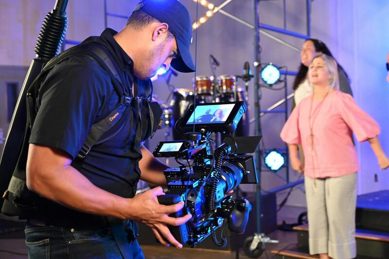
Drone technology in commercial real estate involves the deployment of specialized aerial platforms equipped with high-quality cameras and sensors. This equipment captures detailed images and videos from multiple angles, enabling stakeholders to present properties in a compelling visual format. In Miami’s dynamic market, where waterfronts, skyline views, and expansive urban developments dominate, drone footage offers an unparalleled perspective that traditional ground-based photography cannot replicate. As a result, drone footage enhances online listings, promotional videos, and virtual tours, attracting a broader audience and fostering faster leasing or sales processes.

Beyond marketing, commercial drone services are instrumental in conducting thorough property inspections and maintenance assessments. Equipped with specialized sensors, drones can access difficult-to-reach areas such as rooftops, exterior facades, and large industrial complexes. They facilitate quick, detailed evaluations that traditionally require scaffolding, ladders, or costly manual inspections. This capability not only reduces safety risks and labor costs but also shortens project timelines.
In Miami, where environmental factors like hurricanes and tropical storms frequently challenge property integrity, early detection of damage or structural issues through drone inspections is invaluable. Accurate data collected via drones supports due diligence during acquisitions and ongoing property management, ensuring decisions are based on comprehensive and up-to-date information.

Legal Regulations and Compliance for Drone Operations in Miami
Operating commercial drone services in Miami requires strict adherence to established protocols that govern aerial activities. Commercial operators must secure the necessary permits and authorizations to ensure their flight activities comply with local and federal guidelines. These regulations help maintain safety standards for the public, property, and other airspace users, and foster responsible drone usage within the bustling urban environment of Miami.
Florida has specific rules related to drone operations, including restrictions on flying over crowded areas, above certain altitudes, and near airports. In Miami, operators are expected to be aware of and respect zone-specific restrictions, especially in areas with high foot traffic or sensitive infrastructure. Additionally, regulations governing the privacy of individuals must be diligently followed, especially when capturing high-resolution imagery over private properties. Responsible drone usage also involves maintaining visual line of sight at all times and understanding no-fly zones established around critical infrastructure and government buildings.
Commercial drone pilots are typically required to obtain certification from the Federal Aviation Administration (FAA). This involves passing knowledge tests and registering drones used for business purposes. Beyond federal requirements, local municipal regulations may impose additional rules tailored to Miami's unique urban landscape and development activities. Staying compliant ensures efficient, trouble-free operation and builds trust with clients who seek legally sound solutions for their property visualization, inspection, and documentation needs.

Through thorough knowledge of the regulatory landscape and adherence to established standards, drone service providers in Miami can deliver consistent, high-quality results that foster ongoing client relationships. Employing operators with recognized certification and up-to-date knowledge of local and federal laws reassures clients of the legitimacy and professionalism of the services provided.
Applications of Drone Services in Property Inspection and Due Diligence
Enhanced property management and meticulous due diligence are critical for successful commercial real estate transactions. Drones equipped with advanced imaging technology facilitate comprehensive structural inspections, offering high-resolution aerial views that enable detailed analysis of building facades, roofs, and critical infrastructure. These inspections quickly identify issues such as roof damage, faulty drainage systems, or structural cracks that might otherwise require costly manual inspections or invasive methods.
Site surveys are another vital application of commercial real estate drone services. Aerial surveys rapidly assess land topography, existing use patterns, and potential development constraints. This not only accelerates planning phases but also enhances accuracy, providing detailed 3D models and orthomosaic maps. Environmental assessments benefit from drone data collection, where imagery can monitor vegetation health, water drainage, and protected habitats, ensuring compliance with environmental standards.

Integrating drone data into due diligence processes reduces the need for multiple site visits, minimizes inspection times, and enhances safety by allowing inspectors to evaluate hard-to-reach areas remotely. These digital assets support better decision-making, providing stakeholders with a comprehensive understanding of a property’s condition. Additionally, they facilitate clear communication between investors, developers, and regulatory bodies by furnishing detailed visual documentation.
Legal Regulations and Compliance for Drone Operations in Miami
To operate commercial drones in Miami, service providers must adhere to a complex framework of regulations designed to maintain airspace safety and protect privacy rights. Operators must secure proper certification, often obtained through FAA Part 107 licensing, which involves rigorous testing of knowledge related to airspace rules, safety procedures, and operational best practices. Ensuring that every drone used is registered with the FAA further substantiates adherence to federal standards.
Local regulations also influence drone operations, with specific Miami ordinances potentially imposing restrictions on flight altitude, times, and proximity to certain zones. Many urban areas have designated no-fly zones around airports, government facilities, and densely populated districts. Maintaining awareness of these restrictions is crucial for seamless project execution and to avoid operational disruptions. Responsible pilots always conduct pre-flight planning, including risk assessments and obtaining necessary permits if required.

In addition to regulatory compliance, drone operators should follow best practices related to data security and privacy. This entails informing property owners about data collection procedures, minimizing intrusive image capturing over private spaces, and securely managing flight data. By maintaining transparency and following established protocols, drone service providers establish credibility and foster trust with commercial clients.
Staying current on evolving policies and technological advancements ensures that drone services remain compliant and effective. Regular training for drone pilots and continuous review of local and federal guidelines help maintain high standards of operation. When approached with professionalism and meticulous adherence to regulations, commercial drone services in Miami can deliver reliable, high-quality imagery while safeguarding public interests and operational safety.
Legal Regulations and Compliance for Drone Operations in Miami
Conducting drone operations in Miami’s dynamic urban landscape requires adherence to a comprehensive framework of rules designed to ensure safety, privacy, and efficient airspace management. Maintaining compliance involves understanding both local ordinances and federal guidelines, which collectively govern the deployment of commercial drone services. These regulations stipulate specific parameters for drone flight operations, including altitude limits, flight zones, and operational hours. For instance, flights over certain sensitive areas, such as airports or government facilities, are restricted unless explicit permissions are obtained.
Operations must also include obtaining necessary permits and authorizations. These often involve registration with relevant authorities, establishing operational protocols, and documenting flight plans. Pre-flight planning is critical to identify no-fly zones—such as densely populated districts or environmentally protected areas—and to incorporate contingency measures for unforeseen circumstances. Ensuring that drone pilots are trained thoroughly on safety procedures and regulatory compliance minimizes operational risks and enhances the quality of service provided to clients.
In addition to permission acquisition, drone operators should implement safety protocols that encompass real-time airspace awareness and emergency procedures. Regular maintenance checks of the equipment, detailed risk assessments, and strict adherence to flight boundaries contribute to a seamless operational process. Such practices demonstrate professionalism and foster trust among commercial clients who rely on precise, timely, and compliant imagery and data collection.

To stay aligned with evolving policies, drone service providers often participate in ongoing training programs that update pilots on new federal and local mandates. Keeping abreast of technological innovations that enhance safety and efficiency also plays a vital role in maintaining high standards. By integrating regulatory compliance into every stage of drone service delivery, Miami-based providers can ensure compliant, effective, and secure operations that serve the needs of commercial real estate clients with reliability and professionalism.
Legal Regulations and Compliance for Drone Operations in Miami
Operating commercial drone services in Miami necessitates a thorough understanding of regional procedures and safety standards that govern drone flights. While it is essential to acquire necessary authorizations before initiating drone operations, emphasis should also be placed on meticulous planning and adherence to established protocols to ensure smooth and successful project execution.
One key aspect involves analyzing airspace classifications to identify any restrictions or airspace notifications that might impact drone flights over specific commercial properties. Miami features a mix of urban zones, airports, and environmental protected areas, each requiring careful attention to avoid disruptions or operational setbacks. Effective use of digital tools for airspace analysis can assist in defining optimal flight zones, thereby integrating safety with operational efficiency.
Prior to each mission, detailed flight plans should be developed, encompassing not only the intended flight paths but also emergency procedures and contingency plans for unforeseen circumstances. Conducting pre-flight risk assessments ensures all potential hazards are considered and mitigated, fostering a safer operational environment for drone pilots and surrounding areas alike.
Operational safety measures include the use of geo-fencing technology to delineate flight boundaries explicitly, preventing unauthorized incursions into restricted zones. Regular calibration and maintenance of drone equipment are vital to uphold flight stability and data accuracy, especially when capturing high-resolution imagery critical for commercial real estate evaluation.
Furthermore, deploying well-trained pilots who understand both the technical aspects of drone handling and the specific demands of commercial property data collection contributes significantly to operational success. Ongoing training programs keep pilots updated on evolving regulations and technological innovations, which is crucial in a dynamic regulatory landscape like Miami’s.
The integration of real-time airspace monitoring tools provides an added layer of safety, enabling pilots to receive current information about temporary flight restrictions, dynamic no-fly zones, or unexpected changes in air traffic conditions. Incorporating these systems minimizes the risk of violations and helps maintain a high standard of professionalism in drone operations.
Diligent documentation of each flight session, including flight logs, safety checklists, and compliance records, ensures that all activities are transparent and verifiable. This practice not only supports compliance with regulatory bodies but also enhances client confidence when showcasing comprehensive, certified imagery and data for commercial real estate projects.
Choosing a Drone Service Provider in Miami
Selecting a reliable and experienced provider for commercial real estate drone services in Miami is essential for maximizing the benefits of drone technology. An ideal partner should possess a robust portfolio demonstrating proficiency in aerial imaging, data acquisition, and the ability to tailor services to specific property types and client needs. When evaluating drone service providers, clients should consider the following key factors:
- Experience and Industry Reputation: Providers with a proven track record in commercial real estate projects often deliver higher quality results. Their familiarity with local Miami regulations, airspace nuances, and the unique demands of commercial property markets ensures smoother operations and more accurate outcomes.
- Certifications and Credentials: Qualified pilots credentialed with relevant aviation authorities signify adherence to safety and operational standards. Certification programs such as Part 107 in the United States validate the professional competence of drone operators.
- Technology and Equipment: The latest drone models equipped with high-resolution cameras, thermographic sensors, and GPS stabilization features enable comprehensive data collection and detailed imaging. Providers should continually update their fleet to keep pace with technological advancements.
- Customization and Service Range: The ability to customize services—such as aerial videography, 3D modeling, or thermal inspections—supports diverse project needs. Additionally, providers should accommodate scheduling flexibility and rapid turnaround times to meet project deadlines effectively.
- Data Security and Privacy: Given the sensitivity of commercial property information, a reputable provider must implement strict data security protocols, ensuring client data remains confidential and protected from unauthorized access.

Establishing clear communication channels and detailed service agreements upfront enhances collaboration and sets expectations for project scope, deliverables, and post-mission support. By prioritizing these criteria, clients can make informed decisions, ensuring their commercial real estate investments are supported by precise, comprehensive, and compliant aerial data collection.
Applications of Drone Services in Property Inspection and Due Diligence
Utilizing drone technology for property inspection and due diligence offers a transformative approach to assessing commercial real estate assets in Miami. Traditional inspection methods often involve extensive manual labor, restricted access, and prolonged timelines. Drones streamline this process by providing rapid, high-resolution aerial perspectives that uncover critical details without physical intrusion.
For structural inspections, drones equipped with high-definition cameras and specialized sensors facilitate detailed examinations of rooftops, façades, and hard-to-reach areas. Thermal imaging sensors can identify issues such as insulation deficiencies, moisture intrusion, or electrical hotspots, which might be overlooked during standard visual inspections. This data aids in evaluating property condition and planning maintenance or repairs proactively.
In due diligence processes, comprehensive aerial surveys contribute valuable insights into property boundaries, topography, and environmental features. This information supports accurate valuations, title verification, and transaction assessments. For instance, detailed 3D mapping generated by drones can delineate property extents precisely, ensuring clarity in land use and legal boundaries.

Deploying drone services also reduces the need for site visits, minimizes safety risks, and accelerates data collection, leading to more timely decision-making. This capability proves especially advantageous in Miami’s dynamic real estate market, where rapid project assessments and accurate data are crucial for capitalizing on investment opportunities.
Implementation requires adherence to established operational standards and proper planning. Pre-mission site analysis, risk assessments, and coordination with property owners ensure efficient operations. Post-mission data processing involves integrating aerial imagery into CAD or GIS platforms, providing stakeholders with actionable insights that support negotiations, planning, and compliance documentation.

In summary, drone applications for inspection and due diligence complement traditional methods by delivering faster, safer, and more detailed evaluations of commercial properties. As Miami’s market continues to evolve, integrating drone data into property management and transaction workflows becomes an essential component of an effective real estate strategy.
Extended Benefits of Commercial Real Estate Drone Services in Miami
Leveraging drone technology for commercial real estate in Miami extends beyond simple visual documentation. These advanced aerial systems facilitate comprehensive data collection that enhances decision-making at every stage of the property lifecycle. From initial site analysis to ongoing maintenance, drone services provide accurate, real-time insights that empower stakeholders to optimize property value and operational efficiency.
Integration with Advanced Data Platforms
One of the significant advantages of these drone operations lies in their compatibility with GIS and CAD systems. Data captured via drones can be seamlessly integrated into existing digital maps and models, allowing for precise visualization of property features, topographical variations, and land use. This integration supports accurate planning, risk assessment, and regulatory compliance, ensuring stakeholders have reliable information to guide their actions.
Enhancement of Site Management and Maintenance
Drone services also play a vital role in ongoing property management. Routine aerial inspections enable real-time monitoring of structural integrity, landscaping, and infrastructure conditions. This proactive approach facilitates early detection of issues such as roof damage, drainage problems, or vegetation overgrowth, thus reducing maintenance costs and avoiding unexpected failures.
Support for Sustainability and Environmental Compliance
With growing emphasis on sustainable development within Miami’s commercial real estate sector, drones contribute significantly by monitoring environmental parameters. They can evaluate green roofs, solar panel efficiency, and stormwater management systems, helping property owners meet environmental standards and improve sustainability metrics.
Enhanced Safety and Risk Management
In scenarios involving large-scale site operations, drone usage minimizes the need for personnel to access potentially hazardous areas. Whether inspecting tall structures or hard-to-reach rooftops, drones reduce safety risks for workers while providing detailed imagery and sensor data for safety audits and compliance documentation.
Supporting Transactional Processes
High-quality aerial footage and detailed maps generated by drones enhance marketing efforts, providing prospective tenants or buyers with compelling visualizations of a property’s scope and environment. Additionally, accurate 3D models and land surveys streamline negotiations and due diligence, making transactions more efficient and transparent.