Overview of Commercial Property Aerial Photography
Commercial property aerial photography involves capturing high-quality images of commercial real estate from an elevated perspective using specialized aerial imaging techniques. These images serve as an essential tool in showcasing the full scope of a property, including its size, layout, surrounding infrastructure, and accessibility. In Miami's bustling real estate market, such photography plays a pivotal role in differentiating listings, attracting investors, and facilitating development planning.
This type of imagery is integral for real estate brokers, developers, investors, and marketing professionals aiming to highlight the unique features of commercial properties—be it office complexes, retail centers, industrial sites, or land parcels. By offering a bird’s-eye view, aerial photography allows stakeholders to better understand spatial relationships, property boundaries, and the relationship to nearby amenities, transit routes, and natural features.
In Miami’s dynamic real estate landscape, aerial photography has become an indispensable component of modern marketing and development strategies. Professional aerial images not only bolster online listing attractiveness but also assist in due diligence, urban planning, and infrastructure development. With the city’s diverse architecture and waterfront landscapes, capturing striking aerial visuals helps differentiate properties in a competitive market and provides accurate visual data for decision-makers.
By leveraging advanced camera technology and drone capabilities, professionals can obtain detailed, high-resolution images that convey the true scale and condition of commercial properties. These images serve as vital assets in promotional campaigns, feasibility studies, and project proposals, facilitating a clearer understanding of complex site features from a single, comprehensive vantage point.
Recognizing the importance of these visuals, Miami's real estate sector increasingly relies on expert aerial photography services to deliver consistent, high-quality imagery that aligns with branding, marketing goals, and project specifications. In essence, commercial property aerial photography transforms the way real estate assets are presented, evaluated, and developed in Miami's vibrant urban environment.
Legal and Regulatory Considerations
When conducting commercial property aerial photography, adherence to established protocols ensures the acquisition of high-quality images while respecting operational boundaries. Professionals utilize officially sanctioned airspace and coordinate closely with relevant authorities to obtain necessary permissions for drone operations or aerial imaging platforms. This process involves understanding restricted zones, altitude limitations, and specific operational hours to maintain compliance within designated areas. Employing certified pilots and adhering to aviation standards not only guarantees safety but also ensures that imagery collection aligns with recognized procedures.
It is essential to verify that all equipment and flight plans meet the standards set forth by governing agencies. This verification encompasses obtaining proper authorization, documenting flight paths, and maintaining up-to-date certifications for operators and equipment. Such due diligence prevents interruptions during shoots and avoids potential penalties. Moreover, documentation of permissions and adherence to safety protocols can serve as proof of compliance for future reference or audits, reinforcing the professionalism of the aerial photography process.

In urban zones like Miami, understanding and respecting airspace restrictions is particularly critical due to dense infrastructure and proximity to airports and other sensitive areas. Collaborating with experienced service providers familiar with local airspace regulations ensures a seamless operation that integrates all legal considerations into the project timeline. This approach minimizes the risk of delays and contributes to the overall success of the project.
Key elements include obtaining clearance from the Federal Aviation Administration (FAA) or relevant local agencies and staying informed about temporary flight restrictions (TFRs) during special events or construction activities. Establishing communication channels with authorities and stakeholders beforehand facilitates smooth operation and mitigates potential misunderstandings, ensuring the collection of valuable aerial visuals without infringing on legal boundaries.
Details of Regulations Governing Commercial Aerial Photography in Miami
Executing commercial property aerial photography in Miami requires precise adherence to established protocols that govern the use of unmanned aerial systems (UAS) and aircraft. Operators must familiarize themselves with federal, state, and local regulations designed to ensure safe, responsible airspace use. Within the federal framework, the Federal Aviation Administration (FAA) mandates specific operational standards, including drone registration, obtaining special certificates of authorization (COA) if flying beyond visual line-of-sight, and adherence to altitude restrictions that typically limit flights to 400 feet above ground level. Such rules are crafted to minimize risks to other aircraft and ground-based operations, particularly in densely populated urban environments like Miami. Complementing federal regulations, local ordinances in Miami might impose additional restrictions related to designated flight zones, noise ordinances, and privacy considerations. These stipulations may influence flight times, frequencies, and flight paths, especially near sensitive areas such as airports, government facilities, or private residences. Compliance involves coordinating with city authorities and ensuring all permits and documentation are current and properly filed.
To align with all relevant regulations, operators often work through comprehensive pre-flight planning, which includes mapping out the intended flight path while considering potential obstructions, no-fly zones, and emergency procedures. This process also involves checking for temporary flight restrictions (TFRs) triggered by events like construction activities or public gatherings. Such restrictions are crucial to observe as they temporarily eliminate permitted airspace for specific fly zones.

Operational Protocols and Permitting Process
Operators aiming to conduct commercial aerial photography in Miami must undertake a thorough permit and clearance process. This involves securing approvals from relevant authorities, which may include city agencies, the FAA, and airport authorities. Preparing comprehensive documentation that details the scope of the project, the intended flight plan, and safety measures demonstrates a commitment to responsible conduct and facilitates smoother approval workflows. In addition to permit applications, operators should conduct risk assessments to identify potential hazards, devise mitigation strategies, and establish emergency procedures. These efforts help mitigate unforeseen complications during flight operations, ensuring the safety of personnel and the public. Another critical aspect involves maintaining accurate records of all permissions, flight logs, and safety protocols followed during the project. Such documentation serves as evidence of compliance and can be valuable in case of audits or reviews.
Official Methods for Conducting Commercial Property Aerial Photography
To ensure the success and safety of aerial photography projects over commercial properties, it is crucial to follow a structured approach that emphasizes adherence to established protocols and standards. This involves a comprehensive planning process, starting with obtaining necessary authorizations from local authorities, such as city planning departments and transportation agencies, which oversee airspace management and operational safety in Miami. Such coordination helps define the permissible flight zones and times, and ensures that the project remains compliant with all operational guidelines.
Next, it is important to engage with certified drone operators who are experienced in commercial projects and hold the appropriate credentials or permits. These professionals are well-versed in flight planning, risk management, and safety procedures, significantly reducing the likelihood of disruptions or conflicts during execution. It is advisable to prepare a detailed flight plan that outlines the exact locations, altitudes, and times for each aerial shot, along with contingency measures for unexpected situations.

This planning phase also involves coordinating with local authorities and obtaining explicit permissions where necessary. Compliance with regulations not only facilitates smooth operations but also reflects a responsible approach to aerial photography that considers public safety and private property rights.
During the project, maintaining detailed records of all permits, flight logs, safety inspections, and communications with relevant agencies demonstrates professionalism and transparency. These records are vital for review processes, future reference, and to reinforce adherence to the policies governing aerial operations in urban settings.
Utilizing cutting-edge technology is a key component of official aerial photography methods. High-quality drones equipped with advanced stabilization systems and high-resolution cameras enable comprehensive coverage of commercial sites with minimal disruption. The use of FAA-approved equipment and software for flight path mapping and safety monitoring further enhances operational efficiency and safety.

In addition, professional operators integrate telemetry and real-time data collection tools to monitor flight parameters continuously. This proactive approach helps mitigate risks, ensures optimal image quality, and maintains adherence to all regulatory requirements, fostering confidence among clients and stakeholders.
Adhering to Standards Enhances Aerial Photography Outcomes
Following official protocols and methods not only guarantees smooth project execution but also serves to produce high-quality, reliable imagery vital for commercial property assessments. Such images support marketing initiatives, property evaluations, and infrastructure planning, thereby adding value to real estate portfolios. Collaborating with experienced aerial photographers who are committed to regulatory compliance ensures that every project meets the highest standards of safety, legality, and technical excellence, ultimately contributing to the successful promotion and management of commercial properties in Miami.
Equipment and Technology Used
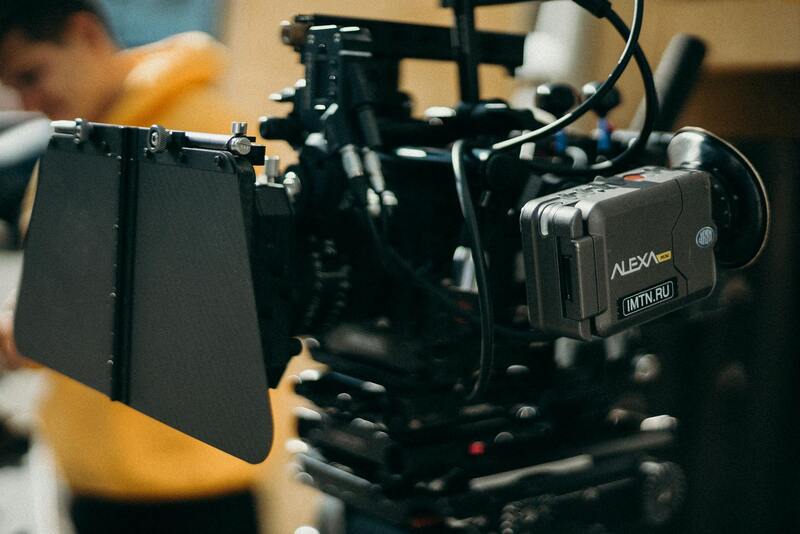
Executing high-quality commercial property aerial photography relies heavily on the use of professional-grade equipment and cutting-edge technology. The core of this approach involves the deployment of FAA-approved drones equipped with high-resolution cameras capable of capturing detailed images from various altitudes and angles. These drones are fitted with stabilization systems that ensure steady footage and clear visuals, even in challenging weather conditions or when navigating complex property layouts.
In addition to camera technology, advanced flight planning software plays a crucial role. This software allows aerial photographers to design precise flight paths, ensuring comprehensive coverage of the commercial site without unnecessary overlaps or gaps. Such planning is essential for creating consistent, high-quality imagery that can be utilized for marketing, property assessment, or infrastructure analysis.
Real-time telemetry and data collection tools are integrated into the equipment to monitor flight parameters continuously, including altitude, speed, and battery health. These tools facilitate immediate adjustments, optimizing image capture and maintaining safety standards. Furthermore, geospatial positioning systems—such as GPS and GLONASS—enable pinpoint accuracy in image stitching and map integration, vital for detailed analysis and comprehensive documentation of commercial properties.

Combining these technological advancements ensures that aerial photography sessions are both efficient and produce imagery that meets rigorous standards necessary for professional use. From real estate evaluation to infrastructure development, the precise, detailed visuals captured through these official methods provide stakeholders with reliable insights crucial for informed decision-making.
Moreover, adherence to safety protocols during drone operation—such as maintaining visual line of sight, respecting no-fly zones, and implementing emergency procedures—reduces risks and enhances the overall quality and authenticity of the imagery captured. Partnering with experienced aerial photographers familiar with these technological tools guarantees the successful delivery of comprehensive and legally compliant aerial visuals for commercial properties in Miami and beyond.
Legal and Regulatory Considerations
Ensuring compliance with pertinent regulations is fundamental when capturing commercial property aerial imagery. Operators must adhere to established procedures for airspace usage, respecting designated no-fly zones such as airports, government facilities, and sensitive infrastructure. Permission protocols often involve securing clearances from relevant authorities or property owners, especially when operating in urban areas with densely populated zones.
Standardized operational guidelines dictate flight altitudes, operating hours, and maximum distances for unmanned aerial vehicles (UAVs). Maintaining a safe distance from other aircraft and ensuring altitude restrictions are followed prevents disruptions and potential hazards. Utilizing approved flight plans mapped with geospatial data helps in documenting operational routes, which is particularly useful for formal audits or inspections.
Proper record-keeping of flight permissions, operator certifications, and maintenance logs underscores professional integrity and accountability. These documented practices not only promote safe aerial operations but also support a seamless integration into official workflows relevant to commercial real estate projects. Adopting these meticulous methods increases confidence among stakeholders and streamlines the coordination process with regulatory bodies.

In addition, technical aspects such as geotagging images with precise metadata contribute to transparent documentation. Accurate timestamping and location data enhance the value of aerial visuals, facilitating detailed analysis and operational tracking. When surveying large or complex commercial sites, this structured approach supports comprehensive asset management and eases future referencing.
Operational safety mechanisms—such as pre-flight risk assessments, real-time telemetry monitoring, and emergency procedures—are integral components of compliant aerial photography. These measures mitigate potential risks during flight, uphold high standards of image authenticity, and sustain a professional reputation in the industry. Engaging skilled pilots familiar with local airspace regulations further bolsters adherence to these official practices, ensuring consistent quality and legal conformity for commercial property imagery.
Legal and Regulatory Considerations
Safeguarding the integrity of commercial property aerial photography necessitates adherence to a comprehensive framework of regulations and procedures designed to ensure safe, efficient, and responsible operation. These protocols encompass obtaining appropriate permissions from relevant authorities, planning flight paths meticulously to avoid restricted or sensitive airspace, and maintaining clear documentation of authorization for each aerial shoot. Ensuring that all flights are conducted within designated operational windows and under supervised conditions minimizes disruption to local air traffic and avoids interference with other aerial activities.
Operators engaged in commercial aerial photography must comply with strict standards regarding aircraft maintenance and pilot qualifications. Regular inspection and servicing of UAVs or aircraft guarantee optimal performance, while certified pilots with specialized training exhibit proficiency in navigation, risk management, and emergency procedures. This level of professionalism not only enhances safety but also fortifies the credibility of the service provider in handling high-value commercial projects.

Furthermore, navigating local ordinances and airspace restrictions involves a detailed understanding of geographic and legislative nuances. Many jurisdictions require permits or notifications prior to conducting aerial surveys, especially in densely populated or protected areas. Allowing sufficient lead time for permit approval and coordinating with local authorities or aviation agencies ensures the smooth execution of projects without legal complications. This proactive approach underscores a commitment to ethical practices and operational transparency, fostering trust with clients and regulatory bodies alike.
Digital tools and geospatial data play an essential role in compliance. Utilizing Geographic Information Systems (GIS) for flight planning enhances precision in avoiding restricted zones, and digital logging of all permissions and flight records facilitates accountability and easy audits. Engaging with licensed operators familiar with the legal landscape further supports lawful and professionally executed aerial captures of commercial sites.
Legal and Regulatory Considerations in Commercial Property Aerial Photography
Ensuring adherence to official frameworks when conducting aerial photography for commercial properties is vital for safeguarding project integrity and operational smoothness. This involves a thorough understanding of local aviation rules, geographic restrictions, and mandatory documentation procedures that govern aerial data acquisition. By following these established protocols, service providers can mitigate risks related to unauthorized access or interference with restricted airspace.
Prior to any aerial imaging project, obtaining the necessary permits is a fundamental step. This process typically requires detailed project proposals, including flight plans, purpose of drone or aircraft operations, and specific locations. Engaging with aviation authorities or local governing bodies early in the planning stage facilitates the approval process and demonstrates compliance with the regulatory environment.
Airspace restrictions are another critical aspect. Many commercial sites are located near protected or controlled zones, such as airports, military bases, or densely populated areas. Identifying these zones through digital tools like Geographic Information Systems (GIS) helps plan safe and compliant flight paths. It’s equally important to consider temporary restrictions that may be active due to special events or national security measures, which require real-time updates and coordination.
Regulatory adherence extends beyond obtaining permits. It involves maintaining comprehensive records of permissions, flight logs, and operator certifications. Digital logging systems assist in tracking all official authorizations and operational data, ensuring transparency and providing a clear audit trail if needed. Utilizing authorized pilots who are familiar with the geographic and legislative landscape helps prevent inadvertent violations and streamlines project execution.
In some regions, specific altitude restrictions, line-of-sight requirements, and operational hours must be observed. Adjusting flight plans accordingly and conducting pre-flight risk assessments are best practices that minimize potential disruptions or safety concerns. Ethically managing these aspects ensures not only legal compliance but also reinforces the professionalism of the aerial photography provider.
Ultimately, a proactive approach involving communication with authorities and adherence to all guidelines enables high-quality, compliant aerial imagery collection. This comprehensive legal awareness fosters confidence among clients and end-users, solidifying the provider’s reputation for operational excellence and responsibility in commercial real estate projects.