Understanding Aerial Real Estate Photography
Aerial real estate photography involves capturing high-quality images and videos of properties from the sky, primarily using drones equipped with advanced cameras. This innovative approach offers a comprehensive perspective that ground-level photos cannot achieve, highlighting the property's scale, layout, surrounding landscape, and unique architectural features. With the increasing competition in the real estate market, high-impact visuals can make a significant difference in attracting potential buyers and investors.
The primary advantage of aerial photography in real estate is its ability to showcase a property's full scope, including outdoor amenities, proximity to key landmarks, and appeal to a broader audience. This method enhances online listings, allowing prospective buyers to visualize the property better and develop an emotional connection even before visiting in person.
For real estate professionals, integrating aerial photographs into marketing strategies can lead to increased visibility and faster sales. It enables showcasing both the property itself and its surrounding environment, which is often crucial in markets seeking homes with scenic views, large lots, or desirable neighborhood features. Additionally, aerial imagery lends a modern, professional appearance to listings, setting properties apart in a competitive landscape.
Advantages of Aerial Photography in Property Marketing
- Enhanced visual appeal for online listings
- Better showcasing of property size and layout
- Highlighting special outdoor features and landscaping
- Creating impressive promotional videos for marketing campaigns
- Providing prospective buyers with a comprehensive perspective from a single image or video
Innovative technological advancements have made aerial photography more accessible and affordable, allowing real estate professionals to leverage these benefits without excessive costs. As drone technology continues to evolve, the quality, stability, and usability of aerial images improve, making them an essential component of modern property marketing strategies.
How to Find Local Aerial Photography Services
Locating reputable aerial real estate photography services near your Miami property requires a strategic approach to ensure you partner with experienced professionals who understand the nuances of the local market and comply with local regulations. The first step involves conducting targeted online searches using specific keyword phrases such as aerial real estate photography near me. This approach helps identify providers with a physical service area in Miami, which is essential for timely and cost-effective service delivery.
Utilizing local business directories and review platforms also offers insights into the reputation and quality of local providers. Look for companies with positive client feedback, a portfolio of completed projects, and clear communication channels. Recommendations from industry peers or real estate agencies in Miami can further narrow down your options to experienced and reliable providers.
Attending local real estate expos or industry networking events in Miami provides opportunities to meet service providers directly. These events often feature demonstrations of the latest drone technologies and showcase portfolios, allowing you to assess their expertise firsthand. Establishing personal contact can also clarify service scope, availability, and pricing structures.

Before finalizing a provider, verify their familiarity with Miami's specific airspace regulations, permitting requirements, and local zoning laws, ensuring smooth project execution. Requesting sample images or case studies of previous Miami projects can further assist in evaluating their ability to produce high-quality, tailored aerial imagery that meets your marketing goals.
In addition to traditional methods, many Miami-based aerial photography providers now maintain professional websites that detail their services, equipment, and expertise. Browsing these digital portfolios offers a direct look at their work quality and the diversity of shots they can produce, from sweeping property views to detailed landscape images. Contacting them directly for quotes and consultations allows you to compare offerings and choose the best fit for your specific needs.
Understanding Aerial Real Estate Photography
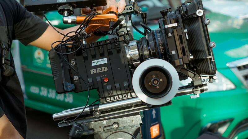
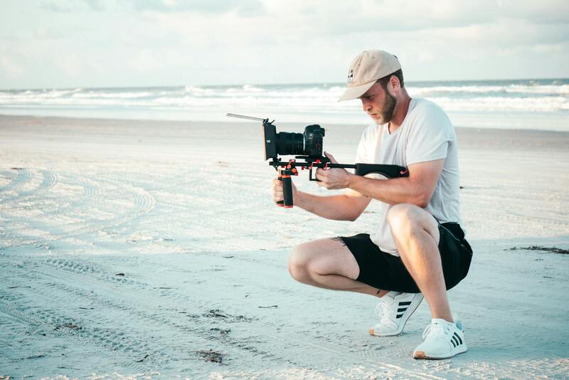
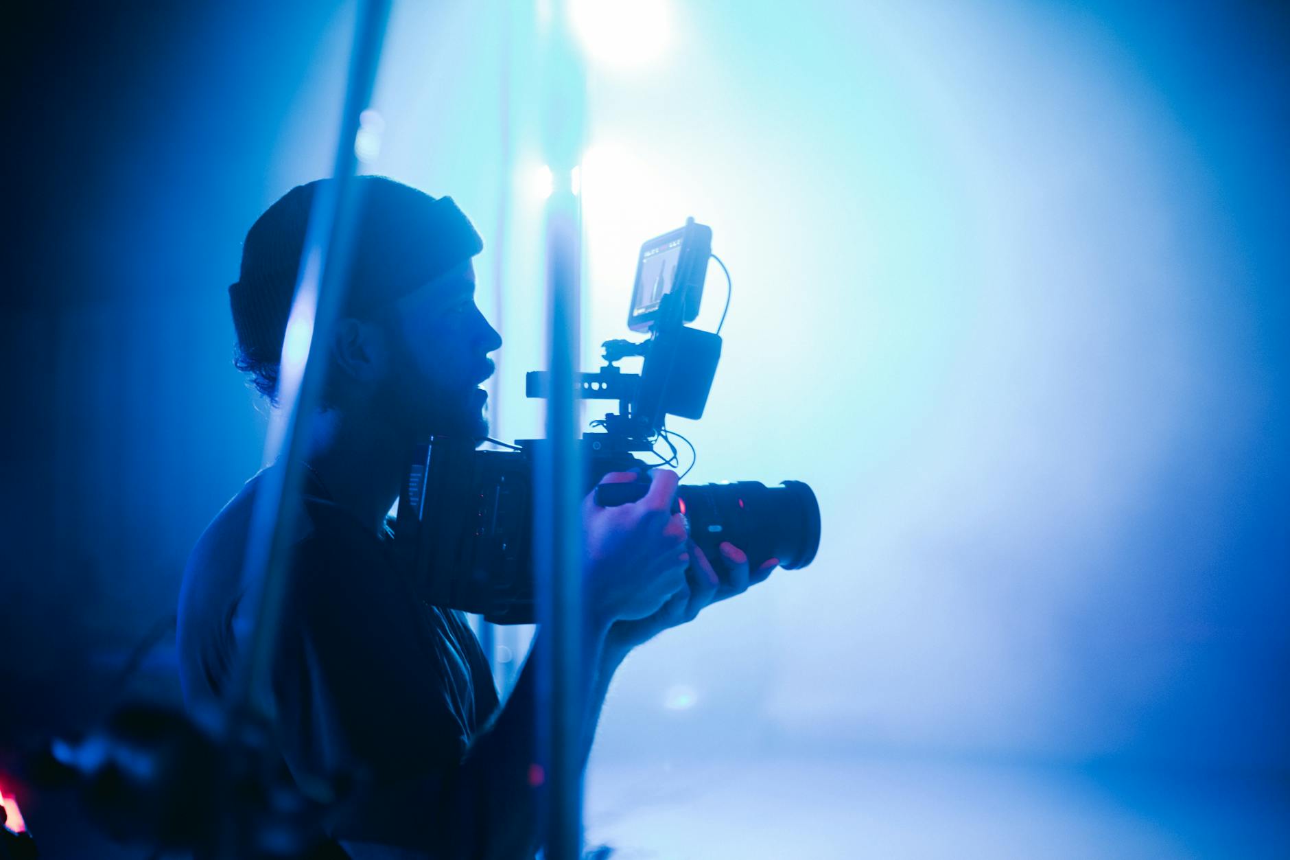
Aerial real estate photography employs drone technology to capture high-quality images and videos from elevated perspectives, offering a unique view of properties and their surroundings. This method enhances visual marketing strategies by providing potential buyers with comprehensive and immersive imagery that traditional photography cannot achieve. When selecting an aerial photography provider, it is essential to consider their mastery of drone operation, camera equipment quality, and experience in real estate projects. Reliable providers utilize state-of-the-art drones equipped with high-resolution cameras, stabilization systems, and advanced imaging technology to ensure sharp, vibrant visuals that highlight the property's best features. Additionally, understanding the workflow, from pre-flight preparations to post-production editing, helps in assessing a company's professionalism and commitment to quality. Proper planning around flight paths, lighting conditions, and property angles ensures that each shot effectively captures the essence of the estate, thereby maximizing its appeal to prospective buyers.

Importance for Miami Real Estate Market
In Miami's competitive real estate landscape, aerial imagery plays a crucial role in differentiating properties in a crowded market. The vibrant cityscape with its distinctive architectural styles and scenic coastal views demands visually compelling content to attract discerning clients. Aerial photography enables real estate agents and property owners to present properties from angles that reveal spatial relationships, surrounding amenities, and lifestyle appeal. For luxury listings, such imagery can emphasize the exclusivity and grandeur of the estate, appealing to high-net-worth buyers seeking unique visual narratives. Moreover, drone images improve online listings' engagement rates, encouraging more visits and inquiries. Given Miami's diverse neighborhoods and distinctive zoning requirements, working with a provider experienced in local airspace regulations ensures efficient navigation through permitting processes, allowing for timely project completion. The right aerial imagery does not just showcase a property—it tells a story that resonates with potential buyers, fostering emotional connections that drive sales.

Tailoring Content to Market Trends
- Highlighting Scenic Views: Emphasizing Miami's waterfronts, skyline, and lush landscapes.
- Showcasing Neighborhood Features: Demonstrating proximity to beaches, parks, and urban amenities.
- Capturing Lifestyle Appeal: Creating images that evoke the vibrant Miami lifestyle—outdoor living, entertainment, and luxury amenities.
By incorporating these elements, aerial real estate photography becomes a powerful tool to appeal to specific buyer demographics, reinforcing the property’s unique advantages within the dynamic Miami market.
Key Features to Look for in a Drone Photography Provider
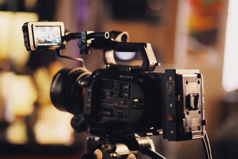
Securing exemplary aerial real estate photography hinges on evaluating the key attributes of the chosen service provider. Critical qualities include a comprehensive licensing and certification process, ensuring their operations adhere to current airspace regulations and safety standards. Experience in real estate photography, particularly within the Miami area, guarantees that the provider understands local zoning patterns, landmark considerations, and environmental conditions that influence drone flights. Additionally, the quality of equipment plays a vital role; high-resolution cameras with stabilization features and advanced drone models capable of capturing detailed images in varying lighting conditions are indispensable.
A reputable provider’s portfolio is an essential resource, offering visual proof of their previous work and familiarity with different property types. An extensive collection showcasing diverse Miami neighborhoods—from waterfront estates to urban condos—can demonstrate versatility and a keen understanding of capturing properties' unique selling points. Customer testimonials and case studies further reinforce the provider’s professionalism, reliability, and ability to deliver tailored visual content aligned with marketing goals.
Providers with experience in post-processing and editing also enhance the final deliverables, ensuring images meet branding standards and market expectations. Such providers typically incorporate color correction, panoramic stitching, and HDR techniques to produce compelling visuals that stand out in listings. Ultimately, choosing a drone photography service with these qualities supports the creation of captivating, professional imagery that elevates property listings and attracts serious buyers.
How to Choose the Best Aerial Real Estate Photography Near You
Finding the right aerial real estate photography service in your vicinity requires a thorough evaluation of several critical factors that ensure you receive high-quality visuals that truly enhance your property listings. Start by reviewing the provider's portfolio to gauge their versatility and proficiency in capturing diverse property types and Miami’s unique landscapes. A comprehensive portfolio reflects their experience and ability to adapt to different lighting, weather conditions, and property features.
Next, consider the technical capabilities of the equipment used. The best providers employ high-resolution cameras with stabilization technology, allowing for crisp, distortion-free images. Advanced drone models capable of operating in various lighting conditions and capturing wide-angle shots are essential for creating captivating visuals that highlight your property's best attributes.
Customer reviews and case studies play an integral role in assessing the provider’s professionalism and reliability. Feedback from previous clients offers insights into their punctuality, communication, and overall service quality. Additionally, inquire about the provider’s approach to post-processing techniques such as color correction, HDR imaging, and panoramic stitching, which significantly enhance the visual appeal of the final images.

Another vital aspect to consider is the provider’s familiarity with local regulations, zoning requirements, and environmental considerations specific to Miami. This knowledge ensures that drone flights are conducted smoothly and without disruptions, leading to efficient project completion.
Pricing structures vary among providers, often influenced by factors such as the scope of the project, image complexity, and delivery timeframe. A transparent quote detailing what is included—such as number of flight hours, editing services, and image resolutions—helps you evaluate value for money effectively. Opt for providers who offer flexible packages tailored to different needs, whether for a single property or a portfolio of listings.
In summary, choosing the right aerial real estate photographer near Miami involves evaluating their technical skill, experience, local knowledge, portfolio, and client feedback. This comprehensive approach guarantees that your property will be showcased through striking, professional imagery that resonates with prospective buyers and enhances your marketing efforts.
Legal Considerations and Permits in Miami
Conducting aerial real estate photography in Miami requires adherence to a set of procedural protocols that ensure safety, privacy, and operational efficiency. While the process may seem complex, understanding the framework of requisite documentation and procedural guidelines helps streamline planning and execution.
Prior to any drone operation, property owners and aerial photographers must familiarize themselves with local airspace restrictions and zoning ordinances. Miami's diverse urban landscape, coupled with its proximity to airports and other high-traffic zones, necessitates detailed flight planning to avoid disruptions and ensure compliance with city regulations.
Securing the appropriate authorizations involves submitting detailed flight plans to the relevant authorities, which often include the Miami-Dade Aviation Department and the Federal Aviation Administration (FAA). This process entails providing information on flight areas, times, and safety measures, and sometimes requires permits or notifications depending on the scope of the project.
Alongside permits, safety considerations extend to maintaining clear communication with local municipal agencies, especially regarding restricted zones such as around government buildings or densely populated areas. During the shoot, drone operators are expected to adhere to altitude limitations, maintain visual line of sight, and avoid intrusions into private property without explicit consent.
Investing in comprehensive pre-flight planning not only facilitates smooth operations but also significantly reduces the risk of delays or violations. Working with experienced local drone service providers who are well-versed in Miami’s regulatory landscape ensures that all necessary permits are secured well in advance. These providers typically handle the entire paperwork process, offering clients peace of mind and a focus on the creative aspects of the project.
Ultimately, professionalism in navigating Miami’s regulatory environment demonstrates a commitment to operational integrity and safety standards, positioning service providers as trusted partners capable of delivering high-quality aerial imagery without legal or procedural hindrances.
Understanding Aerial Real Estate Photography
Aerial real estate photography entails capturing high-quality images and videos of properties from the sky, predominantly using aircraft such as drones or helicopters. This method provides a comprehensive view of the property's exterior, surrounding landscape, and neighborhood context, which traditional ground-level photography often cannot deliver. High-resolution aerial imagery highlights property features, land boundaries, and environmental surroundings, enabling potential buyers or investors to visualize the property in its entirety.
Advanced drone technology has revolutionized this field, allowing for precise camera positioning, smooth footage, and detailed images that showcase property scale, architectural details, and unique installations. These visuals are invaluable for marketing, offering dynamic perspectives that help listings stand out in competitive markets.
Key Benefits of Aerial Photography in Real Estate
- Enhanced Property Presentation: Showcases entire estate, landscaping, and nearby amenities effectively.
- Increased Engagement: Eye-catching images and videos attract more interest from prospective buyers.
- Better Contextual Visualization: Highlights neighborhood features, proximity to schools, parks, and commercial areas.
- Advanced Marketing Strategies: Incorporates into virtual tours, listings, and social media campaigns for greater reach.
- Time-Saving and Cost-Effective: Quickly captures comprehensive views that would require multiple ground shots.
Technology and Techniques in Aerial Photography
Modern aerial photography utilizes high-definition cameras equipped with gimbals for stabilization, ensuring crystal-clear imagery regardless of flight conditions. Operators employ autonomous flight paths, GPS stabilization, and altitude control to achieve consistent results. Careful planning ensures optimal lighting, angles, and timing, which are crucial for producing aesthetically compelling images.
Post-processing of aerial visuals often involves color correction, panoramic stitching, and video editing to maximize visual appeal. These steps ensure that the final output is professional, vibrant, and tailored to real estate marketing goals.
Choosing Between Drones and Traditional Aircraft
While helicopters and fixed-wing aircraft have traditionally been used for aerial shots, drones have become the preferred choice for real estate photography due to their maneuverability, cost efficiency, and ability to access difficult angles. Drones can easily capture high-resolution images at lower altitudes, offering dynamic viewpoints that complement expansive ground shots. However, for larger estates or special aerial shoots, manned aircraft can still be employed, especially for prolonged filming or specialized coverage.
Understanding Aerial Real Estate Photography
Aerial real estate photography utilizes unmanned aerial vehicles, commonly known as drones, equipped with high-resolution cameras to capture expansive views of a property and its surroundings from above. This technique provides a unique perspective that ground-level photos cannot achieve, showcasing the property's size, layout, landscaping, and proximity to key features such as beaches, parks, or cityscapes. Precision flight planning ensures that images are captured from optimal angles and at the right times of day, emphasizing the property's best features. A well-executed drone shot can significantly enhance marketing materials, making listings stand out in a competitive market.

Key Aspects of Aerial Real Estate Photography
- High-Resolution Imaging: Utilizing advanced cameras that deliver sharp, detailed visuals suitable for online listings, brochures, and virtual tours.
- Stable Footage: Gimbals and stabilization technology ensure smooth, clear images even in windy conditions.
- Optimal Flight Planning: Ensuring safe operation while capturing images from angles that highlight the property's best features.
- Post-Processing: Color correction, stitching, and editing to produce visually captivating assets aligned with marketing campaigns.
Advantages of Aerial Photography
This technique offers a compelling visual narrative that communicates a property’s scale, layout, and environment more effectively than traditional ground-based photography alone. Potential buyers gain a comprehensive understanding of the property’s positioning within its locale, increasing engagement and interest. Additionally, aerial images can be integrated into virtual tours and online listings, providing a seamless, immersive experience that encourages prospective buyers to schedule viewings.
Technical Considerations
Operators must follow meticulous planning processes to maximize safety and image quality. This includes checking weather conditions, understanding airspace restrictions, and determining the optimal flight altitude and angles. The use of GPS stabilization and autonomous flight paths helps ensure consistency across shoots, especially when capturing multiple properties or creating a series of marketing materials. Post-production polishing further enhances the visual impact, ensuring the final images meet professional standards suitable for high-end property promotions.