Overview of Drone Photography in Real Estate
In the highly competitive real estate market, visual presentation plays a crucial role in attracting potential buyers and investors. Traditional photography provides detailed imagery of interior spaces and static views of properties; however, it often falls short in showcasing a property's full scope and surrounding environment. This is where professional drone real estate photography becomes indispensable. By employing unmanned aerial vehicles equipped with high-resolution cameras, real estate professionals can capture stunning aerial visuals that highlight the property's size, layout, and unique features from various angles.
Drone photography offers several distinct advantages over conventional methods. It enables the showcasing of expansive land parcels, intricate architectural details, and landscape aesthetics that might be difficult to capture from ground level. The ability to present properties with sweeping views and dynamic perspectives not only enhances listing appeal but also provides potential buyers with a comprehensive understanding of the property's setting and context.
The versatility of drone photography allows for creative visual storytelling. For instance, property developers can showcase entire subdivisions or commercial complexes, highlighting connectivity and accessibility. Similarly, residential listings benefit from aerial shots that illuminate outdoor amenities, landscaping design, and proximity to local attractions. Such imagery aids in creating a compelling narrative that resonates with prospective buyers, effectively boosting engagement and interest.
Furthermore, high-quality drone footage can be integrated into virtual tours, social media campaigns, and promotional videos, elevating the overall marketing strategy. As technology advances, the quality and stability of drone-captured images continue to improve, making aerial photography an essential component of modern real estate marketing. The strategic use of professional drone photography not only amplifies a property’s appeal but also provides a competitive edge in a bustling Miami market, where visual impact significantly influences purchasing decisions.

Legal and Regulatory Considerations in Miami
Operating drone technology within Miami’s vibrant real estate landscape requires adherence to a structured set of guidelines designed to ensure safe and responsible aerial photography. Licensed drone pilots must obtain appropriate permits from relevant municipal authorities and ensure that their aircraft are maintained and operated according to established standards. While these permits are part of the procedural framework, the core focus remains on respecting privacy boundaries and avoiding disruptions to daily activities within the community. Drone operators are encouraged to familiarize themselves with city-specific procedures, including designated no-fly zones, altitude restrictions, and permitted times for aerial operations.
During project planning, pre-flight authorizations might be required, especially in densely populated or protected areas. Clearly marked flight plans not only help in obtaining necessary permissions but also contribute to seamless execution of aerial shoots. Operators are advised to carry comprehensive documentation that confirms their compliance with the relevant policies, which can streamline the approval process and mitigate potential disruptions. Emphasizing transparency, drone professionals typically communicate with local authorities and property owners beforehand, establishing trust and clarifying the scope of the photographic activities.
Safety protocols also involve diligent site assessment, ensuring the drone's flight path avoids wire obstructions, tall structures, and restricted airspaces. Maintaining a safe distance from individuals, private properties, and sensitive zones further minimizes risks associated with aerial operations. By following these structured practices, drone photographers can uphold high standards of professionalism, contributing to a positive reputation within the Miami real estate sector.
Moreover, staying informed about evolving regulations ensures ongoing compliance and aligns operations with best practices. Many trained drone operators utilize comprehensive checklists and software tools to verify compliance before each shoot, reducing the risk of inadvertent violations. This methodical approach not only guarantees lawful operation but also highlights a professional commitment to ethical standards. In a market as competitive as Miami, where visual storytelling can make or break a listing, ensuring lawful and respectful drone use is integral to maintaining credibility and fostering long-term client relationships.
Equipment and Technology for Drone Photography
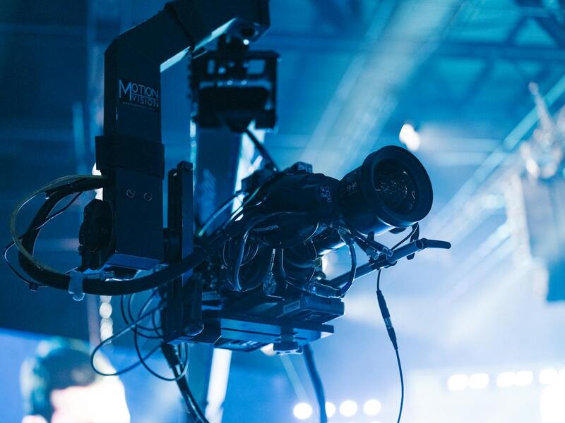
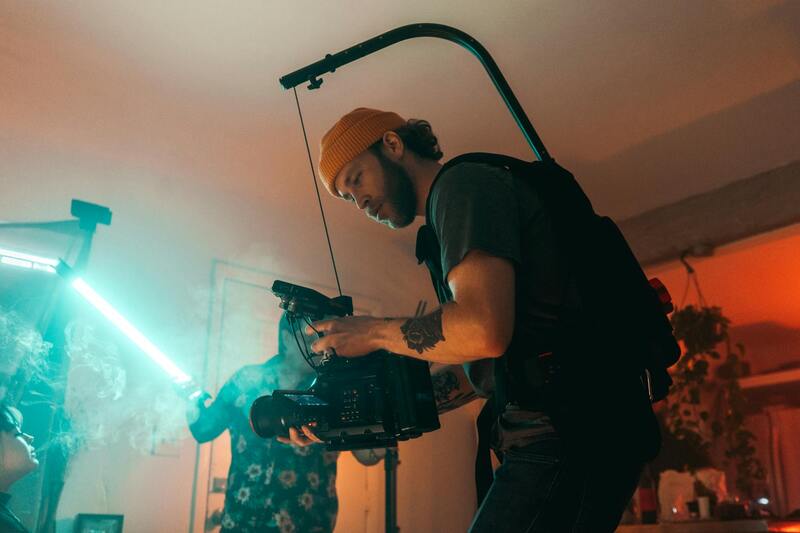
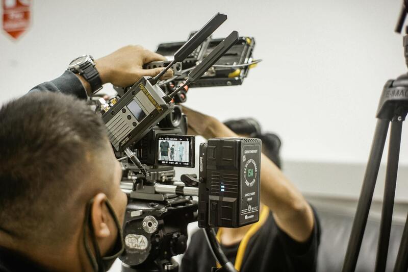
Achieving stunning and precise images in professional drone real estate photography relies heavily on the selection of the right equipment. High-quality drones equipped with advanced stabilization systems and professional-grade cameras are essential for capturing comprehensive, vivid aerial views that showcase a property's best features. Many industry-leading models feature gimbal stabilization, ensuring smooth footage and sharp still images despite varying flight conditions.
Camera selection plays a pivotal role in the clarity and detail of the photographs. Renowned drone cameras with high resolution, wide dynamic range, and excellent color accuracy enable photographers to produce vibrant images with rich textures and true-to-life colors. For real estate visuals, capturing both broad panoramic shots and detailed interior or exterior features is crucial, prompting many professionals to invest in interchangeable lens systems or multi-sensor cameras.
Furthermore, accessories like high-capacity batteries, additional propellers, and advanced GPS modules enhance operational efficiency and flight stability. Modern drone models also integrate obstacle avoidance systems, allowing for safer, more precise flights around complex property layouts. Ensuring equipment reliability and performance minimizes flight disruptions and supports consistent delivery of high-resolution visuals, reinforcing the professionalism of the aerial photography service.
Technological advancements continue to push the boundaries of what’s achievable in aerial imaging. Features like automated flight planning, 3D mapping capabilities, and high dynamic range imaging expand the scope of services that can be offered to real estate clients. These tools enable professional operators to execute complex shots and detailed virtual tours with a high degree of accuracy and cinematic appeal.
Investing in top-tier equipment not only elevates the quality of images but also demonstrates a professional commitment to excellence. When combined with strategic planning and technical expertise, the right gear allows real estate agents and developers to showcase properties in the best possible light, ultimately attracting more prospective buyers and closing sales faster.
Ensuring Data Security and Privacy in Drone Operations
Maintaining data security and respecting privacy boundaries are fundamental aspects of professional drone real estate photography. Operators must implement robust safeguards to protect the high-resolution imagery captured during drone flights. This includes secure storage solutions, encrypted data transfer protocols, and restricted access to sensitive visuals. Limiting data exposure not only preserves client confidentiality but also enhances the credibility of the service provider.
Additionally, establishing clear operational protocols helps in minimizing inadvertent privacy infringements. Techniques such as pre-flight site assessments, setting designated flight zones, and adhering to established flight paths prevent unintentional intrusions into private spaces. Communicating with property owners about the scope and nature of drone flights fosters transparency and trust, ensuring that all parties are aligned on operational boundaries.

Monitoring and Maintaining Drone Equipment
Consistent maintenance of drone hardware is vital for producing consistently high-quality images and ensuring safety throughout operations. Routine inspections should focus on battery health, propeller integrity, rotor balance, and sensor calibration. Keeping firmware and software updated unlocks new features, improves flight stability, and mitigates potential technical issues.
Implementing a regular maintenance schedule allows operators to identify and address potential problems before flight sessions, reducing downtime and enhancing safety. Proper storage practices, including climate-controlled environments for equipment and batteries, further extend the lifespan of the hardware. This level of care demonstrates professionalism and commitment to delivering reliable, superior results for each client.
Utilizing Certified and Experienced Pilots
Choosing operators with documented experience and relevant certifications guarantees that drone flights are carried out with technical proficiency and adherence to established standards. Well-trained pilots possess the skills to execute complex flight patterns, capture optimal angles, and handle unexpected challenges seamlessly.
Certified pilots are adept at managing the technical intricacies of drone operation, including battery management, obstacle avoidance, and real-time adjustments during flights. Their expertise ensures that each project meets high-quality standards, reducing the need for re-shoots and ensuring timely delivery of visuals.

Ensuring Compliance Through Established Methods
For professionals offering drone real estate photography in Miami, employing official and reputable methods is fundamental to delivering exceptional and dependable imagery. These methods include utilizing certified drone operators who are trained to follow standardized flight procedures, ensuring the safe and effective capture of high-quality visuals. Certification programs require operators to master both technical flying skills and awareness of local airspace considerations, which helps in maintaining operational standards across projects.
Additionally, working with FAA-registered drones and adhering to designated flight zones ensures that aerial photography is conducted within authorized boundaries. This approach minimizes risks and aligns with best practices for responsible drone use. Following clear flight plans, obtained through proper pre-flight planning, guarantees that shoots are organized, efficient, and compliant with local guidelines, thereby reducing potential disruptions or unintended violations.
Implementing comprehensive safety protocols, such as conducting thorough site assessments before each flight and having contingency plans in place, further illustrates a commitment to professional standards. These protocols help anticipate and mitigate unforeseen challenges, ensuring the safety of personnel, the public, and property.
Moreover, maintaining detailed records of all drone activities—including flight logs, maintenance schedules, and client instructions—enhances transparency and accountability. This documentation supports a consistent quality of service while demonstrating a serious approach to drone operations, crucial for building trust and long-term relationships with clients in the real estate market.

By integrating these established, legitimate practices into daily operations, professionals not only ensure high standards of work but also foster a reputation for reliability and integrity in the Miami real estate scene. This disciplined approach makes it possible to consistently produce captivating, accurate, and legally responsible aerial visuals that effectively support real estate listings and marketing strategies.
Utilizing Official Software and Flight Planning Tools
Employing advanced, compliant flight planning software is essential for executing professional drone photography in real estate. These applications allow operators to map out precise flight paths, optimize shot angles, and ensure comprehensive coverage of properties while adhering to strict operational standards. Accurate planning reduces the risk of unintentional violations and enhances the quality of aerial imagery by enabling precise altitude control and stable shot sequences.
Such software often integrates obstacle avoidance features, which are crucial when capturing images in dynamic environments, such as crowded urban areas or neighboring property structures. The ability to establish safe, predetermined flight zones minimizes disturbances and maintains a smooth operation flow, preserving the integrity of the property and surrounding area.
Maintenance and Record-Keeping for Drone Equipment
Maintaining meticulous records of all drone equipment is fundamental in sustaining high-quality service standards. This includes regular checks of batteries, propellers, GPS systems, and camera mechanisms. Keeping detailed maintenance logs allows operators to identify potential issues early, ensure equipment remains in peak condition, and reduce the likelihood of mid-flight technical problems.
Furthermore, proper record-keeping encompasses documenting flight logs, which capture vital data such as flight duration, altitude, weather conditions, and any anomalies encountered. This detailed documentation not only reinforces operational transparency but also provides valuable insights for refining future flight plans and improving image quality. Implementing a systematic approach to equipment management and record-keeping demonstrates a commitment to excellence and responsible drone practices within the Miami real estate market.
Implementing Proven Safety Measures During Operations
Adopting structured safety protocols is a cornerstone of professional drone real estate photography. This includes conducting comprehensive site assessments prior to each flight to identify potential hazards, such as power lines, trees, or crowded areas. Having contingency plans ready ensures quick response to unexpected obstacles or adverse weather conditions, safeguarding personnel, property, and the general public.

In addition to careful planning and hazard mitigation, maintaining clear communication with all stakeholders, including property owners and local authorities, is essential. Informing relevant parties about flight schedules and safety measures helps manage expectations and enhances operational transparency. By diligently adhering to these established practices, drone operators in Miami can consistently deliver high-caliber visual content while respecting local environment and community standards.
Conclusion
Deploying legitimate, industry-standard methods in drone operations elevates the quality of real estate visuals and reinforces a professional reputation. Utilizing certified equipment, validated flight software, diligent maintenance, accurate documentation, and robust safety protocols ensures that aerial photography not only meets high standards but also supports sustainable and responsible business practices in Miami’s vibrant real estate market.
Ensuring Legal and Efficient Drone Operations in Miami
Executing professional drone real estate photography in Miami requires adherence to established procedures that uphold safety, quality, and efficiency. Engaging with certified drone operators who possess comprehensive knowledge of local regulations ensures that each flight complies with regional standards. Certified operators are equipped with the right licenses, permits, and understanding of airspace management, which minimizes disruptions and potential delays in capturing optimal shots.
Proper planning involves conducting pre-flight assessments to evaluate environmental conditions such as wind speeds, weather patterns, and potential obstacles. This thorough preparation reduces the risk of accidents and ensures smooth drone operations. Additionally, utilizing authorized flight zones aligns with official protocols, reinforcing responsible aerial photography practices.
The selection of high-grade equipment is crucial for capturing industry-standard imagery. Employing drones with advanced stabilization systems and high-resolution sensors guarantees sharp, vivid visuals that highlight property features effectively. Routine maintenance and calibration of equipment are vital to maintaining optimal performance, preventing technical failures during shoots.
Post-flight procedures also play a significant role in the process. Proper data management, including secure storage of images and videos, facilitates efficient editing workflows. Utilizing validated software for image enhancement helps produce polished, professional results that align with real estate marketing standards.
Operators must also maintain detailed records of each flight, including flight paths, environmental conditions, and equipment configurations. This documentation supports accountability and provides evidence of adherence to operational guidelines, which can be vital for regulatory reviews or client inquiries.
Utilizing Professional Equipment for Superior Imagery
Investing in emerging drone technology and camera systems allows for capturing versatile angles, higher resolution content, and dynamic shots that elevate property listings. The integration of GPS stabilization, automated flight paths, and obstacle avoidance sensors enhances safety and precision during flights. Such features are indispensable for navigating Miami’s diverse urban and natural landscapes efficiently.
Furthermore, employing software tools validated for flight planning provides detailed mapping and risk assessments prior to deployment. These tools enable operators to set up flight routes that maximize coverage while avoiding sensitive or restricted areas. By adhering to these methodical practices, drone operators support a smooth, compliant, and high-impact imaging process.
Post-Production and Delivering Final Content
Post-processing is a critical stage that transforms raw images into compelling visual narratives. Color correction, exposure adjustments, and strategic cropping enhance the presentation and highlight property features effectively. Advanced editing techniques, leveraging reliable software, ensure consistent results across all marketing materials.
Deliverables are typically provided in formats optimized for various platforms, including MLS listings, websites, and social media. Clear communication with clients regarding editing expectations and timelines reinforces professionalism. Tailoring final images to reflect the property's appeal and market positioning maximizes the impact of the visual content crafted through legitimate and proven workflows.
Effective Use of Drone Imaging for Marketing in Miami
For real estate professionals aiming to stand out within the competitive Miami market, leveraging high-quality drone imagery is vital. These visuals provide prospective buyers with captivating perspectives of properties, revealing layouts and surroundings that traditional photography often cannot capture. To maximize impact, drones should be operated with precision to highlight key property features, including expansive yards, proximity to waterfronts, nearby amenities, and architectural details. Consistency in capturing images during optimal lighting conditions enhances clarity and color vibrancy, which further elevates the visual appeal.
Implementing these advanced aerial images into property listings helps create a compelling narrative that aligns with sophisticated marketing strategies. High-quality visuals not only attract more potential buyers but also establish trust and credibility with clients. The visual storytelling capabilities of drone photography allow agents to present properties as desirable, premium assets, which can significantly accelerate the sales process. Additionally, integrating these images with virtual tours and interactive media enhances the overall marketing package, providing a seamless experience for viewers.
Ensuring Optimal Image Quality and Consistency
Achieving professional-grade drone photos requires meticulous planning. This includes choosing the right time of day to utilize natural lighting, preferably during golden hour when sunlight creates warm and inviting tones. Selecting optimal weather conditions is equally important; clear, windless days ensure stable flights and sharp images.
Flight planning should involve pre-mapping with specialized software, which allows operators to identify ideal flight paths, avoid restricted zones, and maximize coverage efficiently. Using high-resolution cameras with stabilized gimbal systems ensures stability and sharpness, even during complex maneuvers. Consistent shooting parameters across sessions guarantee uniformity in visual style, making property portfolios cohesive and appealing.
Post-Processing for a Polished Look
Once images are captured, post-production steps dramatically enhance their visual storytelling. Adjustments to brightness, contrast, and saturation better reflect natural colors and illuminate property features. Strategic cropping directs viewers’ attention to focal points, such as architectural elements or landscaped gardens. Layering these edits with perspective corrections ensures images are geometrically balanced and true to scale.
Utilizing professional editing software allows for high fidelity in delivering polished final products that resonate with target audiences. When images are optimized for various digital platforms, they maintain their clarity and impact—be it on high-resolution websites, social media posts, or printed brochures.
Legal Practices in Miami's Drone Photography
Operating drones within Miami involves adherence to established procedural standards that promote safe and responsible usage. Conducting thorough risk assessments before drone flights is essential to identify potential hazards or constraints in urban, waterfront, and natural landscapes.
>Developing clear flight plans and obtaining necessary authorizations—such as permits or notifications—facilitates smooth operation within local policies. Maintaining detailed records of flight activities and equipment ensure accountability and transparency throughout the project. Additionally, engaging with certified drone operators who possess extensive local experience supports consistent compliance with operational expectations.
Best Practices for Selecting a Drone Service Provider in Miami
When choosing a local provider for professional drone real estate photography, it is crucial to evaluate their experience, technique, and understanding of Miami’s unique environment. Reputable companies should provide a portfolio with examples of previous projects, demonstrating their ability to capture diverse property types comprehensively.
- Verify their adherence to operational standards and certifications.
- Assess their familiarity with Miami’s geographic and regulatory landscape.
- Ensure they utilize state-of-the-art drone technology tailored for high-quality imaging.
- Review client testimonials or case studies highlighting successful marketing campaigns.
Opting for local specialists ensures the nuances of Miami's landscape and architecture are accurately represented, which significantly enhances the appeal of marketed properties. Collaboration with professionals who understand the specific needs of the Miami real estate market results in compelling visuals that drive engagement and sales.