Introduction to Drone Realty Photography
In the dynamic Miami real estate market, visual presentation plays a pivotal role in capturing potential buyers’ attention and facilitating successful property transactions. Drone realty photography has emerged as a vital tool for real estate professionals seeking to showcase properties from breathtaking aerial perspectives that traditional photography cannot provide. This technology offers an expansive view of a property's exterior, surrounding landscape, and neighborhood context, delivering a comprehensive visual narrative that enhances listing appeal.
Utilizing drone photography in real estate listings not only highlights architectural features and property size but also emphasizes unique aspects such as waterfront access, proximity to amenities, and overall curb appeal. As Miami's real estate market becomes increasingly competitive, high-quality aerial images serve as an effective differentiator, attracting more viewers and generating higher engagement. This innovative approach has transformed property marketing, enabling agents and sellers to create compelling visual stories that resonate with prospective buyers.

Incorporating drone realty photography into marketing strategies not only elevates property listings but also streamlines the buying process by providing clearer, more informative visuals. Buyers gain a better understanding of the property’s layout and surroundings without physically visiting each location. This increased transparency builds confidence and accelerates decision-making, making drone photography an indispensable asset for modern Miami real estate professionals.
Legal and Regulatory Considerations in Miami
In the dynamic landscape of Miami's real estate market, deploying drone technology for property showcases demands adherence to specific operational guidelines established by local authorities. Ensuring compliance with Miami-Dade County's regulations and the Federal Aviation Administration (FAA) standards is essential for maintaining professional credibility and operational efficiency. These regulations encompass licensing requirements, flight restrictions, and safety protocols that facilitate responsible drone usage in densely populated or sensitive areas.
Operators must obtain an FAA Remote Pilot Certificate, which certifies their understanding of safe flight procedures and airspace management. This certification process involves passing a comprehensive knowledge test covering regulations, airspace rules, and safety practices, ensuring responsible drone operation across various contexts.
Furthermore, Miami's geographical features, such as proximity to beaches, airports, and urban infrastructures, necessitate careful planning to avoid infringement on restricted zones. Operators should utilize detailed maps and navigational tools to identify no-fly zones, controlled airspace, and altitude restrictions. Staying informed about temporary flight restrictions, especially during special events or emergencies, is vital for uninterrupted service.
Privacy considerations also play a significant role. Respecting residents' privacy by avoiding overly invasive flight paths helps foster positive community relations and maintains ethical standards. This includes avoiding private properties without consent and preventing capturing images outside the scope of the intended property showcase.
Adhering to these official procedures not only upholds safety and privacy but also enhances the reputation of drone realty photography services. As Miami continues to grow as a hub for innovative property marketing, working with operators knowledgeable about local regulations guarantees that visual content is captured professionally and responsibly.
Legal and Regulatory Considerations in Miami
Operating drones for real estate photography within Miami requires adherence to a comprehensive framework of policies and standards that ensure safe and responsible flight practices. These guidelines encompass a range of official procedures designed to maintain the integrity of airspace usage while safeguarding public interests and property rights.
In Miami, drone operators must familiarize themselves with the specific airspace designations which include restrictions around airports such as Miami International Airport and secondary aerodromes. Compliance involves obtaining necessary permits and coordinating with local authorities to mitigate risks associated with flight operations in congested or sensitive airspace zones.
Operators are advised to utilize authorized flight planning tools that provide real-time information about restricted zones, altitude limitations, and temporary flight restrictions. These tools help in mapping optimal flight paths that maximize coverage while avoiding inadvertent incursions into controlled zones.
In addition to federal regulations, Miami's municipal policies may impose specific requirements, such as registration and licensing obligations for commercial drone use. Propensity for strict enforcement emphasizes the importance of documenting all flights through detailed logs, including flight plans, permission records, and safety checks, to ensure transparency and accountability.
Proper understanding of these official procedures transcends regulatory compliance; it establishes a foundation for trustworthy service delivery in drone realty photography. Partnering with operators who possess in-depth knowledge of Miami's airspace structures and who actively observe evolving standards results in high-quality imagery captured with precision and conscience.
Key Equipment and Techniques for Effective Drone Photography
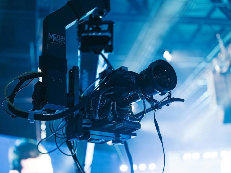
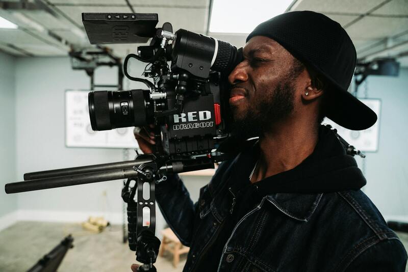
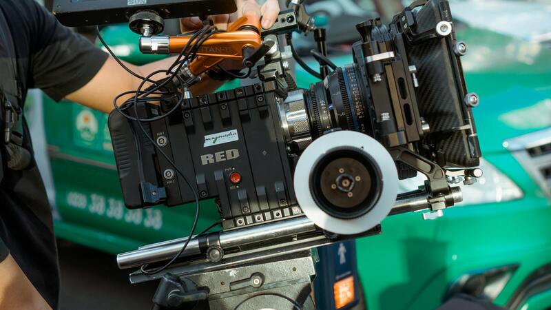
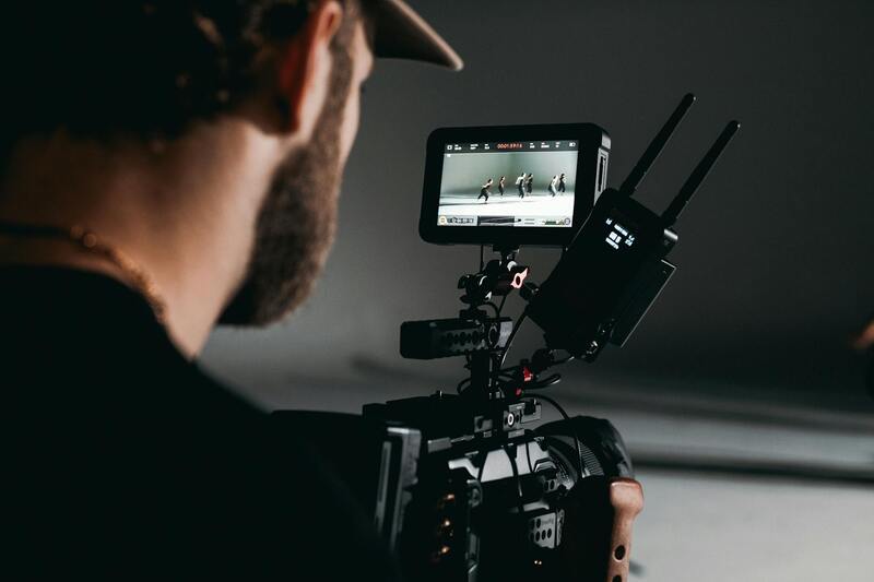
Achieving high-quality drone realty photography in Miami demands the right combination of advanced hardware, precise flying techniques, optimal camera settings, and meticulous post-processing. Each element plays a crucial role in capturing captivating aerial images that elevate property listings and appeal to prospective buyers.
**Drone Hardware:**
- High-resolution cameras capable of 4K or higher output to ensure sharp, detailed imagery.
- Stable gimbal systems to minimize vibrations and ensure smooth footage.
- Reliable flight controllers with GPS stabilization for precise navigation and hover capabilities.
- Extended battery life and backup power solutions to maximize flight duration during multiple shots or complex sequences.
**Flying Techniques:**
- Pre-flight planning involves assessing weather conditions, wind speeds, and potential obstacles to ensure a safe operation within Miami's vibrant urban landscape.
- Utilizing autonomous flight paths for consistent, repeatable shots across different properties.
- Executing shot sequences at various altitudes and angles to showcase property extents and surrounding amenities effectively.
- Maintaining a steady hover to capture crisp images with minimal motion blur.

**Photography Settings:**
- Utilizing aperture controls, ISO, and shutter speed adjustments to optimize lighting conditions and achieve high-quality images.
- Employing HDR techniques to balance exposure levels in scenes with high contrast lighting situations, common in Miami's sunny environment.
- Implementing bracketing and panoramic stitching for expansive landscape shots that highlight entire property plots or scenic views.
**Post-Processing Techniques:**
- Color correction and grading to enhance visual appeal while maintaining realistic representations of the property.
- Sharpness and noise reduction to refine image clarity, especially in low-light conditions.
- Stitching multiple images for high-resolution composites and 3D modeling.
- Adding overlays, labels, and virtual tours to integrate seamlessly into marketing platforms.
Mastery of these equipment and techniques allows Miami's real estate professionals to deliver compelling, polished visual content that stands out in competitive listings. Ensuring proper maintenance and calibration of drone hardware, combined with continuous skill development in flying and photography, provides a foundation for consistent success in drone realty photography endeavors.
Choosing the Right Drone Equipment and Shooting Techniques for Real Estate
When it comes to capturing stunning aerial images of real estate properties in Miami, selecting the appropriate drone hardware and mastering specialized shooting techniques are critical for producing high-quality visuals that attract potential buyers. Professional-grade drones equipped with high-resolution cameras, stabilized gimbals, and advanced flight capabilities are essential in ensuring consistent, crisp, and compelling imagery.
For real estate purposes, drones with camera sensors capable of capturing 4K or higher video and images provide detailed visual content that showcases properties with clarity. Gimbal stabilization minimizes unwanted motion blur during flight, especially when capturing sweeping panoramic shots or intricate architectural details. Additionally, drones with obstacle avoidance sensors help navigate complex environments typical in Miami's urban landscapes and waterfront areas, allowing for safer and more precise flight paths.
Flight Planning for Optimal Results
Effective drone photography begins well before takeoff. Thorough planning involves assessing the property layout, surrounding environment, and lighting conditions to determine ideal flight paths. Conducting pre-flight site surveys ensures safe operation and helps identify the best angles to highlight the property's unique features.
Timing plays a crucial role in achieving captivating shots. The golden hour—shortly after sunrise or before sunset—provides warm, soft natural lighting that enhances the visual appeal of properties in Miami's vibrant neighborhoods. Planning flights during these periods yields images with rich colors and depth, helping listings stand out in competitive markets.
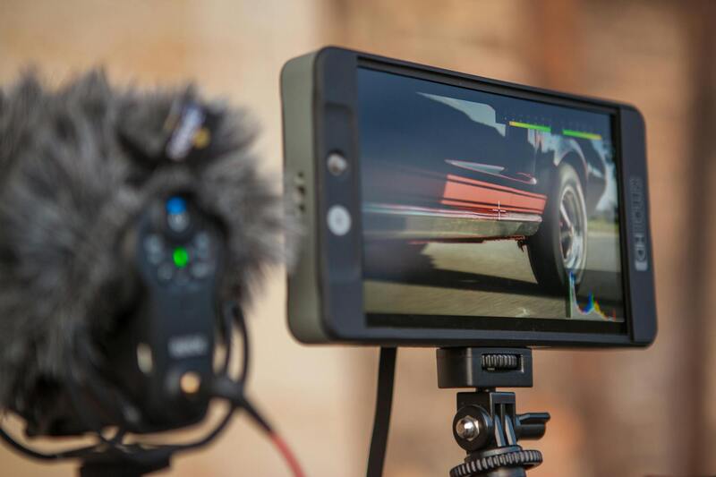
Optimizing Camera Settings for Different Scenarios
- Aperture: Adjust to control depth of field and focus, especially useful for capturing both foreground details and background scenery.
- ISO: Keep as low as possible to prevent noise in bright conditions; increase cautiously in shaded or low-light situations.
- Shutter Speed: Use faster speeds to freeze motion during windy conditions or when capturing fast-moving elements.
- HDR and Bracketing: Techniques that blend multiple exposures help balance scenes with high contrast, common in Miami's sunny environment.
Post-Processing for Enhanced Visual Impact
Post-production techniques refine aerial visuals to ensure they are both compelling and true to life. Color grading adjusts tone and saturation to highlight the property's features without exaggeration. Sharpness enhancement and noise reduction refine image clarity, enhancing details in both daylight and shadowed areas.
Combining multiple images through stitching creates high-resolution composite photos or immersive virtual tours. Overlaying labels, property boundaries, or annotations facilitates effective marketing communication. Mastery of these post-processing skills ensures that each image aligns with branding standards and maximizes the property's visual appeal in Miami's dynamic real estate market.
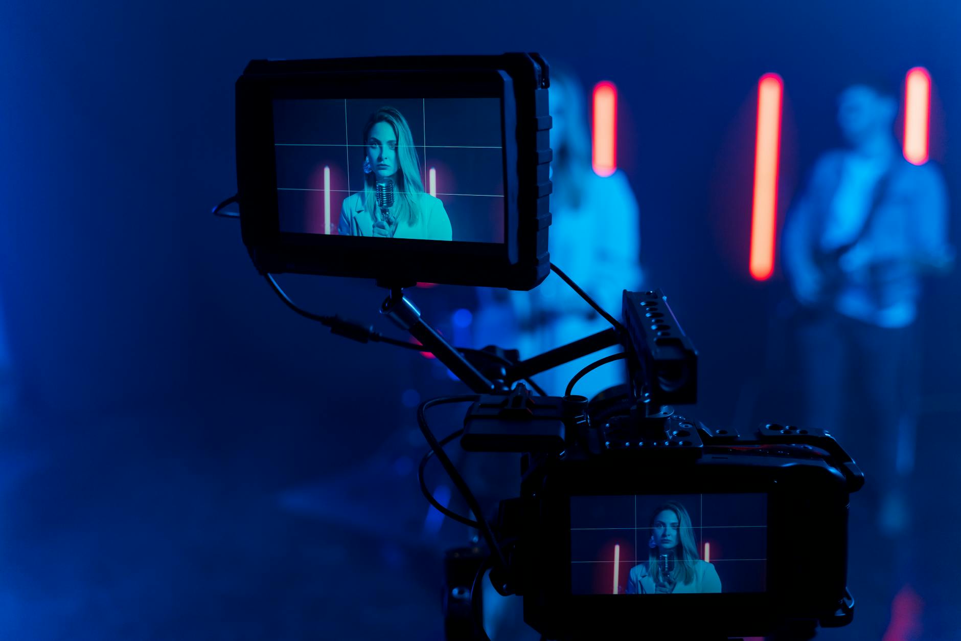
Implementing Drone Photography in Marketing Strategies
For real estate professionals aiming to maximize engagement and attract serious buyers in Miami's competitive market, integrating drone photography into a broader marketing strategy is essential. High-quality aerial images can be harnessed across various platforms, including property websites, social media channels, and virtual tour applications, ensuring consistent and captivating visual storytelling.
Effective use of drone imagery begins with selecting the right online channels. For property listings, incorporating high-resolution aerial photos provides a comprehensive view that highlights unique property features, such as expansive yard space, proximity to waterfronts, or scenic surroundings. This visual context enhances potential buyers' understanding of the property’s position within its environment, fostering a sense of connection even before a physical visit.
On social media, sharing aerial shots can generate significant engagement due to their striking visual appeal. Platforms like Instagram and Facebook benefit from native image uploads or short video clips, which can showcase different angles of the property and its surroundings. Consistent branding, accompanied by compelling captions and relevant hashtags, amplifies reach and helps elevate the property’s profile within Miami's vibrant real estate community.
Virtual tours, increasingly popular among prospective buyers seeking remote viewing options, can be significantly enriched with drone footage. Integrating high-quality aerial videos into these tours provides a holistic perspective, allowing viewers to appreciate the full scope of the property's exterior and landscape. Such immersive experiences are particularly effective in attracting out-of-town buyers or those preferring a contactless viewing process.
Furthermore, professional drone photography can be incorporated into targeted email marketing campaigns. Including eye-catching aerial visuals in newsletters or promotional emails captures recipient attention quickly, increasing click-through rates and driving potential buyers to schedule viewings or more detailed virtual tours.
To optimize the impact of aerial photography, each visual asset should be tailored to the specific platform and audience. For example:
- Web Listings: Use composite images that highlight key property features and surrounding amenities.
- Social Media: Share short videos and behind-the-scenes clips to build engagement and curiosity.
- Virtual Tours: Incorporate seamless drone footage to create an immersive experience.
Careful planning and execution ensure that drone-acquired content aligns with branding and market positioning, thereby elevating the overall presentation of Miami real estate listings.
Finally, tracking engagement metrics across these channels allows real estate professionals to refine their drone marketing approach continually. Monitoring interactions, such as views, shares, and inquiry rates, provides insights into which visuals resonate most with viewers, enabling tailored content strategies that drive results in Miami’s dynamic property landscape.
Creating High-Impact Aerial Property Listings Beyond Basic Photography
Successfully leveraging drone realty photography involves more than capturing stunning images from above; it encompasses strategic presentation that highlights a property's most compelling features. Utilizing high-resolution images that showcase not only the structure but also the surrounding environment can significantly influence prospective buyers. These images should be meticulously curated to reflect key aspects like landscaping, outdoor amenities, proximity to local attractions, and overall neighborhood appeal.
When assembling an aerial listing, consider combining different perspectives—such as wide-angle shots that encapsulate the property in its entirety alongside detailed close-ups that emphasize unique architectural elements. Incorporating image sequences or panoramic views can offer a comprehensive understanding of the property's scale and context.
This multi-dimensional approach helps create a holistic visual story, capturing the essence of the property and its surroundings in a manner that static photos alone cannot achieve. Such rich visual content enhances listings across online platforms, making them stand out amid numerous comparable options.
Enhancing Listings with Virtual Staging and 3D Modeling
To further augment the visual appeal of drone photography, integrating virtual staging or 3D virtual models can be highly effective. These technologies allow potential buyers to visualize living spaces with different interior designs or furniture arrangements, which can be particularly persuasive when comparing multiple properties.
Using drone footage that seamlessly transitions into virtual tours provides an immersive experience. It enables viewers to navigate the property at their own pace, gaining a better sense of layout, flow, and spatial relationships. High-quality aerial perspectives combined with interactive elements can significantly boost engagement and inquiry rates.
Optimizing Property Listings for Different Digital Channels
Effective integration of drone imagery involves tailoring content to various online platforms to maximize impact:
- Websites: Incorporate high-resolution aerial images and videos into dedicated property pages, ensuring seamless loading and mobile responsiveness.
- Social Media: Share short clips or teaser videos highlighting key aerial views to generate interest and shares.
- Virtual Tours: Embed comprehensive drone footage into immersive virtual tour experiences, allowing remote viewers to explore the property from multiple vantage points.
Ensure consistent branding and image quality across all channels to reinforce professionalism and attract serious inquiries. Regularly analyzing engagement data helps refine content strategies, ensuring that drone visuals continue to elevate property presentations effectively.
Advanced Techniques and Best Practices in Drone Realty Photography
To maximize the impact of drone realty photography, professionals in Miami must adopt advanced techniques that ensure their aerial imagery stands out in a competitive market. High-quality drone images and videos require meticulous planning, precision execution, and post-processing expertise. Using pre-flight checklists helps verify that all equipment is functioning correctly and that flight paths are optimized for comprehensive coverage of the property. Planning flight routes that encompass all key aspects of a property, such as landscaping, architectural details, and surrounding amenities, guarantees a rounded visual presentation.
Post-processing is equally crucial. Techniques including color correction, contrast enhancement, and HDR (High Dynamic Range) imaging can dramatically improve visual appeal. Carefully framing shots to highlight the property’s best features, such as impressive facades or scenic surroundings, captures viewer attention. Utilizing software tailored for drone footage editing allows for seamless transitions, stabilization, and focus adjustments, resulting in polished and professional content that resonates with prospective buyers.
Innovative Ways to Utilize Drone Content in Marketing Campaigns
- 360-Degree Virtual Tours: Combine aerial shots with interior walkthroughs to create a comprehensive view of the property, offering potential buyers an immersive experience.
- Time-Lapse and Seasonal Footage: Showcase the property across different times of the day or seasons, emphasizing its appeal throughout the year.
- Night Photography: Use drone lighting techniques to capture striking images after sunset, highlighting landscape lighting and external architecture.
- Neighborhood Context: Incorporate aerial views that demonstrate proximity to local amenities, parks, or schools, providing viewers with context about the neighborhood.
Maintaining Compliance and Respecting Privacy in Drone Operations
Effective drone realty photography in Miami also entails ensuring operations respect neighboring properties and public spaces. This involves adhering to established operational boundaries, avoiding intrusive flights over private properties without consent, and respecting local regulations concerning privacy. Employing flight plans that prioritize altitude control and camera angles minimizes unintended captures of private spaces, fostering good community relationships and professional integrity. Carefully assessing potential flight zones and coordinating with local authorities or property managers when necessary ensures smooth execution of aerial projects.
Investing in ongoing training helps drone operators stay current with industry best practices and technical enhancements, further improving safety and image quality. Using high-resolution cameras and stable gimbal systems minimizes motion blur, enabling crisp, clear images even in challenging conditions. Additionally, maintaining accurate flight logs and data backups supports accountability and continuous improvement of operational procedures.