Benefits of Using Drone Photos for Houses
In the competitive real estate market, captivating visuals are essential to attract potential buyers and showcase properties effectively. Drone photography has revolutionized how houses are presented online and in marketing campaigns, offering unique perspectives that traditional ground-level photos cannot achieve. By capturing high-resolution aerial images, real estate professionals can highlight a property's size, landscape, and surrounding amenities with clarity and sophistication.
One of the most significant advantages of drone photos is the ability to provide a comprehensive view of the property environment. Potential buyers can assess the overall layout, external features, and proximity to crucial infrastructure or scenic areas, fostering an emotional connection and interest. Additionally, high-quality aerial images enhance online listings, making them stand out among competitors, which can lead to increased inquiries and faster sales.
Moreover, drone photography allows for highlighting specific features such as expansive gardens, private swimming pools, or scenic views, providing a realistic and immersive experience for prospective buyers. This method not only improves the aesthetic appeal but also communicates the full scope of the property’s value, essential for high-end or large-scale listings.
In summary, utilizing drone pictures for houses considerably strengthens marketing strategies by providing high-impact, comprehensive visuals that elevate property presentation and attract serious buyers. The innovative perspective enables real estate professionals to create compelling narratives around a property's unique attributes, driving interest and engagement in a highly visual marketplace.
Choosing the Right Drone Equipment
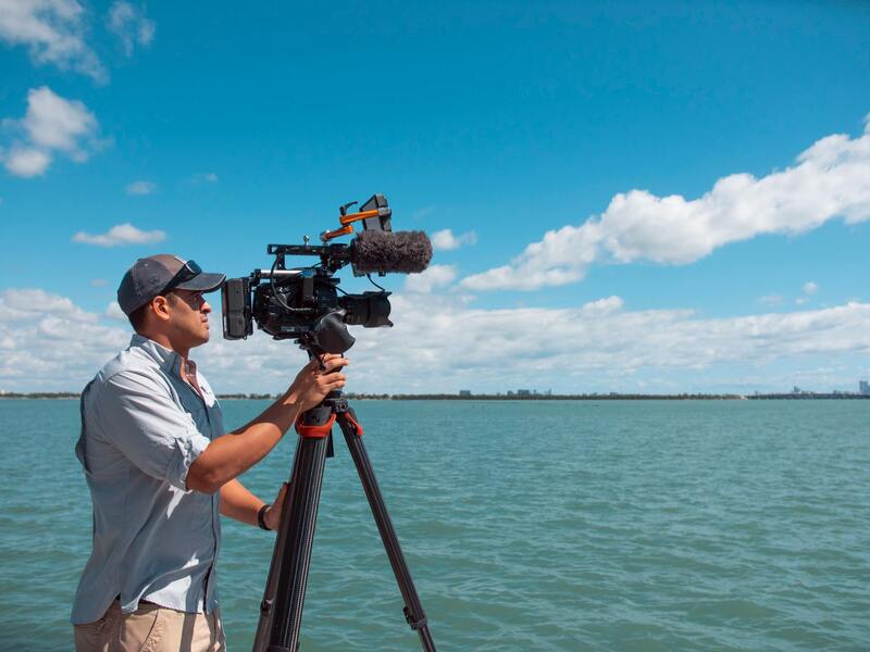
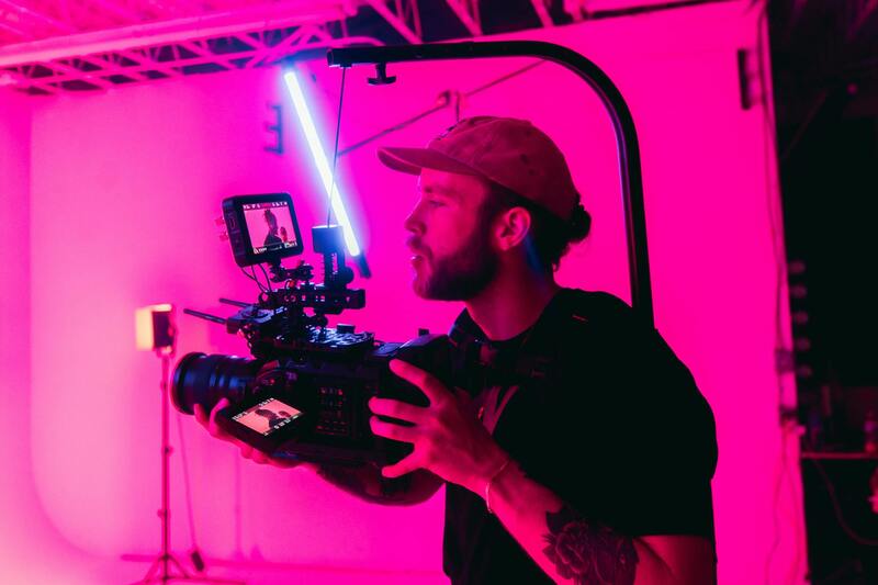
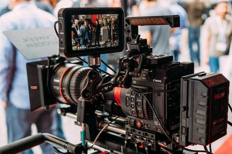
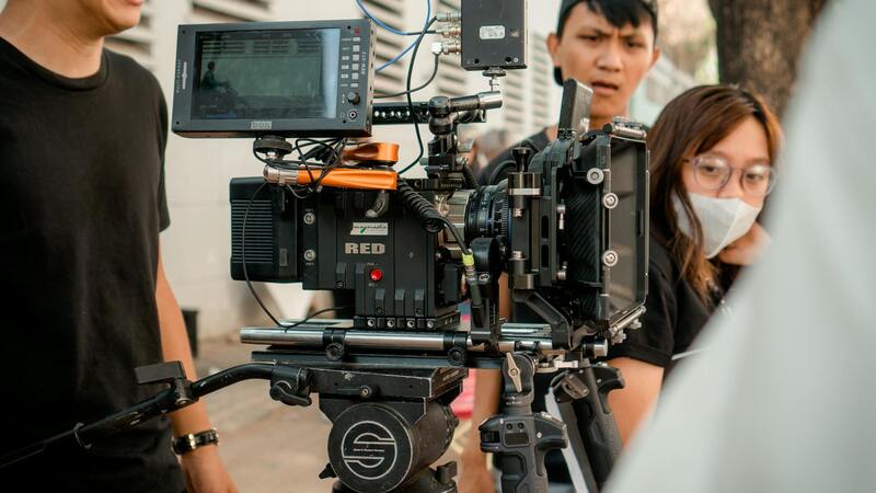
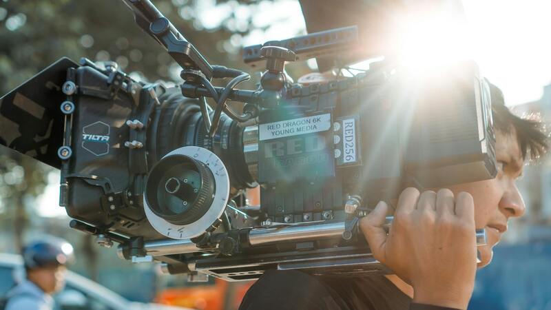
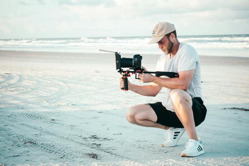
Selecting appropriate drone equipment is essential to achieving high-quality aerial images of houses. Professional-grade drones equipped with high-resolution cameras ensure sharp, detailed visuals that highlight your property’s best features. When considering drone models, look for features such as stabilized gimbals, adjustable camera settings, and GPS navigation, which enhance image stability and allow for precise positioning. Advanced drones often come with intelligent flight modes that simplify complex shots, making it easier to capture stunning visuals with minimal effort.
Camera specifications play a crucial role; sensors with higher megapixel counts enable capturing intricate details of roofing, landscaping, and architectural elements. Additionally, drones capable of capturing images in RAW format provide greater flexibility during post-processing, allowing for optimal color correction and exposure adjustments. Flight time is another important factor, as longer battery life facilitates comprehensive shooting sessions without frequent recharges. Ensuring the drone complies with technical standards for safe operation can prevent disruptions and maintain a smooth shooting process.
Best Practices for Shooting Drone Pictures of Houses
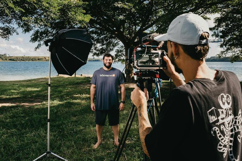
Achieving compelling drone images of homes requires careful planning and execution. It starts with selecting optimal weather conditions—calm, clear days with minimal wind and good lighting create ideal circumstances for capturing sharp images. Early morning or late afternoon light enhances the textures and colors, adding depth and vibrancy to the visuals.
Maintaining consistent flight paths ensures that all critical angles of the property are covered, including aerial shots from different elevations and perspectives. A steady and controlled flight trajectory minimizes motion blur and ensures clarity. When shooting, consider framing to include surrounding landscape features or nearby amenities that add context and appeal. Using automated flight modes or pre-programmed routes can guarantee repeatability, especially for marketing campaigns that require multiple shots from similar angles.
Proper altitude and distance are vital to capture the full scope of the property without distortion. Typically, shots should highlight unique architectural features, expansive outdoor spaces, or picturesque views, depending on the target audience. Employing multi-angle shots and varying heights can produce a dynamic portfolio of images that tell a compelling visual story of the property.
Editing and Enhancing Drone Images
Post-processing is a critical step in transforming raw drone footage into polished marketing assets. Professional editing software allows for adjustments in exposure, contrast, and color balance, enhancing the visual impact of the images. Correcting perspective distortions, which are common in wide-angle aerial shots, ensures that buildings and landscape features appear proportionate and true to life.
Enhancement techniques such as HDR (High Dynamic Range) blending can improve detail in shadows and highlights, providing clarity across the entire image. Sharpening tools help to accentuate details like roof shingles, landscaping textures, and architectural lines. Additionally, minor cropping can improve framing, focusing attention on the property’s most appealing aspects without losing context. Incorporating subtle filters or color grading can also evoke specific moods or stylistic themes aligned with the property’s branding.
Legal and Regulatory Considerations
When capturing drone pictures of houses, adherence to established standards ensures a smooth and professional process. Operators should be familiar with airspace restrictions and obtain necessary clearances when operating near populated areas or private properties. Maintaining a safe distance from nearby structures and individuals is essential to prevent any disruptions or safety concerns. It is important to respect property boundaries; using GPS data and well-planned flight paths helps to avoid encroaching on neighboring areas or restricted zones.
During flight planning, consider environmental factors such as wind speed, weather conditions, and lighting, which can affect both safety and image quality. Ensuring proper calibration of drone sensors and cameras prior to flight enhances the accuracy and clarity of the images captured. Regular maintenance of the drone, including battery checks and propeller inspections, minimizes risks during operation.
In addition to technical precautions, obtaining permissions from property owners before conducting aerial shoots fosters trust and professional integrity. Establishing clear communication about the scope and purpose of the project helps to align expectations and facilitate smooth coordination.
Utilizing professional-grade equipment with advanced safety features often simplifies compliance with operational standards. For instance, drones equipped with obstacle detection sensors and return-to-home functions can automatically navigate complex environments, reducing the chances of accidents. Ensuring all flights are documented and comply with local guidelines demonstrates responsible operation and upholds industry standards.
Investing in certified training programs or working with licensed drone operators not only enhances safety but also improves the quality of imagery. Skilled pilots understand how to maximize drone capabilities, capturing comprehensive, high-resolution shots that meet the high standards of real estate marketing.
Legal and Regulatory Considerations
When capturing drone pictures of houses, understanding the framework of regulations that govern aerial imaging is essential. These guidelines are designed to ensure that drone operations are conducted responsibly, respecting privacy rights while enabling high-quality imaging efforts. Operators should familiarize themselves thoroughly with the specific rules applicable to their region, including flight altitude limitations, designated no-fly zones, and restrictions related to proximity to certain structures or areas.
Furthermore, many jurisdictions require drone operators to adhere to visual line-of-sight requirements, maintaining constant visibility of the drone during flight. This helps to manage safety concerns effectively and ensures that operators can respond promptly to any unforeseen circumstances. Adhering to these standards not only maintains safety but also protects the integrity of the aerial imagery process.
Pre-flight planning also involves checking weather conditions meticulously. Wind speed, temperature, and humidity levels can significantly impact drone performance and image quality. Calm, clear days with optimal lighting conditions—preferably during the golden hours of early morning or late afternoon—are ideal for capturing striking visuals of residential properties.
Obtaining official permissions or notifications, when required, promotes transparency and smooth operation. Many service providers will handle this process as part of their professional package, ensuring compliance with local operational guidelines. Employing certified drone pilots who are trained in adherence to regional standards further reduces risks and enhances the quality of the final images.
Maintaining detailed operational logs, including flight paths and safety checks, reinforces responsible practice. These records are useful for auditing purposes and demonstrate a commitment to operational excellence. By respecting these official procedures, professionals uphold industry credibility and can deliver impressive, high-resolution drone images of residential properties.
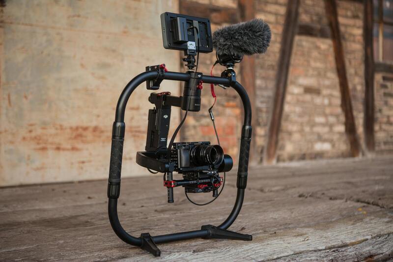
Choosing the Right Drone Equipment
To capture high-quality drone pictures of houses, selecting the appropriate equipment is essential. The right drone should combine stability, camera quality, and ease of operation to ensure detailed and sharp imagery. High-resolution cameras with adjustable apertures and gimbal stabilization systems are preferred, as they provide smooth, clear shots even in varying conditions. Flight time also plays a significant role; longer battery life allows for comprehensive coverage of properties without frequent interruptions for recharging.
Pilots should consider drones equipped with obstacle sensors. These sensors enhance safety by preventing collisions with trees, power lines, or other structures, especially when maneuvering around complex architectural features or navigating tight spaces. Additionally, drones with GPS capabilities facilitate precise positioning and orbiting around points of interest, contributing to more dynamic and engaging visuals.
For professional applications, opting for drones with pre-programmed flight paths and autonomous capabilities helps streamline the process. Such features enable consistent capturing angles and repeatability for comparative shots or ongoing property management projects. When investing in equipment, balancing quality with budget constraints ensures you achieve the desired image results while maintaining operational efficiency.
In addition to hardware, compatibility with advanced camera accessories, such as wide-angle lenses or sensors optimized for HDR imaging, can significantly enhance the detail and vibrancy of drone photos. Proper maintenance and regular calibration of the drone’s camera and flight components are crucial to retain image quality over time. By choosing equipment that combines technological sophistication with user-friendly controls, professionals can produce compelling, high-resolution images that showcase residential properties at their best.
Legal and Regulatory Considerations
When planning to capture drone pictures of houses, understanding and complying with established regulations is essential to ensure smooth operations. Regulations typically encompass restrictions on altitude, permissible flight zones, and privacy considerations. Operators should familiarize themselves with local guidelines that govern the use of aerial imaging equipment, which often specify maximum flight heights to prevent interference with manned aircraft, restrict flights over certain sensitive areas, and set requirements for maintaining visual line of sight with the drone at all times.
Adhering to designated no-fly zones, such as near airports, government facilities, or military installations, is critical. Additionally, flight times may be limited during certain hours of the day to reduce noise disturbances and to promote safety. Some regions might require registration of the drone or a specific license for commercial activities, which is typically obtained through official channels after demonstrating proficiency in operation and safety protocols.
It is equally important to respect privacy boundaries and property rights when capturing aerial images. This involves avoiding capturing images that infringe on private spaces without permission and ensuring that shots are taken in a manner that respects neighbors' and property owners' privacy concerns. Proper planning and respect for these guidelines can help avoid misunderstandings or legal complications while producing high-quality drone images.
Choosing the Right Drone Equipment
Achieving professional-grade drone pictures of houses begins with selecting suitable equipment. The drone itself should feature high stability, reliable GPS, obstacle avoidance sensors, and a user-friendly control system. For detailed and vibrant imaging, pairing the drone with a high-resolution camera equipped with a gimbal for stabilization is highly beneficial. Consider cameras that offer adjustable aperture, wide-angle lenses, and capabilities for HDR imaging, as these features enhance the clarity and depth of aerial photos.
Additionally, drones with automated flight modes, such as waypoint navigation and orbit functions, contribute significantly to capturing consistent, well-composed shots. Ensuring compatibility with supplementary accessories, like extra batteries, range extenders, and ND filters, can extend flight time and optimize image quality.
Regular maintenance and calibration of both drone hardware and camera are necessary to sustain high standards in image output. Choosing equipment from reputable manufacturers known for reliability and support further safeguards investment and workflow efficiency.
Best Practices for Shooting Drone Pictures of Houses
To maximize the impact of drone photography of residential properties, adopting best practices during the shooting process is crucial. Pre-scout the property to identify the optimal angles and lighting conditions, preferably during early morning or late afternoon when natural light is softer and shadows are longer, enhancing architectural features.
Plan your flight path and camera angles carefully to capture key selling points of the property, including front facades, backyards, landscaping, pools, and unique architectural details. Utilize automated flight paths for consistency across multiple shots, especially when creating virtual tours or comparative images.
Maintain a steady and smooth flight to prevent shaky footage; using gimbal stabilization and flying at a consistent altitude will yield sharper images. Be mindful of surrounding structures and natural obstacles, and always ensure the drone maintains a safe distance from the property to prevent any accidents.
Post-flight review of captured images allows for immediate assessment and the opportunity to retake shots if necessary. This iterative process ensures that the final collection of drone pictures truly highlights the property’s best features with clarity and aesthetic appeal.
Editing and Enhancing Drone Images
Professional editing can dramatically elevate drone photographs, making them more appealing, vibrant, and true to the property's character. After capturing images, utilize editing software to adjust brightness, contrast, and color saturation, ensuring that the images reflect natural tones while emphasizing key features.
Correcting lens distortions, applying noise reduction, and sharpening details are additional steps that enhance overall image clarity. For aerial shots with dynamic lighting conditions, employing HDR processing can bring out details in both shadows and highlights, creating balanced visuals.
Compositing techniques, such as stitching multiple images into wide panoramas or creating virtual tours with sequential shots, can provide potential buyers with immersive views of the property. Consistency in color grading and perspective throughout the editing process maintains a professional appearance that can significantly impact marketing efforts.
Legal and Regulatory Considerations
When capturing drone pictures of houses, adherence to established guidelines ensures smooth operations and high-quality results. While the focus remains on utilizing effective methods, understanding the framework within which drone photography should be conducted is essential. This includes respecting privacy boundaries, ensuring safe flight paths, and complying with operational standards set by local authorities. Planning flight routes to avoid restricted zones, such as airports and government buildings, minimizes disruptions and maintains the integrity of the operation.
Pre-flight preparations should involve obtaining necessary permissions or notifications when required, especially if flying over densely populated areas or private properties. Maintaining clear communication with property owners and neighbors fosters transparency and cooperation, which are instrumental in executing a successful shoot. Additionally, staying informed about airspace restrictions, temporary flight restrictions, and no-fly zones through official channels ensures that your aerial photography activities remain within permissible limits.
Effective drone operation also hinges on understanding and respecting height and distance regulations, which are designed to optimize safety and airspace management. Employing geofencing features available on many modern drones offers an additional layer of compliance, automatically preventing flights in restricted zones. For professional projects, partnering with operators experienced in navigating these regulatory conventions guarantees that the process adheres to accepted standards, combining safety with superior image quality.
Moreover, documenting flight activities and maintaining records can be valuable for accountability and for future reference. This comprehensive approach to planning and execution reflects a commitment to responsible drone use, ultimately supporting the production of striking drone pictures of houses that meet professional standards and respect operational guidelines.
Benefits of Using Drone Photos for Houses
Capturing pictures of residential properties with drones offers numerous advantages that enhance marketing, sales, and property management efforts. Drone images provide expansive, high-resolution views of homes and their surroundings, delivering a perspective that traditional photography cannot match. They enable real estate professionals to showcase properties from aerial viewpoints, emphasizing features such as backyard size, landscaping, proximity to amenities, and overall neighborhood context. This comprehensive visual representation can significantly increase buyer interest by offering a more engaging and detailed overview.
Moreover, drone photography facilitates faster property assessments, which can be particularly helpful during large-scale or multi-property sales. Real estate agents can quickly generate compelling visual content that highlights a property's best features, attracting higher interest and potentially commanding better market value. For developers and builders, drone photos assist in documenting construction progress, planning modifications, and presenting projects attractively to stakeholders.
In addition to marketing, drone imagery enhances property management by supporting maintenance planning, security monitoring, and documenting changes over time. They also serve as valuable tools for insurance assessments, providing comprehensive visual records that can simplify claims processes.
Legal and Regulatory Considerations
Operating drones for capturing pictures of houses requires adherence to official guidelines that govern airspace use. These regulations are designed to promote safe and responsible drone operations, especially when flying over private properties or densely populated areas. Before initiating a drone photo shoot, it is essential to acquire necessary permissions, which may include notifying property owners, obtaining permits for specific flight zones, and consulting local airspace authorities.
Adhering to altitude restrictions and distance limitations not only ensures compliance but also enhances safety for all airspace users. Many drones are equipped with geofencing features that automatically restrict access to sensitive zones, such as airports or restricted airspaces, reducing risks associated with inadvertent violations.
Maintaining documentation of flight plans, permissions, and safety measures is a best practice that supports accountability and transparency. While there is no explicit mention of legal requirements here, conducting drone operations within established standards fosters successful and respectful aerial photography practices.
Choosing the Right Drone Equipment
Selecting appropriate drone hardware is crucial for capturing high-quality images of houses. Professional-grade drones equipped with high-resolution sensors, stable gimbals, and multiple camera settings enable precise control and superior image quality. Consider drones that support 4K or higher video resolution, as these offer enhanced detail and clarity for marketing visuals.
The drone's flight stability and maximum flight time are also important factors. Longer flight durations allow for comprehensive shooting sessions without frequent interruptions, ensuring comprehensive coverage of all angles. Advanced features like obstacle avoidance, intelligent flight modes, and GPS stabilization contribute significantly to achieving sharp, well-composed photos.
For house photography, multi-rotor drones with adjustable camera gimbals are often preferred, providing the flexibility to capture smooth, steady shots from various heights and angles. Compatibility with advanced camera accessories, such as wide-angle lenses, can further expand creative options.
Best Practices for Shooting Drone Pictures of Houses
To maximize the quality and safety of drone photography of houses, certain practical guidelines should be followed. Conduct thorough pre-flight planning by scouting the location, noting key features, and identifying potential hazards. Planning flight paths beforehand reduces the risk of crashes and ensures coverage of desired angles.
Consistently use manual camera settings or calibrated auto modes to ensure consistent exposure, sharpness, and color balance across images. Adjust flight altitude carefully to balance detail and context; higher elevations capture the entire property and surroundings, while lower angles highlight architectural details.
Utilize automatic flight modes like waypoints or orbit to streamline complex shots, especially in tight property spaces. Maintain a safe distance from structures, power lines, or trees during flight operations, and always keep the drone within line of sight.
Post-flight, review images for focus and composition, retaking shots if necessary to ensure clarity and impact. Regularly calibrate equipment and perform maintenance to keep drones in optimal condition.
Editing and Enhancing Drone Images
Post-processing plays a vital role in transforming raw drone footage into visually appealing marketing assets. Start with basic adjustments such as correcting exposure, contrast, and color balance to ensure uniformity across images. Cropping can improve framing, emphasizing key property features or clearing distractions from the composition.
Applying sharpening filters enhances fine details, making architectural elements stand out. For images intended for promotional use, consider adding subtle overlays or annotations to highlight property features or layouts.
Advanced editing techniques may include stitching multiple images into panoramic views or creating HDR images that capture a wider dynamic range, especially in scenes with challenging lighting conditions. Utilizing software that supports layered editing allows for precise adjustments and creative enhancements.
Finally, optimize images for digital use by resizing, compressing, and including relevant metadata and keywords, ensuring they are search-engine friendly and suitable for various platforms.
Applications of Drone House Photos in Real Estate
High-quality drone images significantly influence real estate marketing strategies by offering prospective buyers a comprehensive visual understanding of the property. Aerial shots emphasize land size, lot features, and neighborhood context that are difficult to convey through traditional photography.
Utilizing drone visuals in online listings, virtual tours, and brochures increases engagement and provides a competitive edge. These images help buyers envision living spaces more vividly, facilitating quicker decision-making. Real estate agents often pair drone photos with detailed floor plans and interior images to present a complete property profile.
In addition, drone images assist in staging renovations or enhancements by highlighting potential improvements or structural features. They can also be part of open house presentations or marketing videos that attract potential buyers or investors.
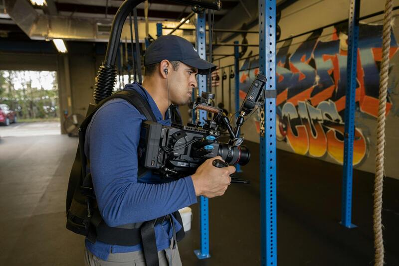
Hiring Professional Drone Services vs. DIY Shooting
Opting for professional drone photography services ensures high-quality results, safety, and adherence to operational standards. Skilled drone operators bring expertise in flight planning, composition, and image capturing, resulting in consistent, striking visuals that elevate marketing efforts.
Professional services typically include comprehensive equipment, including advanced drones and editing tools, which might be costly or complex for hobbyists to procure and operate. They are also familiar with regulatory requirements, ensuring that all flight activities are compliant and executed responsibly.
Conversely, DIY shooting can be more cost-effective for small-scale projects or personal use but requires a learning curve. Hobbyists or property owners must invest time in mastering drone controls, understanding airspace restrictions, and ensuring safety protocols. While DIY may offer greater flexibility, the quality and professionalism of images may vary significantly without proper experience.
Depending on project scope, budget, and desired outcomes, choosing between professional services and DIY approaches requires careful consideration of the specific needs for drone pictures of houses.