Overview of Commercial Real Estate Drone Photography
In the competitive landscape of Miami's commercial real estate market, visual presentation plays a crucial role in attracting prospective clients and investors. Commercial real estate drone photography has emerged as a transformative tool that offers expansive, high-quality aerial imagery of properties. Unlike traditional ground-based photography, drone photography provides a bird’s-eye view, capturing the full scope of a property's layout, surrounding infrastructure, and its integration within the broader environment. This method enhances marketing strategies by delivering compelling visuals that highlight key features and spatial relationships, which are often difficult to convey through photos taken from the ground.
The significance of drone photography in commercial real estate goes beyond mere aesthetic appeal. It allows real estate professionals to showcase properties in their entirety, including parking facilities, landscaping, neighboring developments, and access routes. In a city like Miami, where commercial properties encompass diverse landscapes from urban offices to waterfront developments, high-resolution aerial imagery can make listings stand out significantly. Moreover, drone footage can demonstrate the property's proximity to transportation hubs, retail zones, or business districts, providing valuable context for potential tenants or buyers.
Additionally, drone photography facilitates virtual tours and promotional videos, creating engaging content for various digital platforms. Implementing aerial shots into marketing campaigns not only elevates property presentation but also broadens the reach to international investors and remote clients. This innovative approach also complements traditional photography, offering a comprehensive visual narrative that can significantly influence decision-making processes in commercial property transactions.
By integrating drone photography into their marketing toolbox, real estate professionals in Miami can achieve a competitive edge, streamline property showcasing, and effectively communicate the unique advantages of each commercial listing. As the city continues to grow as a commercial hub, the strategic use of aerial imagery remains an essential component for successful property marketing initiatives.
Equipment and Technology Used in Drone Photography
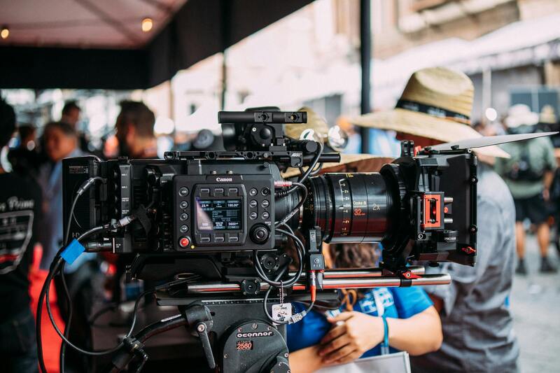
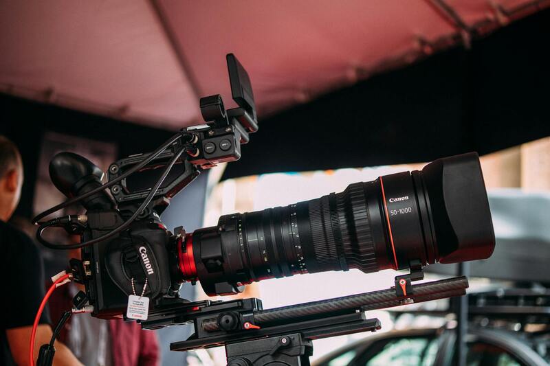
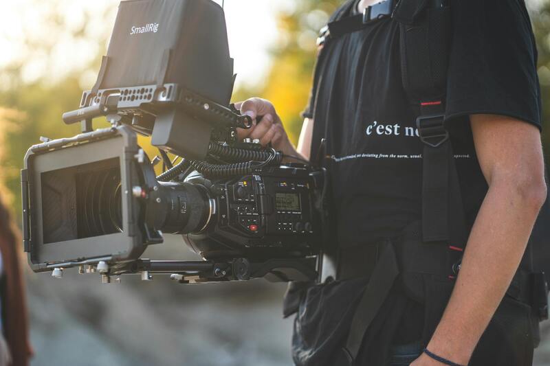
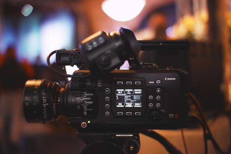
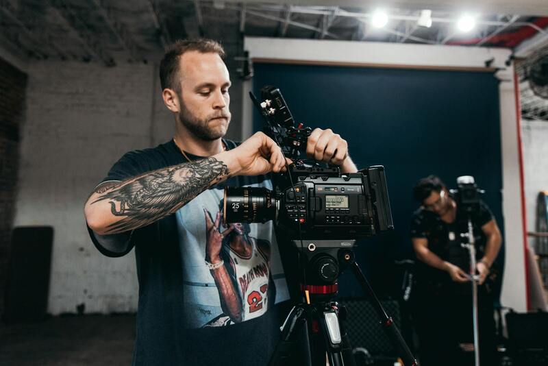
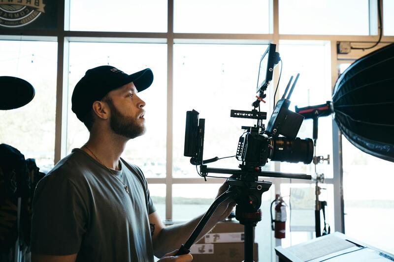
The quality of aerial imagery for commercial real estate hinges significantly on the equipment and technological tools employed during drone missions. Modern drone photography relies on sophisticated hardware to capture crisp, detailed images and videos that appeal to potential investors and tenants. State-of-the-art unmanned aerial vehicles (UAVs) are equipped with high-resolution digital cameras, often capable of capturing 4K or even 8K footage, ensuring that every detail is visible and professional-grade. These cameras are typically stabilized with gimbals that minimize shake and blurring, resulting in smooth, cinematic visuals ideal for marketing materials.
In addition to camera quality, the latest technological advancements involve GPS and positioning systems that enable precise navigation and autonomous flight paths. These systems facilitate complex flight maneuvers, ensuring comprehensive coverage of large property sites while maintaining safety standards. Moreover, autonomous flight planning and waypoint navigation allow operators to execute complex shooting sequences with minimal manual control, optimizing shot angles and coverage.
Now, many drones incorporate obstacle detection and avoidance sensors, which significantly enhance safety, particularly in urban settings like Miami, where buildings, trees, and other structures are prevalent. This feature reduces the risk of collisions, enabling pilots to focus on capturing optimal visuals without constant manual intervention.
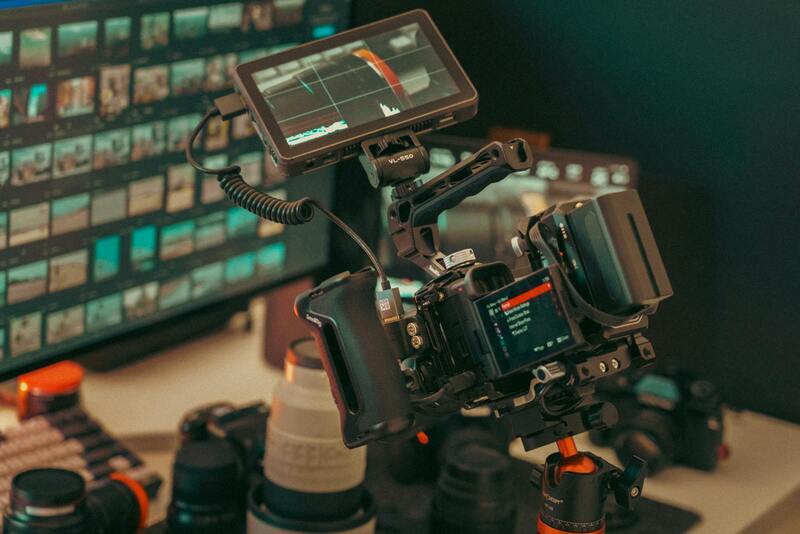
Beyond the hardware, software tools play a crucial role in post-processing and editing. Advanced editing suites allow professionals to fine-tune imagery, correct color discrepancies, and stitch together panoramic views seamlessly. Additionally, some drones support live streaming capabilities, enabling real-time review and adjustments during shoots, which is especially beneficial for complex commercial projects where precision is paramount.
Ultimately, investing in cutting-edge drone technology ensures that commercial real estate listings in Miami can showcase properties with a level of clarity, detail, and professionalism that distinguishes them in a competitive market. Skilled operators who understand how to leverage this equipment effectively can deliver results that elevate marketing campaigns and attract high-caliber clients.
Active and Remote Imaging Techniques for Commercial Real Estate
When capturing commercial real estate in Miami, utilizing active imaging methods ensures precise and comprehensive visual documentation. Techniques such as multispectral and hyperspectral imaging, though more common in specialized industries, can provide valuable data layers for certain commercial applications, including environmental assessments or infrastructure evaluations. These imaging methods capture data across different spectral bands, revealing details invisible to standard cameras, which can be instrumental in assessing property conditions or planning renovations.
Remote sensing approaches, leveraging high-resolution drone-mounted sensors, enable detailed topographic and infrastructural surveys from the air. These methods facilitate the creation of accurate 3D models and orthomosaic maps, which are essential for planning large-scale developments, landscaping, or assessing property boundaries. When executed correctly, these techniques provide stakeholders with comprehensive insights into the property environment without the need for invasive or time-consuming on-site inspections.

Additionally, thermal imaging equipped drones are increasingly utilized to identify heat leaks, electrical issues, or infrastructure vulnerabilities within commercial properties. Such data aids property managers and investors in proactive maintenance, thereby reducing long-term costs and enhancing safety standards. Ensuring the proper calibration of sensors and adherence to recommended operational procedures yield the most reliable data, which can be integrated into comprehensive property reports.
Advanced drone software tools simplify mission planning, allowing operators to set precise parameters for data acquisition. Automated flight paths and waypoint programming ensure consistent coverage of large complexes, minimizing the risk of missed details. Post-flight, data processing software consolidates the imagery into detailed maps and models, facilitating in-depth analysis for marketing, development, or maintenance purposes. These official and methodical approaches support credible, high-quality visual and data-driven storytelling tailored to the commercial real estate sector in Miami.
Legal and Regulatory Considerations in Miami
Conducting commercial real estate drone photography in Miami requires adherence to a set of established protocols that ensure safe and responsible flight operations. These protocols encompass regulations related to airspace management, privacy considerations, and operational procedures that guarantee the safety of both the public and property stakeholders.
One critical aspect involves obtaining the necessary permissions from relevant authorities before commencing any drone flight activities. This process typically includes submitting detailed flight plans that specify the location, altitude, and purpose of the drone operations. Ensuring that all flights are conducted within authorized airspace limits minimizes disruptions to manned aircraft operations, especially considering Miami’s busy urban and recreational airspace.
Operators must also comply with local zoning and privacy regulations, which govern how drone imagery can be captured and used. Respecting the privacy of individuals and neighboring businesses is paramount; this involves maintaining appropriate distances and avoiding intrusive surveillance. In practice, this means planning flight paths to focus solely on commercial properties without encroaching on private residences or sensitive areas.
To align with these parameters, drone operators often conduct pre-flight assessments and risk evaluations, which include checking weather conditions, ensuring technical readiness of equipment, and establishing clear communication channels with local authorities if necessary. Regular updates to operational parameters amid changing environmental conditions enhance safety standards and support smooth project execution.
Adopting official best practices for drone operation, like maintaining visual line-of-sight, respecting altitude ceilings, and following designated flight corridors, contributes to a seamless workflow. Moreover, keeping detailed flight logs and documentation aids in transparency and accountability, especially for projects that may involve multiple stakeholders or require regulatory audits.
Engaging licensed and experienced drone pilots who are familiar with Miami’s airspace regulations ensures that projects stay compliant while achieving high-quality imaging results. These licensed professionals are adept at navigating operational constraints and leveraging the latest technology responsibly, which directly supports credible and consistent commercial real estate marketing efforts.
Advanced Imaging Techniques for Commercial Real Estate
Professional drone photography for commercial real estate extends beyond simple aerial shots. It involves sophisticated imaging techniques that enhance the visual appeal of properties and provide detailed, comprehensive representations that serve marketing and transactional purposes effectively. High dynamic range (HDR) imaging allows capturing a wide spectrum of light and shadow, revealing intricate details in both bright and dark areas of the property, which is crucial for showcasing exterior facades and landscaped surroundings.
LiDAR (Light Detection and Ranging) technology, integrated into some advanced drone systems, enables the creation of precise 3D models of commercial sites. This is particularly useful for large-scale developments, site planning, and architectural visualization. Through LiDAR, prospective investors and contractors can analyze terrain elevation, assess structures' layout, and plan construction phases with greater accuracy, reducing errors and optimizing resource deployment.
Layered imaging techniques, such as 360-degree panoramas combined with high-resolution stills, offer immersive experiences for viewers. These allow potential buyers or tenants to explore the property virtually, gaining a comprehensive understanding of layout and scale without physically visiting the site. Incorporating infrared or thermal imaging can also highlight energy efficiencies or identify structural issues that are not visible to the naked eye, adding an additional layer of value to property assessments.
Ensuring Consistent Quality and Compliance
Consistency in drone imagery quality is essential for maintaining professional marketing standards across multiple listings or project phases. This requires implementing standardized flight parameters, camera settings, and post-processing protocols. High-quality, consistent imagery ensures that each commercial property is presented in a compelling, uniform manner, which reinforces brand credibility and trustworthiness.
Furthermore, adhering strictly to established operational procedures ensures that drone activities align with all relevant guidelines and best practices. Maintaining detailed records of flight logs, technical inspections, and image metadata not only facilitates smooth project management but also supports transparency for clients and stakeholders. Precise documentation helps verify that each flight was conducted within the prescribed parameters, safeguarding the integrity of the imagery and the reputation of the service provider.
Investing in ongoing pilot training and staying updated with technological developments allow operators to leverage the latest advancements responsibly. This continuous improvement ensures that the highest standards of image quality and operational safety are met, leading to more effective marketing tools for commercial real estate portfolios.
Official Methods for Nationwide and Local Drone Operations
When engaging in commercial real estate drone photography, it is vital to adhere to established procedures that promote safety, quality, and compliance, especially within the vibrant market of Miami. These methods include comprehensive pre-flight planning, rigorous pilot training, and the use of certified equipment. Planning involves detailed site assessments, weather evaluations, and securing necessary permissions, ensuring that every shoot is executed efficiently and professionally.
Qualified drone operators follow strict operational protocols, including maintaining safe flight distances from structures and individuals, managing airspace through authorized corridors, and documenting flight logs meticulously. These practices ensure that all drone activities align with current standards for aerial imaging, minimizing risks and enhancing the quality of captured visuals.
Equipment selection plays a critical role in delivering high-quality imagery. Professional-grade drones equipped with high-resolution cameras, gimbals for stabilization, and advanced flight controllers ensure precision and clarity. Regular maintenance and calibration of these devices are essential to maintain consistent output, particularly in demanding environments typical of commercial real estate projects.
Engaging with authorized airspace management systems allows operators to coordinate flights effectively, avoiding disruptions and ensuring compliance with local air traffic regulations. This proactive approach facilitates seamless integration of drone photography into overall marketing and development timelines.
Finally, establishing clear communication channels with property owners, stakeholders, and local authorities further streamlines operations. Maintaining transparency and cooperation fosters trust and ensures adherence to all operational guidelines, thereby securing the integrity of the imagery and the safety of everyone involved.
Advanced Post-Processing and Image Enhancement in Commercial Drone Photography
Once the aerial imagery has been captured, the process of post-production becomes vital in elevating raw footage to a polished, market-ready presentation. High-resolution images from commercial real estate drone photography often require meticulous editing to highlight the property’s best features, correct distortions, and ensure color accuracy. This step enhances the visual impact of each image, making it more appealing to potential clients and investors.
Professional editing workflows typically include geometric correction to rectify perspective distortions caused by wide-angle lenses, as well as lens distortion correction to ensure that lines and edges appear natural. Adjustments to brightness, contrast, and saturation refine the overall visual tone, capturing the property’s true aesthetic qualities. Often, HDR (High Dynamic Range) processing is employed to balance exposure across complex scenes with varied lighting conditions, such as bright skies against shadowed facades.
Further, advanced software tools enable the creation of composite images, panoramas, or even virtual tours that provide a comprehensive view of the property. These techniques help prospective tenants, buyers, or investors understand spatial relationships better, allowing for a more immersive property viewing experience. By integrating drone footage seamlessly with existing marketing assets, such as brochures or online listings, real estate professionals ensure consistency and visual coherence across all platforms.
In addition to visual improvements, metadata embedded during post-processing can improve content discoverability—making images more accessible through search engines and digital asset management systems. Metadata annotations include property details, geographic coordinates, and camera information, which can be useful for marketing analysis and AI-driven property recommendations.
Implementing these advanced editing techniques requires not only skilled professionals but also sophisticated software solutions. Tools such as Adobe Photoshop, Lightroom, or specialized drone image processing software provide the necessary capabilities to refine images efficiently, maintaining high standards of quality in a competitive commercial real estate market.
Optimizing Delivery and Presentation of Drone Content
Effective delivery strategies include utilizing high-resolution image galleries on websites, interactive maps with integrated aerial shots, and 3D virtual walkthroughs. The goal is to optimize the visual content for various digital platforms, ensuring fast load times and responsiveness across devices. Compressed but high-quality images guarantee that potential clients receive visually compelling content without sacrificing website performance.
Another noteworthy practice is organizing content in a logical sequence—starting with exterior shots of the entire property, followed by detailed images showcasing key amenities and surrounding infrastructure. This approach guides viewers through a structured visual narrative, highlighting the property’s most attractive features sequentially.
Overall, advanced post-processing, strategic presentation, and integrated content delivery create a comprehensive visual storytelling framework — empowering commercial real estate professionals to attract interest and accelerate transaction timelines with high-quality aerial imagery.
Maximizing the Impact of Commercial Drone Photography in Your Marketing Campaigns
Incorporating drone imagery into a strategic marketing plan enhances the visibility and appeal of commercial properties, drawing the attention of prospective tenants, investors, and brokers. Modern commercial real estate marketing relies heavily on high-quality visuals to differentiate listings in a competitive market. Drone photography offers a unique vantage point that captures the full scope of a property, providing potential clients with a comprehensive view that ground-level images cannot achieve.
For effective integration, professionals often use a combination of aerial shots, detailed close-ups, and dynamic video tours to craft a compelling narrative around the property. High-resolution aerial photography can highlight characteristics such as rooftop features, parking layouts, landscaping, and surrounding infrastructure. These images serve as powerful tools in brochures, online listings, and social media campaigns, helping to generate buzz and increase engagement.
Moreover, integrating drone footage into virtual tours or 3D walkthroughs provides an immersive experience that elevates property presentations. Potential clients can explore a property remotely, assessing its layout and surroundings with clarity and precision. This approach not only aids in decision-making but also demonstrates a commitment to innovative marketing practices, positioning the agency or property owner as forward-thinking and client-focused.
Analytics and tracking tools can further measure the effectiveness of drone-based marketing content. Monitoring engagement rates, click-throughs, and inquiries generated by aerial visuals allows real estate professionals to optimize their campaigns continually. When paired with targeted advertising, such as geo-specific social media ads or email marketing, drone imagery can significantly boost outreach and lead generation efforts.
Strategic Placement and Optimization of Drone Content
- Ensure images and videos are optimized for fast loading times on all device types, maintaining high resolution without compromising website performance.
- Use descriptive and keyword-rich captions to improve search engine visibility, assisting future clients in locating your property listings more efficiently.
- Arrange visual assets to tell a logical story — start with broad exterior shots and gradually move into detailed views of interior spaces, amenities, and key features.
- Combine drone imagery with traditional photos and virtual tours for a comprehensive, multi-sensory marketing experience.
Effective Use Across Digital Platforms
Embedding drone imagery within property websites integrates seamlessly into existing digital marketing ecosystems, providing a modern, professional aesthetic that appeals to tech-savvy buyers and tenants. Interactive elements such as clickable maps or 360-degree aerial views allow users to engage actively with the property’s features, fostering a deeper connection. On social media, sharing captivating drone videos and images can exponentially increase reach and brand recognition, especially when using trending hashtags and location tags relevant to Miami’s vibrant commercial real estate landscape.
Collaborating with Experienced Drone Service Providers
Partnering with reputable drone photography firms ensures access to the latest technology, skilled operators, and adherence to all official standards. Specialists in commercial drone imaging understand the nuances of capturing impactful visuals that resonate with target audiences. They possess the expertise to recommend optimal flight paths, lighting conditions, and post-production enhancements that elevate the visual quality of each project. Their broad industry experience translates into tailored solutions that meet specific marketing goals and property needs, ensuring a seamless workflow from planning to delivery.
Leveraging a professional service also minimizes operational disruptions on-site and guarantees compliance with all operational standards. This investment not only results in superior imagery but also streamlines the overall marketing process, providing peace of mind that content is crafted responsibly within the appropriate parameters.