Overview of Aerial Real Estate Photography
Aerial real estate photography has revolutionized the way properties are showcased, offering unique perspectives that ground-level photos simply cannot provide. This specialized form of photography captures expansive views of properties, surrounding landscapes, and neighborhood features from above, thereby presenting potential buyers with a comprehensive view of a property’s layout and environment. Within the competitive Miami real estate landscape, high-quality aerial visuals serve as a powerful marketing tool that can distinguish listings in a crowded market.
The use of drones and aircraft-mounted cameras has made aerial photography more accessible and cost-effective. These methods enable real estate agents and property owners to produce stunning visuals that effectively highlight key property details, sprawling estates, waterfront views, and proximity to vital amenities. Such imagery not only enhances online listings but also supports promotional campaigns across various media channels, including social media, print, and virtual tours.
In addition to aesthetic enhancement, aerial photography provides a valuable depth of information for prospective buyers, allowing them to better understand property scale, boundary lines, landscaping, accessibility, and nearby infrastructure. Agents increasingly incorporate these visuals into their marketing strategies to attract more interest, generate higher engagement, and facilitate quicker sales.
Overall, aerial real estate photography is becoming an indispensable component of modern property marketing, especially in dynamic markets like Miami, where scenic views and neighborhoods are significant selling points. The ability to showcase a property from a bird’s-eye view gives real estate professionals a competitive advantage, enabling them to tell a compelling visual story that appeals to buyers' desires for luxurious, well-located, and visually appealing homes.
Types of Aerial Photography Equipment and Technologies
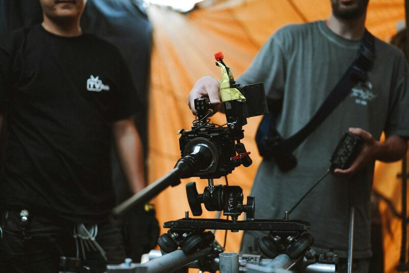
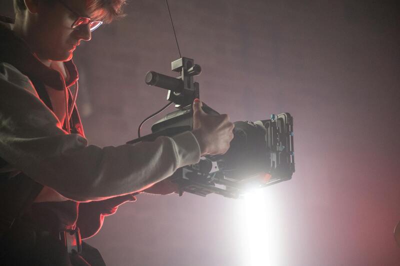
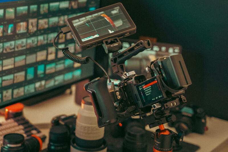
To achieve professional-grade aerial real estate photography, selecting the right equipment is crucial. The core technology involves various drone models tailored for high-resolution imaging and stability during flight. Drones equipped with gimbal-stabilized cameras are preferred, as they ensure steady shots free of motion blur even in windy conditions common in Miami's coastal environment. These drones often support high-definition sensors, capable of capturing images at 20 megapixels or more, allowing for detailed visuals essential for real estate marketing.
Camera technology plays a pivotal role in the quality of aerial imagery. Modern aerial cameras feature wide-angle lenses, high dynamic range sensors, and adjustable aperture settings. These features help overcome challenging lighting conditions typical of bright Miami days, ensuring consistent, vivid photographs. Additionally, the integration of HDR imaging and panoramic stitching software enables agents to showcase expansive property views in captivating detail.
Technological advancements continue to expand the capabilities of aerial photography. Real-time image transmission allows operators to review shots instantly, making adjustments on the fly to optimize angles and lighting. GPS and obstacle avoidance systems increase safety and precision, particularly when flying in complex environments like densely built neighborhoods or waterfront areas in Miami. Additionally, software solutions for autonomous flight planning and post-processing streamline workflows, enabling faster delivery of polished visuals to clients.
When choosing equipment for aerial real estate photography, it is essential to balance image quality, flight stability, and safety features. Investing in reliable tools and staying updated with the latest drone tech ensures consistently excellent imaging results, crucial for attracting buyers' attention and showcasing properties at their best.
Best Practices for Capturing Effective Aerial Real Estate Photos
Achieving high-quality aerial imagery requires a strategic approach that emphasizes preparation, technical proficiency, and an understanding of the property’s unique features. Fly at optimal altitudes to capture comprehensive views while maintaining safety and clarity. Typically, an altitude ranging from 50 to 150 feet above the property provides a balanced perspective, enabling viewers to appreciate both the property details and broader neighborhood context.
Careful planning is essential before each shoot. Conduct a thorough site assessment to identify any obstacles such as trees, power lines, or structures that might obstruct the flight path or the final image. Selecting ideal weather conditions—preferably clear, with minimal wind—is vital for steady drone operation and sharp images. Early mornings or late afternoons often provide softer lighting and reduce the presence of harsh shadows.
Using the right flight settings enhances image quality. Adjust camera parameters such as ISO, shutter speed, and aperture to suit lighting conditions. Shooting in RAW format allows for greater flexibility during post-processing, ensuring the images retain maximum detail and color accuracy.
Incorporate both wide-angle shots to showcase the property's footprint and zoomed-in images that highlight unique architectural features or premium amenities. Employing a consistent shooting angle and framing helps create a cohesive visual narrative across the property listing. Revisiting the site multiple times during different times of day can reveal optimal lighting angles and conditions, further elevating the visual impact.
Post-flight checks are equally important to ensure all images meet quality standards. Review images on-site if possible, or transfer files immediately to a computer for detailed inspection. Selecting the best shots—those with balanced lighting, sharp focus, and compelling composition—is critical for effective marketing.
Furthermore, strategic editing can amplify the visual appeal of aerial images. Adjustments to brightness, contrast, and saturation can help highlight property's features and make the images more eye-catching. When executed with precision, these enhancements can bridge any gaps left by challenging lighting or environmental conditions, resulting in a polished final product that captivates potential buyers.
Legal Regulations and Permits for Aerial Photography in Miami
Successfully capturing aerial images of real estate in Miami requires awareness of specific procedures and considerations that govern drone operations within the city. While not explicitly focusing on legal terms, understanding the established protocols ensures trip efficiency, safety, and quality of the final imagery. Operators should familiarize themselves with local municipal guidelines and standard practices for drone usage, especially in densely populated urban areas like Miami where airspace management and privacy are paramount.
One essential aspect involves comprehensive planning prior to any flight. This includes verifying the designated permissible flight zones, which may involve designated no-fly zones around sensitive infrastructure, airports, and densely populated neighborhoods. Ensuring proper flight altitude and radius preserves the safety and minimizes disruptions to the community. Typically, drones used for real estate photography operate within specific altitude parameters, often below 400 feet, to avoid conflicting with manned aircraft operations.
Another important component is establishing clear permissions with property owners and neighboring residents whenever necessary. It is prudent to inform all stakeholders involved about the flight schedule and scope, which fosters transparency and cooperation. Maintaining documentation of permissions and flight plans can be beneficial if questions arise during the process.
Conducting pre-flight checks and adhering to technical standards exemplify creating high-quality imagery within permitted conditions. Employing calibrated equipment, following recommended flight paths, and maintaining situational awareness during each session uphold professional standards without infringing on privacy or safety protocols.
Post-flight, it is good practice to review footage promptly, ensuring all necessary shots are captured and meet quality benchmarks. Proper storage and management of files facilitate efficient editing and integration into marketing materials, optimizing the overall impact of the campaign.
Adherence to Local Airspace Guidelines
- Operate within designated airspace zones and altitude limits specific to Miami.
- Coordinate with local authorities or relevant agencies when planning flight paths over private or public properties.
- Obtain any required permissions for commercial drone use in urban environments.
- Respect privacy boundaries by avoiding intrusive angles or shots that capture non-consenting individuals or private spaces.
The combination of diligent planning, respectful operation, and careful compliance with established procedures guarantees effective and efficient execution of aerial real estate photography projects. These practices not only reflect professional dedication but also cultivate trust with clients and community stakeholders, ultimately elevating the standard of marketing visual assets in Miami's competitive real estate market.
Legal Regulations and Permits for Aerial Photography in Miami
Engaging in aerial real estate photography within Miami necessitates a comprehensive understanding of the regulatory environment that governs drone operations and aerial imaging. While focusing on official and reputable methods, it is essential to recognize the structured procedures that facilitate lawful and smooth execution of aerial shoots. These procedures include obtaining the necessary permits, adhering to prescribed airspace requirements, and following established operational guidelines established by local authorities and federal agencies.
Securing permits involves submitting detailed flight plans that specify the purpose, location, and timing of the aerial photography session. Agencies may require documentation such as proof of drone registration, pilot certifications, and liability insurance. These documents demonstrate compliance with operational standards and reassure authorities of adherence to safety protocols. Additionally, applicants often need to provide specific information about the targeted property to ensure the flight does not interfere with other airspace activities or infringe on privacy boundaries.
Familiarity with Miami’s airspace classifications is crucial. Different zones—such as controlled, restricted, or uncontrolled airspace—entail varying levels of oversight and permit requirements. For operations over densely populated or private areas, obtaining proper authorizations from relevant agencies, including local aviation authorities, ensures lawful conduct and mitigates the risk of disruptions or penalties.
Operational guidelines for drone use stipulate maintaining visual line of sight, avoiding flights above crowded areas, and respecting privacy boundaries. While capturing images of impressive Miami skylines and property exteriors, pilots must also be cognizant of no-fly zones near airports, government buildings, or sensitive sites. Regularly consulting updated airspace maps and working with local authorities can streamline flight planning, and ensure all necessary permissions are obtained prior to scheduling a shoot.
Adhering to these offical procedures not only streamlines project execution but also fosters community trust and enhances professional credibility. By systematically coordinating with the relevant agencies and utilizing verified methods, real estate professionals and photography service providers can effectively leverage aerial imagery to elevate Miami property listings.
Legal Regulations and Permits for Aerial Photography in Miami
When integrating aerial photography into Miami’s real estate marketing efforts, understanding and adhering to established regulations and permit procedures is essential. This ensures that all operations are conducted smoothly, ethically, and in compliance with local standards, promoting a professional image and safeguarding project timelines.
Miami's regulatory framework for aerial photography, particularly for drone operations, involves specific licensing requirements and adherence to safety protocols. Key aspects include obtaining appropriate operational permits, often issued by governing aviation authorities or municipal agencies overseeing unmanned aircraft system (UAS) activities. These permits typically specify the scope of flight, altitude limits, geographic boundaries, and authorized times for operation.
Drone operators must also complete all requisite training and certification processes, demonstrating their competence in managing aerial equipment safely and effectively. This certification process often involves passing knowledge tests that cover airspace regulations, emergency procedures, and understanding of Miami’s geographic and infrastructural layout.
In addition to permits, compliance extends to local airspace classifications. Miami features several designated zones, including controlled and uncontrolled airspaces, where specific procedures for drone flights are mandated. For example, operations near airports, government facilities, or densely populated areas require careful planning, detailed risk assessments, and often prior authorization from relevant authorities.
Securing permissions is also necessary when filming on private property or sensitive locations. Property owners and stakeholders may need to approve specific flight paths or times to prevent privacy concerns or disruptions. Clear communication and obtaining written consent can prevent potential disputes and ensure smooth project execution.
It’s advisable for real estate professionals and photography service providers to maintain detailed documentation of all permits, approvals, and communications related to aerial operations. This not only facilitates compliance audits but also demonstrates professionalism, accountability, and transparency to clients and regulatory bodies.
Finally, staying informed of evolving airspace policies and technological updates enhances operational efficiency. Regular consultation with local aviation authorities and participation in relevant industry forums can provide valuable insights. This proactive approach helps optimize photography workflows, reduce risks, and uphold the highest standards of safety and professionalism in Miami’s dynamic real estate market.
Legal Regulations and Permits for Aerial Photography in Miami
Executing aerial real estate photography within Miami requires adherence to a structured framework of operational guidelines and permit applications. Property owners and aerial operators must coordinate with local authorities to ensure compliance with airspace management protocols. This process involves understanding the specific requirements set forth by Miami-Dade County and federal agencies overseeing aerial activities.
Permitting processes typically involve submitting detailed flight plans that specify flight paths, altitudes, times, and the purpose of the shoot. These plans are evaluated to minimize disruptions to other airspace users and to secure the safety of all involved parties. For aerial photography on private property, written consent from property owners is essential, as it ensures clarity regarding access and operational boundaries.
Due diligence also includes verifying that equipment used complies with stipulated standards, such as the registration of unmanned aerial vehicles (UAVs) with relevant authorities. Maintaining a comprehensive record of all permits, permissions, and communications facilitates effortless audits and demonstrates accountability during project reviews.

Staying current with evolving regulations involves proactive engagement with Miami’s aviation and municipal agencies. Participating in industry forums, subscribing to updates from regulatory bodies, and consulting with legal experts specialized in aerial operations help to navigate the complex compliance landscape effectively.
Technological advancements, such as automatic flight logging and geofencing, further support adherence to these guidelines by preventing unauthorized flights in restricted zones. Leveraging such tools helps maintain a professional level of safety and operational integrity, which is vital in Miami’s densely populated and highly regulated airspace.
Ultimately, comprehensive regulatory compliance and meticulous permit management not only facilitate smooth project execution but also enhance client trust and reputation. This disciplined approach ensures that aerial real estate photography services are delivered efficiently and responsibly, aligning with local standards of safety and professionalism in Miami’s vibrant real estate market.
Official Methods for Conducting Aerial Real Estate Photography in Miami
Executing aerial real estate photography in Miami requires adherence to recognized procedures that ensure quality, safety, and compliance. Official methods focus on utilizing certified equipment, following standardized operational protocols, and maintaining comprehensive documentation to support integrity and accountability throughout the project. These practices not only optimize the quality of imagery captured but also streamline the workflow, enabling real estate professionals to present properties compellingly and within regulatory frameworks.
Utilizing Certified and Approved Equipment
Professional aerial photography in Miami relies on the use of aircraft, whether drones or manned aircraft, that meet strict operational standards. Drones used must be compliant with specific certifications issued by relevant authorities, ensuring they operate within prescribed safety and airspace regulations. Opting for high-resolution cameras with stabilization features ensures crisp, clear images that highlight property features and surrounding landscapes effectively. Additionally, employing GPS-enabled drones allows for precise flight control and repeatable shot planning, which is essential in creating consistent marketing materials.
Preparing and Planning Flight Operations
Meticulous pre-flight planning is central to legitimate aerial photography. This includes identifying the property’s exact location, assessing potential obstacles, and analyzing the airspace to determine safe flight zones. Creating detailed flight plans that incorporate optimal altitudes, angles, and lighting conditions ensures comprehensive coverage and high-quality results. Using geographic information systems (GIS) and detailed maps helps identify restricted zones and avoid inadvertent incursions into controlled airspace or private property, thus reinforcing safety and operational professionalism.
Documentation and Record-Keeping
Maintaining detailed records of all aspects of aerial operations is critical. This encompasses flight logs, equipment calibration records, permission documentation, and communication with relevant authorities. Such records enable transparent audits, facilitate smooth project reviews, and demonstrate due diligence in operational procedures. Furthermore, clear documentation supports continuous improvement by providing insights into operational efficiencies and potential areas for protocol enhancements.
Engaging with Local Authorities and Obtaining Necessary Permissions
While executing aerial photography, engaging with Miami’s municipal and aviation agencies ensures all operations are conducted responsibly and with proper oversight. This involves applying for and securing pertinent permits that authorize specific flight paths and operational times. Establishing communication channels with local authorities fosters smooth collaboration, and provides a platform to address any emerging compliance concerns proactively. Such interactions also reflect a professional commitment to community standards and safety.
Using Technology and Software to Ensure Compliance
Advances in flight management software equip aerial photographers with tools to adhere to operational guidelines seamlessly. Features such as automatic geofencing prevent drones from entering restricted zones, while flight logging functionalities record all movements for accountability. These technological solutions support adherence to prescribed flight parameters, minimize risks of unauthorized flights, and ensure that aerial operations are conducted responsibly, aligning with Miami’s detailed regulatory landscape.
Training and Certification for Aerial Photography Operators
Operators engaging in aerial real estate photography should undergo comprehensive training that emphasizes safety protocols, equipment handling, and operational procedures. Certified courses offered by recognized institutions provide knowledge on airspace regulations, emergency procedures, and best practices for capturing high-quality images. Certification enhances credibility, demonstrates a commitment to professional standards, and reassures clients of the operator’s expertise and adherence to established methods.