Introduction to Aerial Real Estate
Aerial real estate refers to the use of drone technology and aerial photography to capture comprehensive visual representations of property landscapes, layouts, and surrounding environments from above. This innovative approach has gained significant traction in Miami’s vibrant real estate market, where showcasing a property’s exterior, lot size, neighborhood features, and proximity to key amenities is essential for attracting prospective buyers and investors. High-quality aerial images and videos provide an immersive view that traditional ground-based photography cannot achieve, thereby enhancing marketing efforts and property documentation.
In today’s competitive real estate landscape, aerial content serves as a critical visual tool, offering a unique perspective that highlights the property’s best attributes while giving potential clients a real sense of spatial relationships and overall value. Miami’s diverse real estate market—including luxury waterfront estates, commercial developments, and urban apartments—benefits immensely from aerial visuals, which help distinguish listings amid a crowded field. As technology continues to evolve, professionals increasingly rely on advanced aerial imaging methods to create compelling visual narratives that appeal to both local and international buyers.

The rise of aerial real estate activities underscores their influence on property marketing, documentation, and development planning. While ground-level photographs remain fundamental, aerial perspectives provide a comprehensive view of the property and its context within the Miami skyline, urban layout, or natural surroundings. This multidimensional visual approach not only improves listing appeal but also aids in strategic planning for real estate professionals, investors, and developers who seek detailed overviews for project analysis or marketing campaigns.
As Miami continues to grow as a dynamic hub for real estate investment and development, aerial methods are becoming indispensable for delivering professional, engaging, and accurate visual content. Their increasing integration into real estate workflows reflects a broader recognition of the value that aerial imagery adds to property presentation, making it a key component of modern real estate marketing portfolios.
Types of Aerial Equipment and Technology
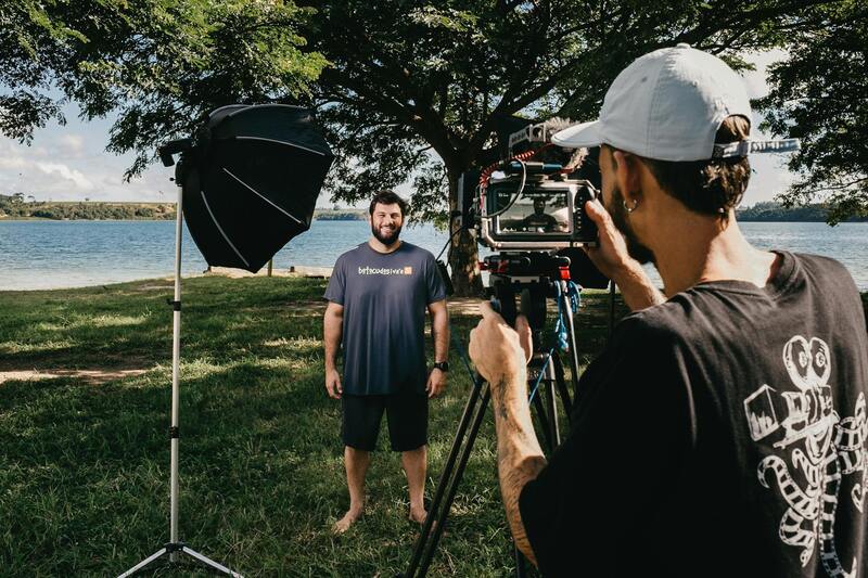
To capture high-quality aerial imagery for real estate marketing in Miami, professionals utilize a variety of cutting-edge equipment tailored to different project requirements. The selection of equipment is crucial for producing clear, stable, and compelling visuals that accurately represent the property's attributes.
Unmanned Aerial Vehicles (UAVs), commonly known as drones, are the most prevalent tools in aerial real estate photography. Modern drones are equipped with high-resolution cameras capable of capturing detailed images from multiple angles and altitudes. They also incorporate stabilization features, such as gimbal systems, to ensure smooth footage even in challenging wind conditions, which are common in Miami's coastal environment.
Fixed-wing aircraft and helicopter-based systems are often employed for larger-scale projects, especially when extensive acreage or multiple properties are involved. These methods provide broader coverage and can access higher altitudes, delivering expansive views of urban developments and natural landscapes.

Infrared and thermal imaging sensors are also increasingly integrated into aerial systems. These technologies allow real estate professionals to showcase unique property features, such as energy efficiency or landscape zoning, which might not be visible through standard imagery.
Furthermore, the integration of GPS and autonomous flight technologies enables precise planning and execution of flight paths. This ensures consistent coverage, optimal angles, and adherence to designated flight zones, which is particularly important in densely developed Miami neighborhoods or protected natural areas.
Innovations in image processing and editing software advance the quality of aerial visuals. High dynamic range (HDR) imaging, panoramic stitching, and aerial mapping enable the creation of professional-grade visuals that stand out in competitive listings. These tools also aid in generating detailed 3D models and virtual tours, further enriching the potential marketing impact of aerial content.

Types of Aerial Equipment and Technology
In the realm of aerial real estate showcasing, the selection of equipment plays a pivotal role in capturing high-quality imagery that truly elevates property marketing efforts. The core tools include various unmanned aerial vehicles (UAVs), aircraft, and sophisticated camera systems, each tailored to meet specific project demands and property characteristics.
Unmanned Aerial Vehicles (UAVs), commonly known as drones, have revolutionized the field with their versatility, maneuverability, and affordability. Modern drones equipped with high-resolution digital cameras, stabilizers (gimbals), and advanced navigation systems allow operators to capture crisp images and smooth videos from multiple angles. These devices are especially useful for residential properties, commercial complexes, and sprawling estates, offering dynamic perspectives that ground-based photography cannot match.
For larger-scale projects or developments requiring extensive coverage, fixed-wing aircraft or helicopter systems are deployed. These are ideal for surveying expansive properties, urban landscapes, and natural environments over larger distances. Fixed-wing aircraft can sustain longer flight durations and higher altitudes, providing broad views of neighborhoods and cityscapes, essential for contextually rich real estate presentations.
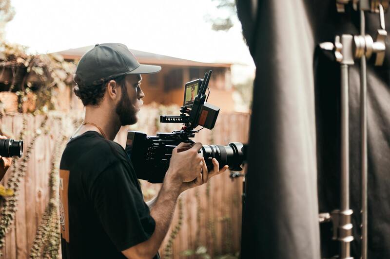
Camera gear utilized in aerial photography varies from standard high-definition (HD) or 4K footage cameras to specialized imaging sensors. Thermal and infrared sensors are increasingly integrated, allowing agents and developers to highlight features such as energy-efficient layouts, landscape zoning, or environmental conditions, enriching storytelling through visual data.
Technological advancements have introduced autonomous flight systems, GPS-guided flight paths, and obstacle avoidance mechanisms. These features enhance operational safety and ensure systematic coverage without repeated or missed angles, optimizing the quality and consistency of aerial content. Additionally, software tools for image processing—including HDR imaging, panoramic stitching, and 3D mapping—further refine visuals, supporting the creation of immersive virtual tours and detailed property representations.

The integration of these advanced tools enables real estate professionals to produce compelling visual narratives, helping properties stand out in competitive markets. The choice of equipment is driven by project scope, property size, and the desired viewer impact. Proper utilization of this technology ensures high-quality, engaging content that resonates with prospective buyers and investors, especially in a dynamic market like Miami where aerial visuals significantly enhance property appeal and visibility.
Legal and Regulatory Considerations in Miami
When implementing aerial real estate strategies in Miami, adherence to established operational standards is crucial to ensure safety and compliance. Professional aerial imaging services utilize equipment and procedures that conform to the city’s guidelines for drone flight and aerial data collection. These include obtaining the necessary clearances for airspace use, respecting privacy boundaries, and following safety protocols to safeguard both personnel and property.
Operators often coordinate with local authorities to secure appropriate flight authorizations, especially in densely populated areas or near sensitive infrastructure. This process involves submitting detailed flight plans, confirming adherence to height restrictions, and ensuring that no disruption occurs to surrounding communities. It is also essential to stay updated with any temporary flight restrictions (TFRs) that may be put in place due to city events or security measures.
In addition to regulatory compliance, employing seasoned professionals who understand Miami’s airspace can help prevent operational delays or issues. These specialists are trained in drone operation techniques that minimize risks and maximize coverage efficiency. Their experience ensures that aerial content creation proceeds smoothly, with consideration for local regulations and environmental factors like weather conditions and wind patterns.
Moreover, the use of federal and state licensing, such as certifications from relevant authorities, ensures that aerial work aligns with nationwide standards. This not only enhances the credibility of the visual content but also provides a seamless experience for clients and stakeholders involved in the real estate process.

Legal and Regulatory Considerations in Miami
Navigating the skies over Miami for aerial real estate purposes requires adherence to a comprehensive framework of regulations designed to ensure safe and responsible drone operations. These guidelines encompass a broad spectrum of operational practices, licensing requirements, and privacy standards that are essential for maintaining harmony within the bustling airspace of a major metropolitan area.
Operators need to obtain specific permits and authorizations prior to conducting aerial footage or photography. This involves submitting detailed flight plans that outline the scope, altitude, and timing of drone flights. Such plans are reviewed by relevant authorities to assess potential impacts on other airspace users and public safety, especially when operating near sensitive infrastructure or densely populated areas.
Miami’s vibrant urban environment presents unique challenges for aerial real estate activities. Flight restrictions are often in place around airports, important public venues, and during city events. These temporary flight restrictions (TFRs) are enforced to prevent interference with aviation traffic and to protect the privacy of residents and businesses.

Privacy considerations are also paramount. While capturing stunning aerial views can significantly enhance real estate listings, operators must be cautious to avoid infringing on private property and personal privacy. Respecting property boundaries and avoiding intrusive filming techniques helps maintain community trust and demonstrates professionalism.
In addition to local guidelines, federal and state licensing standards govern drone operations across the country. Certified drone pilots who hold relevant certifications are trained to execute flights with precision and safety, complying with national regulations. These certifications verify their competency in handling various operational scenarios, thereby minimizing risks associated with aerial filming.
Operators are encouraged to stay informed of changes in Miami’s airspace regulations and to work closely with local authorities to schedule flights that align with city planning and public interests. Engaging experienced professionals familiar with Miami’s operational landscape ensures the execution of aerial real estate projects with the highest standards of safety and compliance.
Legal and Regulatory Considerations in Miami
When conducting aerial real estate projects in Miami, adherence to established operational guidelines is essential. Drone operators should familiarize themselves with the city’s specific airspace restrictions, which include designated no-fly zones around sensitive locations such as airports, military bases, and major public venues. Understanding temporary flight restrictions (TFRs) is crucial, especially during city events or large gatherings, to avoid interference with aviation traffic and ensure safe operations.
Compliance with Miami’s airspace regulations involves meticulous planning and coordination with local authorities. This includes submitting flight plans when necessary, obtaining permits, and conducting pre-flight assessments to identify potential hazards. By establishing clear communication channels with relevant agencies, operators can schedule flights during optimal timeframes that align with city policies, reducing the risk of disruptions or fines.

In addition to city-specific protocols, all drone flights must adhere to federal and state regulations governing unmanned aircraft systems. Certified drone pilots are trained to operate within these parameters, ensuring safety and precision. These professionals conduct comprehensive risk assessments and employ operational safety measures, such as maintaining line-of-sight and avoiding congested areas, to minimize potential issues during filming.
Engaging with local authorities during the planning phase not only supports compliance but also fosters a collaborative environment that benefits all stakeholders. Transparency with city officials and community members can help mitigate concerns related to privacy or aerial disturbances. Proper documentation, including flight logs and permission records, ensures a clear trail of responsible operation, reinforcing trust and professionalism.

Ultimately, the key to successful aerial real estate videography in Miami lies in meticulous planning, clear communication, and strict adherence to operational protocols. By leveraging licensed and experienced drone professionals, real estate entities can ensure their aerial content is both compelling and compliant, harnessing the full potential of drone technology while respecting local airspace boundaries.
High-Quality Post-Production and Editing
Once the aerial footage or images are captured, the post-production process begins. This stage is critical for transforming raw footage into visually compelling content that highlights the unique features of a property. Professional editing involves color correction to enhance visual clarity, stabilization to ensure smooth visuals, and the integration of graphics or informational overlays that convey essential property details. Advanced editing software allows for the seamless stitching of images and videos, creating a polished final product that effectively captures the attention of potential buyers and investors.
In addition to visual enhancements, adding background music or narration can further elevate the presentation, making it more engaging and informative. Consistency in branding is also vital; incorporating logos, contact information, or brand themes reinforces recognition and credibility. An optimized video length, usually between 1 to 3 minutes, ensures viewers remain engaged without feeling overwhelmed. High-resolution exports and compatibility with all major platforms guarantee that the content appears professional across various digital channels, from social media to official property listings.
Distribution Strategies for Aerial Real Estate Content
To maximize the impact of aerial imagery and video, implementing targeted distribution strategies is essential. Sharing high-quality content across multiple digital platforms—such as real estate websites, social media channels, and email campaigns—broadens reach and visibility. Paid advertising campaigns can further boost exposure, especially when targeting specific buyer demographics or geographic markets.
Embedding aerial content into virtual tours or online open house events offers potential buyers an immersive experience, allowing them to explore properties remotely with a comprehensive perspective. Regularly updating galleries with new aerial visuals keeps listings fresh and engaging, maintaining interest over time. Leveraging analytics to monitor viewer engagement helps refine marketing tactics, ensuring future content resonates effectively with the target audience.
By combining expert post-production techniques with strategic content distribution, real estate professionals can significantly enhance their marketing efforts. This approach not only elevates property presentations but also builds trust and authority within the Miami real estate market, resulting in quicker sales and higher valuation offers. Precise, high-quality aerial content remains a pivotal asset in modern real estate marketing, offering a dynamic view of properties that static images alone cannot achieve.
Implementing Official Methods for Aerial Content Acquisition
For real estate professionals seeking to utilize aerial imagery and video, it is crucial to follow proper procedures for obtaining and deploying such content. Engaging certified drone operators who possess appropriate licenses ensures that aerial footage is captured adhering to established standards. These operators are well-versed in operational protocols that promote safety, accuracy, and professionalism during shots of residential, commercial, or undeveloped properties.
Leveraging accredited aerial service providers guarantees access to high-grade equipment and adherence to operational best practices. This typically involves a collaborative planning phase, where the operator assesses the property layout, surrounding environment, and potential flight zones. Pre-flight site inspections help identify any obstacles or restricted areas, thus enabling safe and efficient shoot arrangements.
Furthermore, scheduling flights during suitable weather conditions minimizes the risk of poor image quality or flight disruptions. Clear pilot documentation and insurance coverage from licensed providers add additional layers of integrity, safeguarding clients from potential liabilities. The focus remains on obtaining authentic visuals that accurately represent the property’s features and location.
In addition to hiring licensed pilots, real estate entities should ensure that all drone operations are documented with flight logs and compliance records. Such documentation demonstrates a commitment to responsible practices and supports the integrity of the marketing content.
Utilizing Stock Aerial Footage and Licensed Media
Another reputable approach involves the use of stock aerial footage or licensed media libraries. High-quality stock sites offer a diverse array of professionally shot videos and images, which can be suitable for properties or locations where custom footage is not feasible. This approach is particularly beneficial for pre-marketing materials or conceptual visualizations.
It is essential, however, to verify the licensing terms associated with stock footage. Licensed media ensures that all content used complies with intellectual property rules and is acquired from reputable sources with clear usage rights. This practice avoids potential disputes and maintains the integrity of the marketing campaign.
Employing a combination of authoritative custom footage and vetted stock content provides versatility in creating compelling visuals that highlight the greatest attributes of a property or neighborhood. This balanced strategy supports tailored marketing narratives while adhering to established content procurement protocols.