Importance of Drone Photography in Miami Real Estate
In the highly competitive Miami real estate market, the use of real estate drone photography has become an essential tactic for agents and property marketers aiming to elevate their listings. Drone imagery offers a unique perspective that traditional ground-based photography simply cannot achieve, providing potential buyers with a comprehensive view of the property and its surroundings. By capturing expansive aerial shots, prospective buyers can better visualize property size, layout, proximity to key amenities, scenic views, and nearby attractions that are pivotal in decision-making processes.
The visual appeal of drone footage significantly impacts the online listing experience. Listings featuring high-quality aerial images tend to generate more interest, attract more inquiries, and often result in quicker sales. This is particularly crucial in Miami, where waterfront properties, luxury estates, and large commercial developments dominate the market. Drone photography adds a dramatic and professional touch to property presentations, making listings stand out amidst a sea of images.
Moreover, the dynamic perspective provided by drone photography allows real estate professionals to highlight the property's best features, such as landscaped gardens, swimming pools, outdoor living spaces, or unique architectural details. This visual storytelling increases emotional engagement, helping potential buyers envision their future home or investment more vividly. In markets like Miami, where lifestyle and environment are key selling points, drone imagery can effectively showcase the vibrant cityscape, stunning coastlines, and lush neighborhoods that define the area.
From a strategic perspective, incorporating drone photography into marketing campaigns enhances the overall branding of real estate agencies. It demonstrates a commitment to cutting-edge technology and professionalism, which can build trust with clients and distinguish them from competitors. Buyers increasingly expect immersive and high-quality visuals to inform their purchasing decisions, making drone imagery an invaluable asset in the modern real estate toolkit.
Overall, the integration of real estate drone photography into Miami property marketing not only elevates the visual appeal of listings but also provides comprehensive insights that align with the needs of today's digital-savvy buyers. This technique facilitates a more engaging, transparent, and compelling presentation that directly influences the success of property sales.
Equipment and Technology for Real Estate Drone Photography
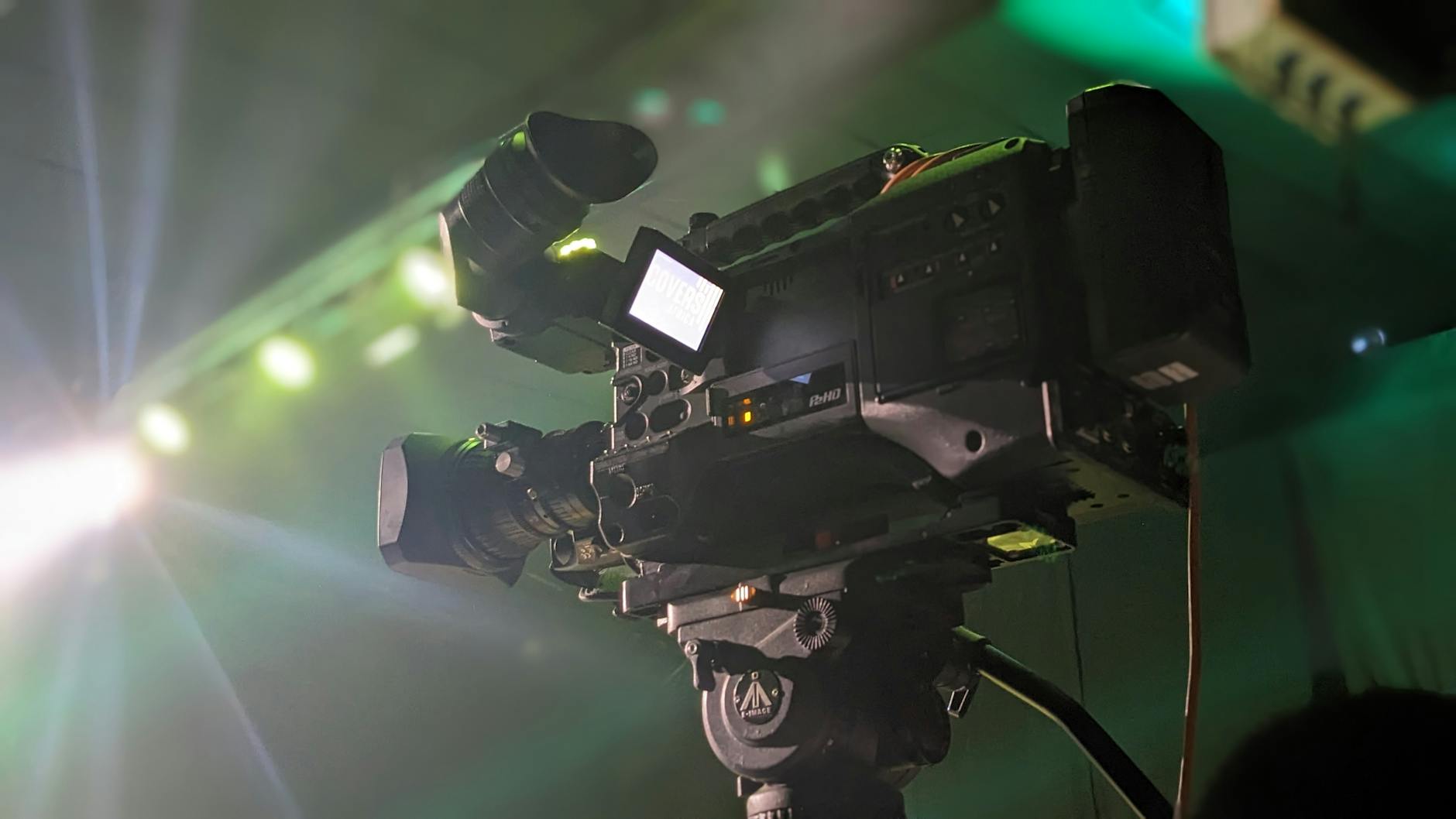
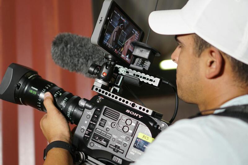
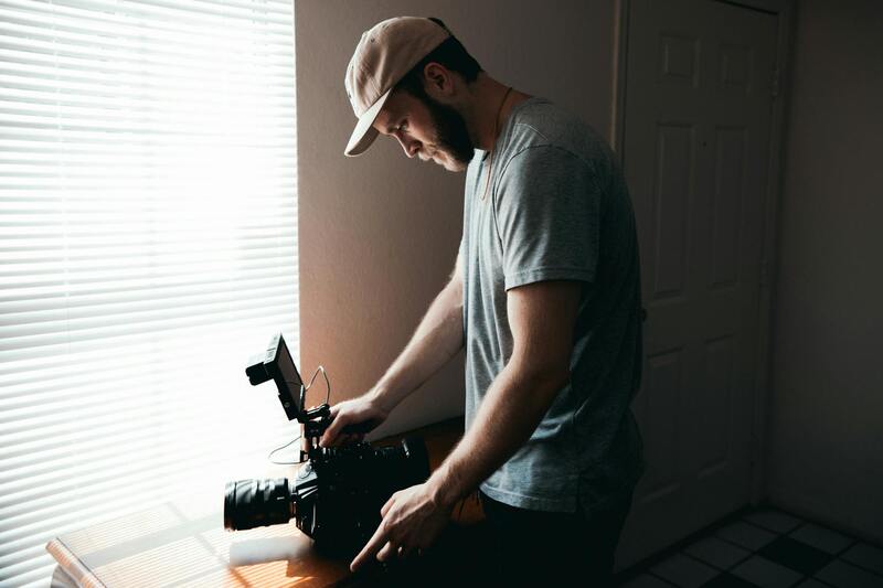
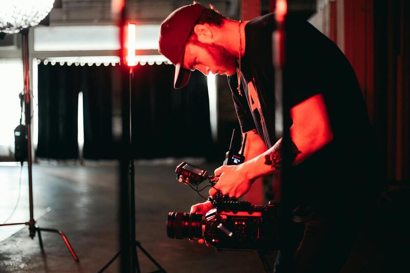
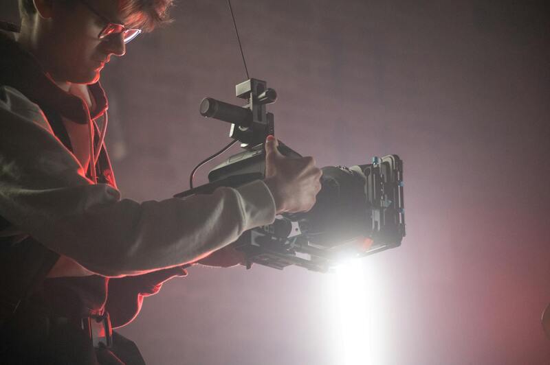
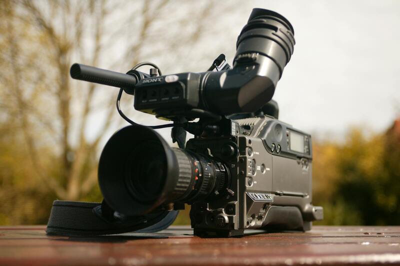
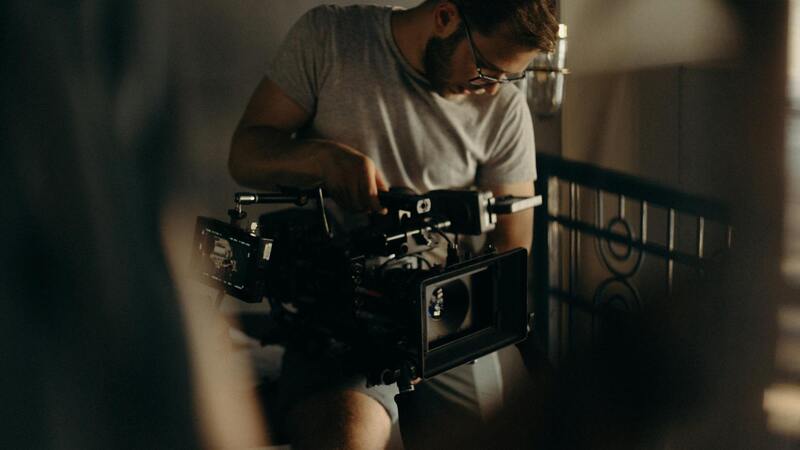
Achieving high-quality aerial imagery for Miami’s dynamic real estate market hinges on the selection of advanced drone equipment and complementary technology. Professional-grade drones equipped with high-resolution cameras are essential for capturing sharp, vibrant images that do justice to luxurious properties, sprawling estates, or scenic coastal views. Features such as stabilized gimbals, obstacle avoidance sensors, and long-flight batteries enable smooth footage, safety, and extended shooting sessions, contributing to the overall quality and efficiency of the project.
Modern drone technology also incorporates intelligent flight modes, such as automated orbit, waypoint mapping, and hyperlapse capabilities. These functionalities simplify complex shot sequences, ensuring consistent framing and dynamic perspectives without the need for extensive manual control. Additionally, the integration of high-dynamic-range (HDR) imaging enhances detail in both shadowed and brightly lit areas, capturing the property's true colors and textures under Miami’s varied lighting conditions.
Proper post-flight data management tools are equally vital. Software that offers seamless image stitching, color correction, and stabilization allows professionals to refine raw footage into polished marketing assets. Cloud storage solutions and editing suites compatible with drone footage streamline the workflow, enabling quick turnaround times and reliable backups for large media files.
Investing in versatile, rugged equipment ensures consistent results regardless of weather conditions or complex urban landscapes encountered in Miami's diverse neighborhoods. As drone technology continues to evolve, staying abreast of innovations like 4K or higher resolution support, multispectral sensors, and longer flight times ensures that real estate professionals can deliver compelling visuals that meet the high standards expected in Miami’s competitive market.
Choosing the Right Equipment and Technology
Successful real estate drone photography hinges on selecting devices that provide crisp visuals, stable flight, and versatile functionality. High-quality drones equipped with advanced stabilization systems are essential for capturing smooth, professional-grade footage. Models featuring 4K or higher resolution cameras ensure that every detail of the property is vividly represented, whether showcasing expansive landscapes or intricate architectural features. Multi-axis gimbal stabilization further enhances image clarity, reducing motion blur and jitters during flight.
In addition to the drone platform itself, selecting suitable lenses and camera sensors impacts image quality significantly. Wide-angle lenses provide sweeping views of entire estates, neighborhoods, and surrounding landscapes, giving prospective buyers comprehensive perspectives. Multispectral or HDR sensors can adapt to Miami’s varied lighting, ensuring consistency across different times of day and weather conditions. Accessories such as spare batteries, high-capacity SD cards, and sun shields are vital for extending flight times and protecting gear during shoots.
Advanced Flight Capabilities and Software Support
Modern drones should incorporate intelligent flight modes that streamline the capturing process and enhance image diversity. Automated orbit, waypoint navigation, and hyperlapse features allow for dynamic shot sequences that highlight the property's scale and context without extensive manual control. Pre-programmed flight paths ensure consistency across different shoots and facilitate complex shots that would be challenging to execute manually.
Complementary flight planning and editing software are crucial components. Platforms that enable precise route mapping, real-time flight monitoring, and obstacle avoidance contribute to safer operations—especially important in Miami's dense urban environments. Post-flight, software tools offer capabilities such as image stitching, color grading, stabilization, and rendering, transforming raw footage into compelling marketing materials. Cloud-based workflows allow for rapid editing and sharing, critical for quick turnaround times in a competitive real estate market.
Maintaining Consistency and Reliability
Consistency in capturing compelling drone images necessitates regular calibration and maintenance of equipment. This includes GPS calibration, firmware updates, and pre-flight checks to ensure optimal performance. Weather considerations, such as wind speed and lighting conditions, must also be factored into scheduling shoots to achieve the best possible results. Investing in durable, weather-resistant gear expands operational windows and reduces downtime due to environmental factors.
Furthermore, employing backup devices and redundant batteries guarantees that the workflow remains uninterrupted, providing the flexibility to adapt on-site. Setting standardized camera settings and shot compositions enables the creation of uniform marketing visuals, strengthening brand identity and listing professionalism across Miami's diverse neighborhoods.
Techniques for Capturing Effective Drone Shots
Achieving visually compelling drone imagery for Miami real estate requires strategic planning and execution. Selecting optimal angles and flight patterns is essential to highlight a property's unique features while providing prospective buyers with an immersive perspective. For example, a gentle ascent to capture the entire façade from an elevated vantage point can accentuate property size and landscaping, while low-altitude shots focusing on architectural details bring intricacies into focus.
Flight patterns should be meticulously designed to produce smooth, cinematic footage. Circling around the property at a consistent altitude can showcase its layout, neighboring features, and surrounding environment. Linear or linear-yielding paths help in capturing sweeping vistas and connecting different sections within the property, such as pools, gardens, and outdoor entertainment zones. Employing these patterns ensures comprehensive visual coverage, offering a holistic view that resonates with potential buyers.
Lighting conditions significantly influence image quality and emotional impact. The golden hours—shortly after sunrise and before sunset—offer warm, diffuse light that minimizes harsh shadows and highlights property details. Overcast days can also be advantageous by providing even lighting, reducing glare, and enhancing color accuracy. Planning shoots during these optimal times elevates the overall aesthetic and helps in conveying an inviting atmosphere.
Furthermore, the use of specific camera techniques, such as adjusting camera pitch and tilt, can emphasize certain property features or landscape elements. Incorporating drone maneuvers like orbit shots, reveal movements, or slow flyovers can create dynamic visuals that capture attention and provide a comprehensive view for viewers. Combining these techniques results in a premium presentation that highlights both the unique charm and structural specifics of Miami properties.
When planning drone sequences, it's critical to consider the site’s environmental context to avoid obstacles and adhere to safe operational practices. Prior reconnaissance helps identify potential hazards such as power lines, trees, or dense foliage, thus facilitating smooth flight paths and minimizing risks. Properly scaled shot compositions and thoughtful framing reinforce the property’s scale and grandeur, ultimately making the listing more appealing and memorable to prospective buyers.
Utilizing Legitimate Methods for Drone Operations
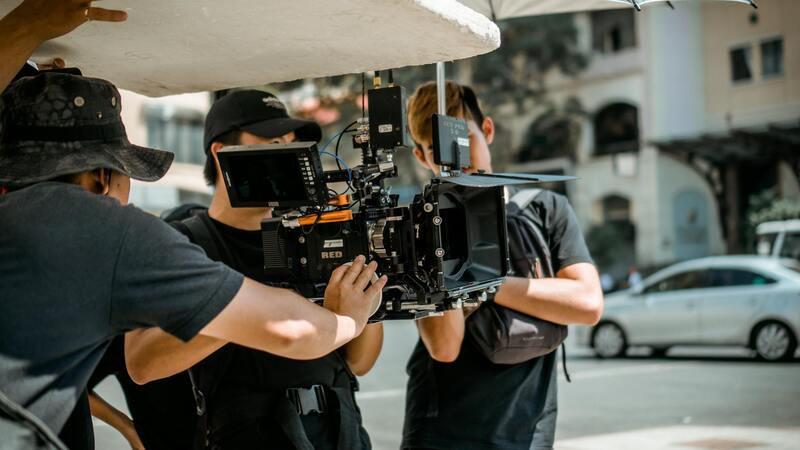
Adhering to authorized procedures when deploying drones in real estate photography ensures the safety and quality of the visual content captured. Professionals rely on well-established frameworks that involve obtaining the necessary permissions and understanding the specific guidelines for drone use within the Miami area. These methods include coordinating with local aviation authorities, securing explicit permissions for each shoot, and scheduling operations to minimize disturbances to residents and other airspace users.
Operators employ detailed flight planning that incorporates environmental assessments, such as wind speed, weather conditions, and obstacle mapping. This proactive approach reduces the likelihood of accidents or unintended disruptions, allowing for seamless shoot execution. Ensuring equipment is maintained according to manufacturer specifications is also a standard practice, which ultimately contributes to stable footage and longer drone lifespan.
In addition, utilizing software that supports compliance with flight restrictions, geofencing, and automated safety zones can help operators stay within permitted airspace boundaries. Many professional drone operators in Miami incorporate these tools into their workflow, which enhances operational reliability and protects all parties involved. This disciplined approach to drone use not only guarantees high-caliber visuals but also reinforces the credibility of the service provider.
High-Quality Equipment and Technology for Superior Imagery
To produce compelling real estate visuals, investment in state-of-the-art drone technology is essential. Professionals prefer drones equipped with high-resolution cameras, often exceeding 4K video capabilities and 20-megapixel still image sensors, thus capturing every architectural detail with precision. Gimbals with advanced stabilization systems are vital for smooth, shake-free footage, even in windy environments typical of Miami's coastal areas.
Additionally, drones with longer flight times and intelligent flight modes—such as automated orbiting, waypoint navigation, and obstacle avoidance—enhance efficiency and safety. Advanced sensors and imaging techniques, like thermal or multispectral cameras, can also be employed for specialized property assessments beyond standard visual coverage.
By integrating the latest in imaging software, real estate professionals can manipulate and enhance footage post-capture. Techniques such as HDR blending, color correction, and panoramic stitching contribute to a polished, professional presentation. This high level of technological capability allows brokers and property owners in Miami to distinguish their listings in a competitive market, ultimately attracting more qualified buyers.
Ensuring Proper Equipment and Technology for Drone Photography
To achieve exceptional visuals, it is crucial to utilize equipment that matches the demands of high-end real estate presentation in Miami. Professionals invest in drones capable of capturing high-resolution images and ultra-smooth video footage. Cameras with 4K or higher resolution, paired with stabilized gimbals, are standard to ensure clarity and stability, even in windy coastal conditions.
The choice of drone should also include features such as extended flight times, which allow for comprehensive coverage of large properties, and obstacle avoidance sensors, minimizing risks during complex shoots around multi-story structures or landscaped terrains.
Advanced imaging sensors, including thermal or multispectral cameras, can provide additional insights into property features or environmental factors, especially useful for large estates or properties requiring detailed assessments.
Investing in top-tier drone technology signifies a commitment to quality and professionalism, reinforcing trust for clients and setting listings apart from competitors. The combination of high-quality hardware and sophisticated imaging techniques facilitates the production of compelling visual narratives that resonate with prospective buyers.
Skilled Techniques for Capturing Impactful Drone Shots
Proficient use of drone technology involves more than just flying the aircraft; it requires strategic planning and mastery of various shooting techniques. Common approaches include establishing a captivating aerial perspective that includes sweeping views of the property and its surroundings, creating a sense of space and context. Utilizing different flight modes such as orbit shots, orbiting around the property’s most impressive features, or linear approaches to showcase landscape elements can significantly enhance visual storytelling. Lazy quads and high vantage angles are effective for emphasizing size and scale, particularly when highlighting Miami’s expansive coastal estates or downtown penthouses. Planning the shoot based on optimal lighting conditions—preferably during golden hours—ensures images are vibrant and inviting. Incorporating smooth, cinematic motion via slow, deliberate drone movements adds a professional touch that captures the viewer’s attention. Another critical aspect involves paying attention to framing, composition, and maintaining consistent shot parameters across sessions to create a cohesive visual presentation. This disciplined approach results in high-quality content capable of elevating a property’s market appeal.
Technical Equipment and Imaging Standards
To achieve the highest quality aerial visuals for Miami real estate, professionals rely on state-of-the-art drone technology coupled with advanced imaging accessories. High-resolution cameras capable of capturing 4K or higher video quality ensure crisp, detailed footage that showcases every architectural detail and landscape feature. Many drones are equipped with gimbal stabilization systems, which prevent camera shake and produce smooth, professional footage even in challenging wind conditions characteristic of Miami’s coastal areas.
Beyond the primary camera system, supplementary equipment plays a crucial role in elevating output quality. Wide-angle lenses help encompass expansive property views, while ND filters are employed to control exposure during bright daylight hours, ensuring balanced images without overexposure. UAVs with longer flight times and increased battery life extend shooting durations, allowing for comprehensive coverage without interruptions.
Utilizing drones with obstacle avoidance sensors is essential for safe navigation around complex property terrains, especially those with tall trees, narrow spaces, or nearby infrastructure. This technology minimizes risks during flight operations and preserves the integrity of the property for optimal visual representation.
Optimizing Shooting Conditions
Achieving exceptional drone shots of Miami’s diverse real estate portfolio requires meticulous planning of flight timing and environmental conditions. Ideally, shoots are scheduled during the golden hour period—shortly after sunrise or before sunset—when natural lighting is soft and warm, enhancing the property’s aesthetic appeal.
By choosing stable weather days with minimal wind and clear skies, drone operators can maintain steady flights and avoid shaky footage or abrupt movements. Paying close attention to the Sun’s position ensures shadows do not obscure key features of the property, allowing for unobstructed views of architectural and landscape elements.
Pre-flight site assessment helps identify potential obstacles such as power lines, trees, or neighboring structures that could interfere with drone flight paths or compromise shot composition. Conducting these assessments reduces the need for reshoots and ensures that all desired aerial perspectives are captured efficiently.
Ensuring Consistent Results through Technique
Consistent and high-quality drone imagery is achieved through disciplined operational techniques and industry best practices. Establishing a shot list prior to flight rehearsals helps align the creative vision with technical execution, ensuring that all key property features and visual storytelling elements are covered.
Maintaining uniform camera angles, altitudes, and movement speeds creates a coherent visual narrative across multiple shots. This consistency is particularly important for compiling footage into comprehensive property videos or virtual tours that present the property in the best possible light.
Using a combination of pre-programmed flight paths and manual controls allows for precise maneuvering and framing. Smooth, cinematic camera movements—such as slow panoramas or vertical ascents—add a dynamic yet professional feel, appealing to prospective buyers.
Post-flight review and immediate footage analysis enable operators to identify any shortcomings or needed reshoots promptly, ensuring that each project maintains a high standard of quality.
Enhancing Your Miami Property Listing with Drone Imagery
Integrating drone footage into residential and commercial property listings elevates marketing efforts, providing prospective buyers with an immersive view of the property and its surroundings. High-resolution aerial images serve as a compelling visual narrative that captures the scale, architectural details, and environment of the property. When thoughtfully incorporated into online listings, these visuals can significantly increase viewer engagement and generate more inquiries, ultimately leading to quicker sales.
Dynamic drone videos, showcasing sweeping panoramic shots and smooth orbitals, create an emotional connection, helping potential buyers envision themselves in the space. This virtual experience adds a layer of authenticity and transparency that traditional photography might not fully convey. For real estate agents and property owners, leveraging these captivating visuals can differentiate their listings in competitive markets like Miami.
Best Practices for Incorporating Drone Footage into Listings
- Strategic Placement: Embed drone footage prominently within online property listings to catch the eye of visitors immediately. Use snippets of aerial videos in virtual tours or as header images to draw attention.
- Consistent Quality Standards: Ensure that all drone footage maintains high resolution, proper framing, and smooth motion to keep the listing professional and appealing.
- Complement with Ground Photography: Combine aerial shots with detailed ground-level images to provide a comprehensive view that highlights both the property's overall landscape and intricate interior details.
- Optimize for Mobile Devices: Since a significant portion of viewers access listings via smartphones and tablets, ensure that drone videos and high-resolution images are optimized for fast loading and clarity on all devices.
- Effective Captioning and Descriptions: Pair drone visuals with informative captions and descriptions to enhance understanding of the property's features and location advantages.
Legal and Ethical Considerations for Drone Content
While integrating drone footage into real estate marketing offers numerous benefits, it is crucial to adhere to specific operational guidelines. This includes verifying that drone flights are conducted during appropriate times to minimize noise disturbance and maximize visibility of natural lighting conditions. Operating within designated flight zones and obtaining necessary authorizations helps maintain a smooth marketing process, avoiding disruptions or delays.
Attention to privacy is paramount. Ensuring that drone captures do not infringe on neighboring properties or private spaces respects community standards and fosters positive relationships with local residents. When planning aerial shots, it’s advisable to communicate intentions clearly, especially in densely populated neighborhoods where drone flying might be more sensitive.
Additionally, maintaining logs of flight plans and ensuring operators are trained in precise handling and safety protocols enhances the overall quality and professionalism of the content produced. Licensing and insurance coverage are integral components of a comprehensive drone marketing strategy, safeguarding all parties involved against unforeseen issues.
Innovative Use of Drone Technology for Immersive Marketing
Advancements in drone technology, like 3D mapping and high dynamic range (HDR) imaging, are expanding the possibilities for real estate marketing in Miami. 3D models generated from drone data provide interactive virtual tours, allowing prospective buyers to explore the property remotely with a realistic, three-dimensional perspective. HDR imaging, on the other hand, captures a broader tonal range, producing vibrant, lifelike images that reveal every detail in both shadowed and brightly lit areas.
These innovations facilitate more engaging presentations, enabling agents to deliver compelling visual narratives that highlight property features with extraordinary clarity and depth. As these technologies become more accessible, real estate professionals who adopt them can set their listings apart, creating immersive experiences for buyers irrespective of location.